Step into the "Little Heat" in the twenty-four solar terms and welcome the sunny weather.
The Observatory said that the temperature in Hong Kong today (7th) is expected to be between 27 and 31 degrees. As of 12 noon, the maximum temperature in the urban area rose to 31 degrees.
The Observatory predicts that due to the influence of the high-altitude anticyclone, the weather will gradually become extremely hot in the beginning of next week, with the highest temperature in the urban area reaching 33 degrees, and a hot weather warning is expected to be issued by then.
In addition, the Mainland Central Meteorological Observatory predicted that a tropical depression may form in the central and southern waters of the South China Sea in the next ten days, bringing obvious wind and rain to the southern waters of China.
As for the U.S. model forecast, it is also found that there will be a tropical depression in the South China Sea in the middle of next week, which can intensify to the level of a tropical storm at the highest, and move to the area of Hainan Island.
However, the European model only sees the formation of a low pressure area.
It remains to be seen whether the wind will blow again next week.
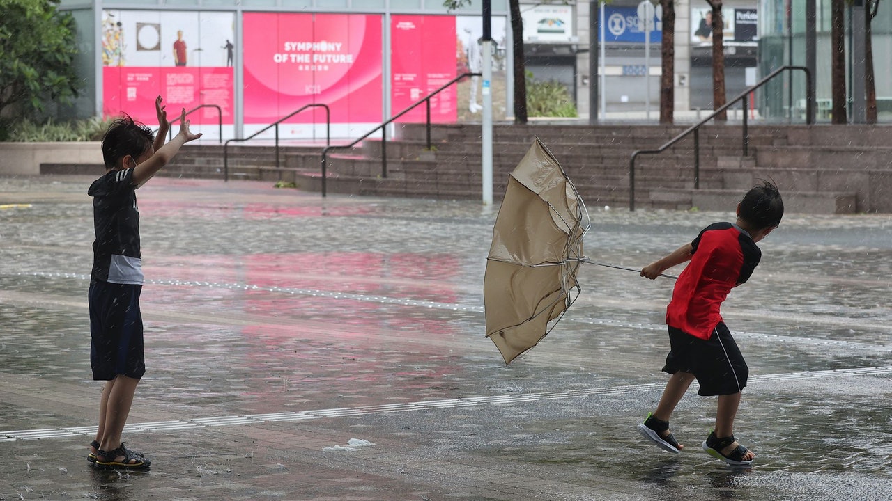
▼The situation of Typhoon Siamba hitting Tsim Sha Tsui, Hong Kong on July 2▼
+6
Today is "Small Heat". Hong Kong is sunny in the morning, but there are still a few showers during the day, and there are thunderstorms in some areas, with moderate south to southeast winds.
The Observatory predicts that the high-altitude anticyclone will bring generally sunny weather to southeastern China in the next few days. It is expected that there will be sunshine in Hong Kong for part of the next two days, and the maximum temperature in the urban area will reach 32 degrees, reaching a hot level; by the beginning of next week The weather is generally fine and very hot. It is expected that the maximum temperature in the urban area will reach 33 degrees from Sunday to Tuesday (10 to 12), and the weather will become hot again, but there are still showers in some areas.
(Screenshot from the Observatory's website)
U.S. forecasts tropical storms to form in South China Sea next week
Hong Kong has just sent off its first typhoon Siam this year. The Observatory predicts that a broad area of low pressure will affect the central and northern parts of the South China Sea in the early to mid-week next week. It is expected that there will be a few showers in Hong Kong from next Wednesday (13th), but there will still be some sunshine. The urban area is as high as 32 degrees, and the weather is still hot.
The Mainland Central Meteorological Observatory also predicted that in the next ten days, a tropical depression may form in the central and southern waters of the South China Sea, bringing obvious wind and rain to the southern waters of China.
With reference to the US Global Forecast System (GFS), next Tuesday (12th) found traces of a tropical depression in the South China Sea, which later intensified to a tropical storm level and moved towards Hainan Island next weekend.
However, according to the forecast of the European Centre for Medium-Range Weather Forecasts (ECMWF), only a low pressure area was seen, and no tropical cyclone was seen.
▼US Global Forecast System GFS forecast▼
The Observatory once said that the tropical cyclone generated by the Guizhou Sea is generally more difficult to predict
As for whether there will be more winds in Hong Kong?
Earlier, the Observatory also briefly talked about the forecasting method of tropical cyclones in its blog. In the initial forecast of tropical cyclone Siamba, there was a marked difference in the forecasted path between the US model and other models, and the intensity forecast was also erratic, so the reference value was relatively low; , the use of ensemble forecasts can reduce the errors caused by individual models.
The Observatory also pointed out that tropical cyclones generated in the South China Sea are generally more difficult to predict, because the time from their generation to affecting Hong Kong is shorter and the observation time is less. There are larger revisions to the forecast in a shorter period of time.
▼On July 2, the Siamba typhoon hit Hong Kong’s Tsim Sha Tsui Pier with wind and rain▼
+15
▼On July 2, Typhoon Siamba hit the seaside of Xinghua Village in Hong Kong▼
+7
Siamba typhoon | Observatory says computer forecast is one of its tools: intensity and wind forecasts are roughly correct Siam Ballin Chaoying: It is a deep-seated problem. Typhoon Typhoon No. 8 has become a typhoon for more than 21 hours. One first and two top 10 Siamese typhoons | 3 people were injured and admitted to hospital during the storm hitting Hong Kong. 1 Flooding Report of Fallen Tree