
Hong Kong has just passed its hottest July on record, and a tropical cyclone may strike in August.
The Observatory predicts that a low pressure area will bring unstable weather to the South China Sea early next week, and may develop into a tropical cyclone, but its path and intensity are variable.
According to the nine-day weather forecast, it will be cloudy with showers next Tuesday (9th) and Wednesday (10th), and winds of magnitude 6 will be blown off the coast, that is, the wind force of No. 3 typhoon.
According to forecasts from Europe and the United States, the low-pressure area is expected to form in the South China Sea next Monday (8th), but various organizations have differences in its path and intensity forecasts.
The United States is forecasting the area of low pressure to reach the level of a severe tropical storm and pass about 100 kilometers south of Hong Kong next Tuesday before moving westward.
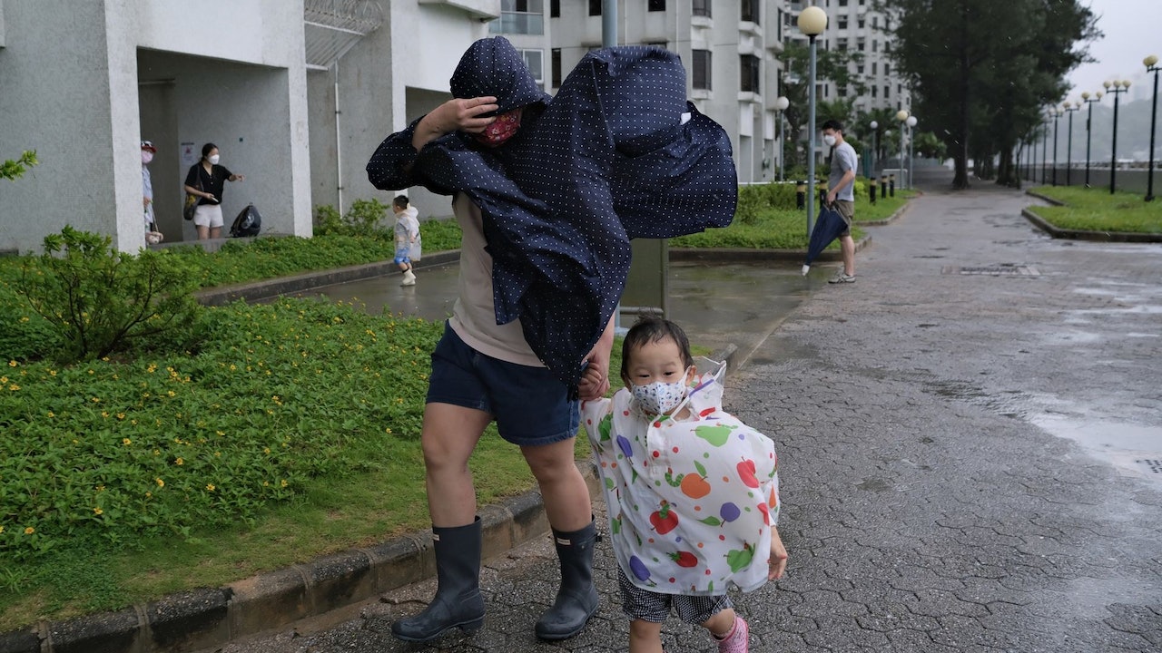
▼On July 2, Typhoon Siamba hit the seaside of Xinghua Village in Hong Kong▼
+7
The weather in Hong Kong today (2nd) is still very hot. The Observatory predicts that the temperature in Hong Kong will range from 29 to 34 degrees today. As of 12 noon, the Observatory recorded a maximum temperature of 33.1 degrees in the urban area.
However, it may be windy next week, and it is expected to cool down.
The Observatory predicts that an area of low pressure will bring unstable weather to the South China Sea early next week and may develop into a tropical cyclone.
The Observatory is also expected to blow moderate 6 winds off the coast on Tuesday and Wednesday (9th and 10th).
According to the Beaufort wind scale, the average wind speed of Category 6 winds is 41 to 51 kilometers per hour, that is, the wind reaches the level of the No. 3 typhoon.
▼On July 25, the observatory recorded a high temperature of 35.8 degrees ▼
+8
European and American forecasting systems disagree on the intensity and track forecast of the low pressure area
Referring to the forecast of the European Centre for Medium-Range Weather Forecasts (ECMWF), a low pressure area is expected to form in the south of the South China Sea next Monday (8th), and it is expected to move northward. It will be closest to Hong Kong in the early morning of next Tuesday, passing by about 300 kilometers west of Hong Kong. And moved to the Leizhou Peninsula area, and then moved to Vietnam.
ECMWF predicts that the central pressure at sea level in this low pressure area is also the lowest at 992 hPa, which is only a tropical storm.
The US Global Forecast System (GFS) predicts that a low pressure area will form in the northwest of the Philippines in the early morning of next Monday, and then rush towards Hong Kong. It will pass about 100 kilometers south of Hong Kong next Tuesday, and then move westward and brush next Wednesday. After the Leizhou Peninsula, it will land in Vietnam next Thursday (11th).
GFS predicts that the low-pressure area will be strong, with a minimum central pressure of 983 hPa at sea level, which is a severe tropical storm.
▼European Centre for Medium-Range Weather Forecasts ECMWF forecast▼
▼US Global Forecast System GFS forecast▼
Showers and thunderstorms for three consecutive days since Wednesday
In terms of local weather, the Observatory expects a broad trough of low pressure to bring heavy showers and thunderstorms to southern China in the next few days.
Showers decreased over the area as the trough of low pressure moved away.
It is generally sunny in southern China today.
Meanwhile, showers are affecting the coast of Guangdong and the northern part of the South China Sea.
It is forecast that the weather will be mainly fine in the afternoon and tonight in Hong Kong, but there will be showers and thunderstorms in some areas. It will be very hot in the afternoon with mild to moderate southerly winds.
According to the nine-day weather forecast, the Observatory expects to be mostly cloudy for three consecutive days starting tomorrow (3rd), with showers and thunderstorms, and the rain is sometimes quite heavy.
On Thursday (4th) and Friday (5th), the maximum temperature in the urban area fell below the "3 prefix", ranging from 26 to 28 degrees.
The Observatory predicts that there will be sunshine and a few showers for a short time on Sunday (7th) and next Monday, and the temperature will also rise to between 28 and 32 degrees.
According to the nine-day weather forecast, it will be cloudy with showers next Tuesday (9th) and Wednesday (10th), and winds of magnitude 6 will be blown off the coast, that is, the wind power of No. 3 typhoon.
(Screenshot of the Observatory's website)
▼On July 2, the Siamba typhoon hit Hong Kong's Tsim Sha Tsui Pier with wind and rain▼
+15
Extreme high temperature in July broke 11 records
The Observatory expects the low-pressure area to bring unstable weather The US forecast goes straight to the Hong Kong Observatory and records more than 20 hot nights in July Extremely hot weather to 24 degrees | Labor and Welfare Bureau introduced the Observatory’s heat index to prevent workers from heat stroke This summer, the “hot blast” weather broke 6 high temperature records in July.