The temperature in Hong Kong recently dropped slightly compared with last week. The Observatory recorded a maximum temperature of 29.9 degrees in the urban area at 12:00 noon today (3rd), and the maximum temperature in many districts also hovered between 30 and 31 degrees.
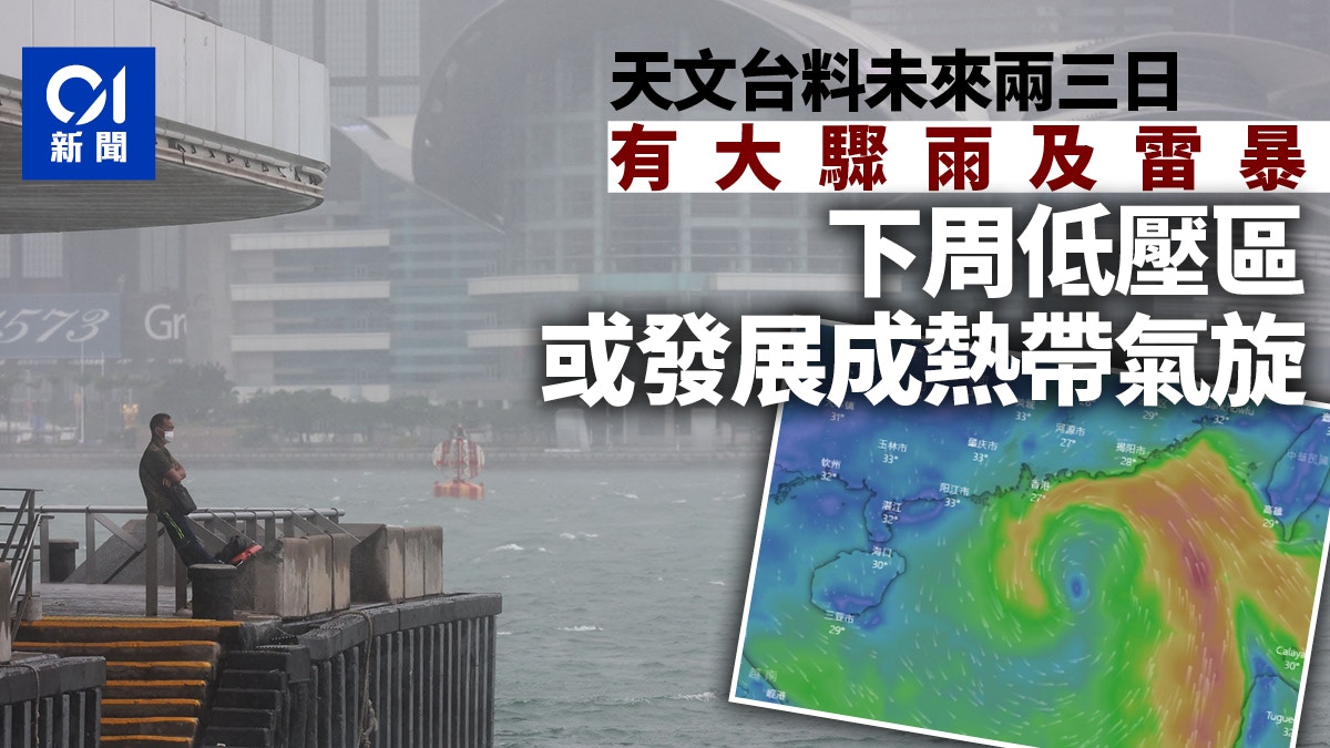
The Observatory predicts that there will be heavy showers and thunderstorms in Hong Kong in the next two to three days, and the sun will return to the sun for a short time until Sunday and Monday (7th and 8th).
However, there may be winds in Hong Kong next week. The Observatory said that in the early to mid-week next week, a low pressure area will bring unstable weather to the South China Sea, and it is more likely to develop into a tropical cyclone.
According to the forecast of the European Centre for Medium-Range Weather Forecasts, a low-pressure area will form in the South China Sea on the 8th of this month, and it is expected to move northward and gradually press against Hong Kong.
▼The weather is hot▼
+3
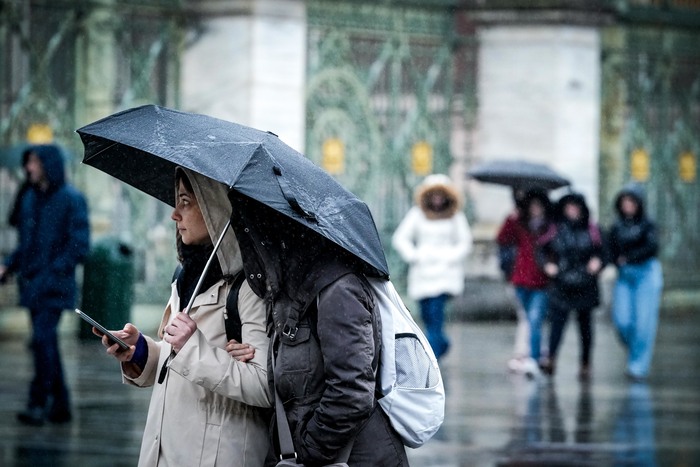
There will be rain in Hong Kong today and the temperature will drop slightly. The Observatory predicts that the temperature will range from 27 to 31 degrees today.
As of 12:00 noon, the highest temperature recorded by the Observatory in the urban area did not reach the "3 prefix", only 29.9 degrees, and the highest temperature in many districts also hovered around 30 degrees, including Shatin, Tai Po, Sheung Shui, etc. ) ranging from 2 to 4 degrees lower at noon.
The Observatory predicts that Hong Kong will be mostly cloudy in the afternoon and evening, with a few showers and thunderstorms. The showers will be more frequent later on. Members of the public are advised to bring umbrellas when going out.
Heavy showers and thunderstorms in the next two or three days, with brief sunshine on Sunday and Monday
The Observatory predicts that a broad trough of low pressure will bring heavy showers and thunderstorms to southern China in the next two to three days. It will be cloudy on Thursday and Friday with showers and thunderstorms. The rain will be heavy at times, and the temperature will range from 26 to 29 degrees Celsius.
By Saturday (6th), the maximum temperature will rise back to the "3 prefix", which is expected to be between 27 and 31 degrees Celsius.
To Sunday and Monday (7th and 8th), as the trough of low pressure moves away, the showers will decrease, and there will be sunshine for a short time.
Nine-day weather forecast (screenshot from the Observatory's website)
The low pressure area on the first day of next week may develop into a tropical cyclone, and the offshore wind will reach the level of No. 3 typhoon next Tuesday.
But next week or another windy day.
The Observatory predicts that a low pressure area will bring unstable weather to the South China Sea early next week, and may develop into a tropical cyclone, but its path and intensity are variable.
The Observatory is expected to experience heavy rain on Tuesday and Wednesday (9 and 10 days), with squally showers and thunderstorms, and occasional Category 6 winds off the coast.
According to the Beaufort wind scale, the average wind speed of Category 6 winds is 41 to 51 kilometers per hour, that is, the wind reaches the level of the No. 3 typhoon.
The temperature will range from 27 to 31 degrees Celsius next Thursday and Friday, with showers and thunderstorms still expected.
▼European Centre for Medium-Range Weather Forecasts ECMWF forecast▼
According to the forecast of the European Centre for Medium-Range Weather Forecasts (ECMWF), a low pressure area will form in the South China Sea next Monday (8th), and is expected to move northward, gradually approaching Hong Kong, and will move to about 300 kilometers southeast of Hong Kong next Tuesday (9th). , will make landfall about 120 kilometers west of Hong Kong by next Wednesday (10th).
▼A moment of lightning beauty on the evening of August 2▼
+4
Weather and Traffic|Today's highest temperature is about 31 degrees, with showers and thunderstorms later. Very hot weather|Lin Chaoying broke into sweat and refused to turn on the air-conditioning network to teach "cooling tips", but was ridiculed and had no effect More showers and thunderstorms