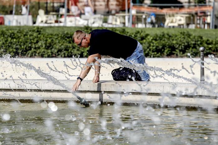
The anticyclone which has been cooling the Channel for a few days persists and with it pushes back the heat wave in the Center-East and South-East of France, according to
La Chaîne Météo*
.
It will be accompanied by more or less stable thunderstorms in the assembly from the afternoon.
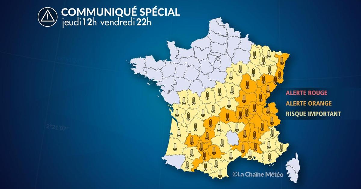
Ain, Ardèche, Corrèze, Côte-d'Or, Doubs, Drôme, Gard, Haute-Garonne, Isère, Jura, Loire, Lot, Lot-et- Garonne, Puy-de-Dôme, Bas-Rhin, Haut-Rhin, Rhône, Haute-Saône, Saône-et-Loire, Savoie, Haute-Savoie, Tarn, Tarn-et- Garonne, Vaucluse and the Territoire de Belfort remain on heat wave orange alert.
Read alsoClimate change has made UK heatwave 10 times more likely, study finds
The weather in your area
From
Brittany
to
Pays-de-la-Loire
, via
Poitou-Charentes
and
Lower Normandy
, a sunny day is coming.
A light breeze will pass from North to North-East without getting too hot.
In
Hauts-de-France
and
Haute-Normandie
, sun and clouds will alternate throughout the day.
A light rain can be expected in the North and Pas-de-Calais during the afternoon.
Temperatures will return to seasonal normals.
On the
Ile-de-France
side , the weather will be particularly variable in the morning.
Between clouds and clearings, the temperatures will again be breathable.
A few thundery showers can be expected in the east in the morning.
In the
South-West
, the clouds will be relatively low in the morning and the sun veiled in the afternoon.
In the morning, the temperatures will always be intense, before dropping in the afternoon.
The Pyrenees chain retains its stormy risk.
In
Occitania
, the heat persists from the morning.
The weather will quickly be heavy and thunderstorms will break out over the eastern Pyrenees and Cévennes.
Locally, the showers will be heavy and sometimes accompanied by hail.
The Gulf of Lion however remains calm with only a few mists.
In the
East
and the
Center-East
, the heat does not weaken after a tropical night.
The sky will be cloudy and heavy in the afternoon.
Temperatures are falling slightly in the East but not in the Rhône-Alpes which will still have peaks at 36°C.
Thunderstorms will break out in the afternoon over the Alps and the Cévennes and could even descend into the lower Rhône valley.
The
South-East quarter
retains its morning mists and a strong sun.
Watch out for strong thunderstorms that can break out at the end of the day in the Southern Alps and the Mercantour, especially for campers and hikers.
*The Weather Channel is a property of the Figaro group.