The Observatory issued an alert signal No. 1 at 3:40 am today (9th), and the low pressure will maintain a distance of more than 500 kilometers from Hong Kong this morning, and the No. 1 typhoon will remain until 10 am this morning. Considering the change of the local wind force, the No. 3 strong wind signal will be issued.
At 5:00 a.m. on August 9, a tropical depression assembled about 650 kilometers south-southwest of Hong Kong, with a maximum sustained wind speed of 45 kilometers per hour near the center.
(Photo from the Observatory).
▼The Observatory issued a yellow rainstorm warning on August 3▼
+3
[04:45] The Observatory said that the tropical depression is about 650 kilometers south-southwest of Hong Kong. The highest sustained wind speed near the center is 45 kilometers per hour. It is expected to move northward at a speed of about 18 kilometers per hour. From the west of Guangdong to Hainan Island, it gradually intensified into a tropical storm. The maximum sustained wind speed near the center rose to 85 kilometers per hour, close to the level of a severe tropical storm.
(Maximum sustained winds rose to 90 km/h near the center).
[03:45] According to the Observatory, a tropical depression in the central part of the South China Sea is about 660 kilometers south-southwest of Hong Kong and is expected to move northward at a speed of about 18 kilometers per hour. According to the current forecast path, the tropical depression will be close to the Hong Kong maintains a distance of more than 500 kilometers. The No. 1 Standby Signal will be maintained until 10 am this morning, and then the No. 3 Strong Wind Signal will be considered depending on the wind changes in Hong Kong.
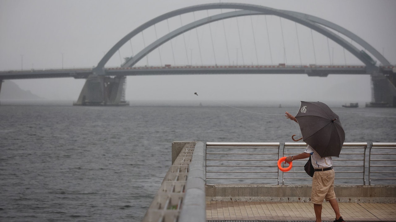
Hong Kong will be affected by the outer rainbands of the tropical depression today, with squally showers and thunderstorms, with heavy rain at times.
There will be large waves and swells on the sea surface, the public should stay away from the shore and stop all water activities.
[03:40] The Observatory issued the No. 1 alert signal.
Typhoon | The Observatory issued a typhoon signal No. 1 in the early morning and maintained until 10 am this morning
The Macao Meteorological Bureau predicts that the chance of typhoon No. 3 being issued today is high.
▼The situation under the tropical depression No. 1 typhoon on August 4▼
+4
Today's offshore and highland winds reach No. 3, and the typhoon will intensify to Category 8 gale force tomorrow
The Observatory updated the nine-day weather forecast at 0:00 a.m., which is roughly similar to the forecast at 4:30 p.m. yesterday. It means that due to the influence of its outer rainbands, there will be squally heavy showers and thunderstorms in the northern part of the South China Sea and the coast of Guangdong in the next one or two days. There are swells.
However, the Observatory said that due to the influence of its outer rainbands, there will be squally, heavy showers and thunderstorms in the northern part of the South China Sea and the coast of Guangdong in the next two or three days. The wind will be quite strong and there will be swells in the sea. The shore blows at level 6 (strong wind), and later it reaches level 7 (strong wind) in the highlands.
That is, the wind force of the No. 3 typhoon (level 6 and 7) will also reach level 6 early tomorrow, and the offshore and highland will reach level 8 (strong wind), which is the wind force of the No. 8 typhoon.
The typhoon | The Observatory issued the No. 1 typhoon in the early morning, and the No. 1 typhoon was maintained until 10:00 this morning | The Macao Meteorological Bureau of the Observatory was the first to issue a forecast path map tonight to hit the wind | The rain in Hong Kong will continue until the wind blows next week. The Observatory expects that the No. 1 typhoon will be issued as soon as tomorrow and will cross the northern part of the South China Sea on Tuesday and Wednesday. Wind|The Observatory expects multiple factors to be favorable