
The anticyclone over the British Isles is again protecting us according to
La Chaîne Météo*
.
The sunny, dry and increasingly hot weather continues and extends towards the North-West with in the first line the Pays de la Loire and Brittany.
In the South, it is the furnace.
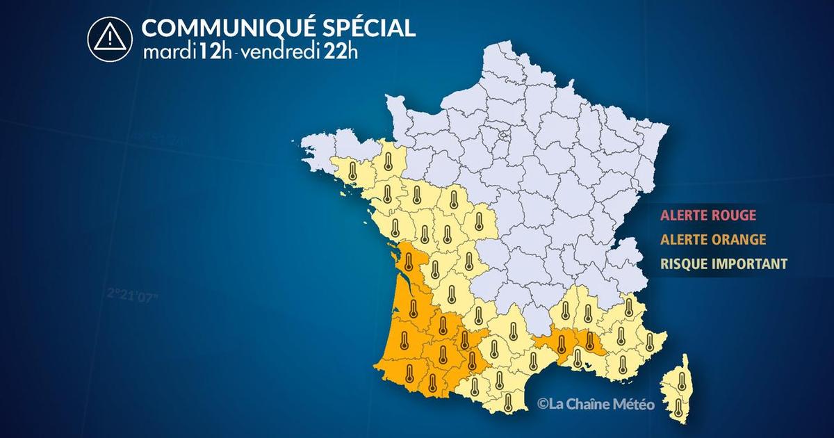
Eleven departments are placed on heatwave orange alert (Charente-Maritime, Gard, Gironde, Haute-Garonne, Gers, Landes, Lot-et-Garonne, Pyrénées-Atlantiques, Hautes-Pyrénées, Tarn-et-Garonne, Vaucluse).
Read also Heat wave: everything you need to know about the new heat wave expected in France from this Monday, until August 15
Weather by regions:
Brittany
and the
Pays
de la Loire
wake up under a great blue sky which remains present in the afternoon accompanied by very strong heat.
Near the English Channel, the sensitive northeast wind is still blowing.
Afternoon temperatures range from 24 to 36°C.
The same applies to
Île-de-France
,
Hauts-de-France
and
Normandy
with lower temperatures which vary between 23 and 34°C.
In
Centre-Val de Loire
,
Bourgogne-Franche-Comté
and
Grand Est
, the drought continues with full sun and marked heat in all three regions.
The maximum temperatures are between 30 and 34°C.
Auvergne-Rhône-Alpes
,
PACA
and
Corsica
enjoy good weather and heat all day long, especially in the Rhône Valley and near the Mediterranean.
In the afternoon, high temperatures are widespread and can reach maximum temperatures of between 31 and 37°C.
The heat wave continues from
New Aquitaine
to
Occitania
, with heat setting in from the morning and highs above 35°C except on the shores of the Big Blue due to the sea wind.
Temperatures rise to 38°C in general.
*La Chaîne Météo is a property of the Le Figaro group.


