
Typhoon No. 3 is now in effect, a tropical storm affecting Hong Kong, officially named "Mulan" on the afternoon of Tuesday (9th)!
The Observatory said in the early hours of Wednesday that unless Mulan strengthens significantly, or there is a clear upward trend in local winds, there is little chance of a higher tropical cyclone signal being issued.
The No. 3 strong wind signal will remain at least until noon.
The Hong Kong Observatory stated on August 10 that Mulan will gradually move away from Hong Kong around noon on August 10. Unless Mulan significantly strengthens or the local wind has a clear upward trend, there is little chance of a higher tropical cyclone signal being issued.
(Observatory website)
August 10th wind report
[09:45] The Observatory stated that Mulan is currently closest to Hong Kong, and will gradually move away from it. The No. 3 strong wind signal will remain at least until 3 pm, and when the local wind shows signs of weakening, the Observatory will change the No. 1 alert signal.
The Observatory reminds that the outer rainbands of Mulan will occasionally bring violent gusts to Hong Kong. At first, the offshore waters and highlands are still blowing strong winds occasionally. The public should continue to be vigilant.
[07:00] The Macao Meteorological Bureau issued the southeast typhoon signal No. 8, which is expected to remain in the morning.
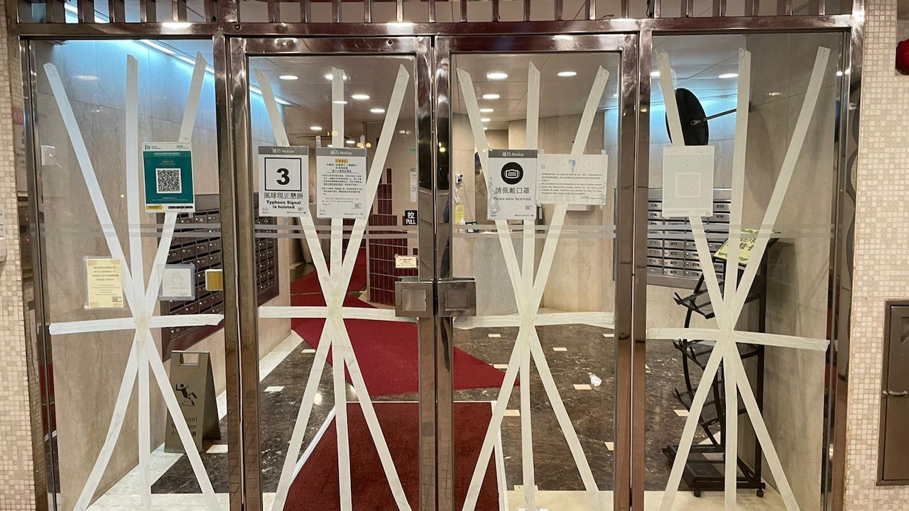
[05:25] The Education Bureau announced that as the No. 3 Tropical Cyclone Warning Signal is now in force, kindergartens, schools for children with physical disabilities and schools for children with intellectual disabilities will be closed today.
The Social Welfare Department advises the public not to send their children or family members to child care centres, centres providing after-school care services, elderly service centres or day rehabilitation services including sheltered workshops, integrated vocational rehabilitation service centres, integrated vocational training centres and development centres Units, but centres will remain open to those in need during their normal office hours.
Citizens who need to send their children or family members to the center or service unit can contact the center or service unit first.
[04:50] At present, strong winds are generally blowing in Hong Kong, but under the influence of showers, there will be violent gusts, and strong winds will occasionally blow in the offshore waters and highlands.
According to the current forecast path, Mulan will be closest to Hong Kong in the next few hours, passing 350 kilometers southwest of Hong Kong.
As the gale range near the center of Mulan is relatively small and it is kept at a certain distance from Hong Kong, unless Mulan strengthens significantly, or there is a clear upward trend in local wind, there is little chance that a higher tropical cyclone signal will be issued.
The No. 3 strong wind signal will remain at least until noon.
▼On August 9, there was slight flooding in Sanjia Village, Liyumen▼
+5
▼August 9, Xinghua Village will be ready for Tropical Storm Mulan▼
+3
[04:00] The Macao Meteorological Bureau stated that the tropical storm "Mulan" located in the northern part of the South China Sea generally tends to the area of the Leizhou Peninsula.
Since "Mulan" is gradually strengthening and will be closest to Macau this morning, the wind force in Macau will likely reach the lower limit of the No. 8 typhoon, so the No. 8 southeast typhoon will be issued at 7:00.
August 9th wind report
[23:50] The Observatory said that at 12 midnight, Tropical Storm Mulan gathered about 440 kilometers south-southwest of Hong Kong, and was expected to move northwest or north-northwest at a speed of about 18 kilometers per hour, moving towards the west of Guangdong to Hainan Island. and gradually increase.
According to the Observatory, according to the current predicted path, Mulan will be closest to Hong Kong tomorrow morning (10th), passing by 300 kilometers southwest of Hong Kong.
Since the gale range near the center of Mulan is relatively small and maintains a certain distance from Hong Kong, unless Mulan significantly intensifies or takes a path closer to Hong Kong, the No. 3 strong wind signal will remain until 6 a.m. tomorrow.
The Observatory will closely monitor Mulan's development and trends to assess whether a higher signal is needed.
In the past hour, the highest sustained wind speeds recorded at Tap Mun, Tate's Cairn and Cheung Chau were 64, 62 and 60 km/h respectively, and the highest gusts were 81, 93 and 73 km/h respectively.
Mulan typhoon︱The Observatory said on Wednesday that a temporary shelter bridge was set up in low-lying areas or flooded Liyumen
[23:48] Tropical storm "Mulan" is affecting Hong Kong. The Observatory issued a typhoon signal No. 3, which will remain at least until 6:00 a.m. tomorrow (Wednesday, 10th). At present, strong winds are generally blowing in Hong Kong, but it is affected by showers and there are strong gusts , with occasional gale force winds in the offshore waters and highlands.
The Observatory also reminded that tomorrow will be an astronomical spring tide, and the storm surge caused by Mulan may cause flooding in low-lying areas tomorrow morning. The public should be vigilant and take precautions against wind and flooding as soon as possible.
The area near the Lei Yue Mun Rest Garden in Sanjia Village, Lei Yue Mun, was flooded to the level of the foot in the middle of the night. Some workers built a temporary road above the water wall so that the villagers could avoid getting their legs wet.
The tropical depression in the central part of the South China Sea intensified into a tropical storm on the afternoon of August 9 and was named "Mulan".
(Photo from the Observatory's website)
[23:00] The Macao Meteorological Bureau stated that the tropical storm "Mulan" is generally trending towards the Leizhou Peninsula and will be closest to Macao tomorrow (10th) morning; the No. 3 typhoon will remain until 4:00 a.m. tomorrow.
As Mulan is gradually strengthening, and it may take a more northerly path closer to Macau 1, the wind force will likely reach the lower limit of the No. 8 typhoon tomorrow. Therefore, it will depend on the development of Mulan and local wind changes, and it will be considered in the morning tomorrow. Whether typhoon signal No. 8 needs to be issued.
The Bureau of Meteorology said that due to the circulation and rainbands of "Mulan", the weather is expected to be unstable, with winds of magnitude 6 to 7, with occasional magnitude 8 and gusts, heavy showers and thunderstorms.
The bureau pointed out that due to the astronomical spring tide in the next few days, under the influence of superimposed storm surge and continuous rainfall, flooding will occur in the inner harbor and low-lying areas from early morning to morning from Wednesday to Thursday, and the highest flooding height will reach 0.5 in the morning on Wednesday to 1 meter.
[21:01] Tropical Storm Mulan is about 460 kilometers south-southwest of Hong Kong, and is expected to move north-northwest at a speed of about 18 kilometers per hour, moving to the west of Guangdong to Hainan Island, and gradually intensifying.
According to the Observatory, according to the current forecast path, Mulan will continue to approach the coast of Guangdong from tonight to tomorrow morning (10th). The strong wind signal will be maintained until 2 a.m. tomorrow.
The Observatory will closely monitor Mulan's development and trends to assess whether a higher signal is needed.
Observatory said.
At present, strong winds are generally blowing in Hong Kong, but due to the showers, there are violent gusts, and gale force winds are blowing occasionally in the offshore waters and highlands. Tomorrow will be an astronomical high tide, and the storm surge caused by Mulan may cause flooding in low-lying areas tomorrow morning. Members of the public should be vigilant. Take precautions against wind and water as soon as possible.
Mulan typhoon │ Cheung Chau residents take a boat home from the Central Pier and do not want to see the No. 8 typhoon: worry about flooding
[20:11] Tropical storm "Mulan" is affecting Hong Kong, and Typhoon Signal No. 3 is now in force.
According to the latest forecast of the Observatory, Mulan will enter the range of 400 kilometers in Hong Kong at night.
In the evening, there were not too many people at the Central Pier, and the wind was not strong.
A number of Cheung Chau residents expressed that they do not want to switch to Typhoon Signal No. 8, because "vegetables are expensive and expensive, and housing enterprises have the opportunity to enter the water".
[19:30] Regarding the online rumors that "there is a high chance of changing the No. 8 wind or storm signal from 7:00 p.m. to 10:00 p.m.", the director of the Observatory, Zheng Chuming, posted on Facebook, referring to "there are misinformation on the Internet", and Call on "everyone remember to be wise".
JUPAS Ranking 2022|The ranking will be released at 9 o'clock on Wednesday, and the arrangement will remain unchanged in case of bad weather. What you need to know
[18:10] JUPAS announced tomorrow (10th) that tropical storm "Mulan" hit Hong Kong.
However, JUPAS publishes the rankings online. In case of bad weather, the ranking arrangement will not change.
Even if the Observatory issues the Tropical Cyclone Warning Signal No. 8 or above or the Black Rainstorm Warning Signal is in force tomorrow morning, students can still log on to the JUPAS website, the websites of 9 institutions or call the 24-hour interactive voice system of the JUPAS Office from 9:00 tomorrow morning ( 2334 2330) to obtain the application result.
Accepted students should note that before 5:00 p.m. on the next day (11th) after the announcement of the results, they must pay a reservation fee of RMB 5,000 in cash through PPS, online banking or at a Bank of East Asia branch.
If the typhoon signal No. 8 takes effect tomorrow, PPS and online banking services will not be affected. As for students who choose to pay by cash, they will not be able to pay until the East Asia branch resumes business.
[17:00] The Macao Meteorological Bureau expects that the No. 3 typhoon will remain until 9:00 tonight, and the wind in Macao is forecast to increase.
Mulan typhoon︱The Observatory is expected to blow the No. 8 typhoon off the coast on Wednesday, strong winds and rainy days will continue for 9 days
[16:45] According to the Observatory, the broad outer rainbands associated with Mulan are affecting the northern part of the South China Sea and the coast of Guangdong, bringing heavy showers, violent gusts and thunderstorms to Hong Kong. Due to the relatively small area of gale near the center of Mulan, the current distance The coast of Guangdong is still far away. Unless Mulan strengthens significantly or takes a closer path to Hong Kong, the No. 3 strong wind signal will remain until 10 p.m.
The Observatory pointed out that strong winds are generally blowing in Hong Kong at present, but due to the showers, there are violent gusts, and the winds in the offshore waters and highlands sometimes reach the level of gale force. The public still needs to be vigilant. high signal.
In the past hour, the highest sustained wind speeds recorded at Tap Mun, Cheung Chau and Tate's Cairn were 62, 59 and 58 km/h respectively, and the highest gusts were 74, 72 and 85 km/h respectively.
Mulan typhoon | No. 3 typhoon has been windy and rainy, and the swells are fierce or due to the low pressure of the monsoon
[15:48] The Observatory said that at 4 pm, the tropical storm located in the central part of the South China Sea was named Mulan, and it concentrated about 540 kilometers south-southwest of Hong Kong at a speed of about 18 kilometers per hour, moving towards the west of Guangdong to Hainan Island. , and gradually increase.
The Observatory pointed out that the broad outer rainbands related to Mulan are affecting the northeastern part of the South China Sea and the coast of Guangdong. Strong winds are generally blowing in Hong Kong, and gale force winds are occasionally blowing off the coast and highlands. The No. 3 strong wind signal will remain at least until 6 pm today, and will there be any further changes? The issuance of a higher signal will depend on changes in the intensity of Mulan and local wind changes. The Observatory will closely monitor the development and trends of Mulan.
In the past hour, the highest sustained wind speeds recorded at Cheung Chau, Tap Mun and Waglan Island were 65, 65 and 56 km/h respectively, and the highest gusts were 89, 95 and 66 km/h respectively.
[15:30] The Japan Meteorological Agency officially named the tropical storm "Mulan".
[14:45] The Observatory pointed out that the tropical depression in the central part of the South China Sea has intensified into a tropical storm.
At 3 p.m., the tropical storm gathered about 550 kilometers south-southwest of Hong Kong, and is expected to move northward at a speed of about 18 kilometers per hour, moving towards the area from western Guangdong to Hainan Island, and gradually intensifying.
[14:10] The Macao Meteorological Bureau updated the tropical cyclone warning forecast. The bureau originally predicted that the probability of changing the No. 8 typhoon this evening was "moderate".
The latest local forecast shows that the probability of changing to the No. 8 typhoon signal is "moderate to high" from this evening to the evening.
(Photo from the website of the Macao Geography and Meteorological Bureau)
[13:45] Strong wind signal No. 3 is now in effect.
The Observatory said that the tropical depression in the central part of the South China Sea is about 560 kilometers south-southwest of Hong Kong, and is expected to move northward at a speed of about 18 kilometers per hour, moving towards the area from western Guangdong to Hainan Island, and gradually intensifying.
Strong winds prevailed in Hong Kong, with occasional gale force winds from offshore and highlands.
In the past hour, the highest sustained wind speeds recorded at Tap Mun, Tate's Cairn and Cheung Chau were 63, 60 and 51 km/h respectively, and the highest gusts were 84, 88 and 80 km/h respectively.
The No. 3 strong wind signal will remain at least until 6 pm today.
Whether a higher signal will be issued later will depend on changes in the intensity of the tropical depression and local wind changes. The Observatory will closely monitor the development and movement of the tropical depression.
[13:30] Fuyu Ferry stated that due to strong winds and waves on the sea, the service of the "Tuen Mun-Tung Chung-Sha Lo Wan-Tai O" route will be suspended from 11 am, and the resumption time will be notified separately.
As for Tsui Wah Shipping from Aberdeen, Stanley to Po Toi Island; Ma Liu Shui to Tap Mun; and Kaito services from Tap Mun to Wong Shek Pier have been suspended.
Blue Ocean Shipping's Kaito service from Peng Chau to Discovery Bay, the last boat has also departed.
[12:45] The No. 3 strong wind signal is now in effect, and the average wind speed in Hong Kong is expected to be 41 to 62 kilometers per hour.
The Observatory said that the tropical depression located in the central part of the South China Sea at 1 p.m. gathered about 570 kilometers south-southwest of Hong Kong, and is expected to move northward at a speed of about 18 kilometers per hour, moving towards the area from western Guangdong to Hainan Island, and gradually intensifying.
At present, the highest sustained wind speed of some wind monitoring stations has reached the gale level. The highest gust at Tate's Cairn is 94 kilometers per hour, the highest gust at Tap Mun is 78 kilometers per hour, and the gust at Waglan Island is 80 kilometers per hour.
[11:45] Strong Wind Signal No. 3 is now in effect, and the average wind speed in Hong Kong is expected to be 41 to 62 kilometers per hour.
The Observatory said that at 12:00 noon, the tropical depression in the central part of the South China Sea gathered about 580 kilometers south-southwest of Hong Kong, and is expected to move northward at a speed of about 18 kilometers per hour, moving towards the area from western Guangdong to Hainan Island, and gradually intensifying.
[11:25] The Observatory said that the No. 3 strong wind signal was issued at 11:25 in the morning, and the average wind speed in Hong Kong is expected to be 41 to 62 kilometers per hour.
Typhoon No. 3 will remain at least until 6 pm today.
Whether a higher signal will be issued later will depend on changes in the intensity of the tropical depression and local wind changes. The Observatory will closely monitor the development and movement of the tropical depression.
The Observatory also pointed out that the broad outer rainbands associated with the tropical depression are affecting the northeastern part of the South China Sea and the coast of Guangdong.
There are showers, thunderstorms and violent gusts in Hong Kong today. The rain is sometimes heavy.
[10:55] The Macao Meteorological Bureau stated that it will change the No. 3 typhoon signal at 11:30 today, and it is predicted that the local wind will increase.
As for Macau, the probability of changing to Typhoon Signal No. 8 this evening is medium.
As for the Mainland's Central Meteorological Observatory, the latest typhoon alert at 10:16 a.m. stated that the intensity of the tropical depression has been upgraded to a tropical storm, and the maximum wind force in the center has increased to 65 kilometers per hour.
(Photo from the website of the Macao Geography and Meteorological Bureau)
[10:23] The Leisure and Cultural Services Department announced that due to strong waves and inclement weather, Tung Wan Beach and Lower Cheung Sha Beach in Cheung Chau in the outlying islands, and Samsung Beach, Silverstrand Beach and Clear Water Bay in Sai Kung District A red flag has been hoisted at Second Bay Beach, indicating that swimming there is dangerous, and members of the public should not swim there.
[09:47] The Education Bureau announced that since the Hong Kong Observatory will consider changing the Tropical Cyclone Warning Signal No. 3 between 10:00 a.m. and 1:00 p.m., kindergartens, schools for children with physical disabilities and schools for children with intellectual disabilities will be closed today. Keep school buildings open while implementing contingency measures to take care of students who have returned to school and arrange for students to return home when it is safe to do so.
Parents do not need to rush to school to pick up their children home.
[09:45] The Observatory said that at 9:30 am, strong gusts of about 70 kilometers per hour were recorded in Cheung Chau.
[08:45] According to the Observatory, at 9:00 am, a tropical depression in the central part of the South China Sea gathered about 590 kilometers south-southwest of Hong Kong, and is expected to move north or north-northwestward at a speed of about 18 kilometers per hour, moving towards the west of Guangdong to Hainan Island area, and gradually strengthened.
The Observatory expects squally showers and strong squally thunderstorms in Hong Kong. The rain will be heavy at times. During the day, the easterly wind will be clear and strong, and the wind will be further strengthened later.
The sea has big waves and swells.
[08:00] The Observatory issued a special weather warning, referring to the extension of the thunderstorm warning until 10:30 am today. Strong squally thunderstorms are expected in Hong Kong, and violent gusts of up to 100 kilometers per hour or more will hit Hong Kong.
[07:45] The Observatory said that it will consider changing the No. 3 strong wind signal between 10 am and 1 pm today, depending on local wind changes.
According to the Observatory, according to the current forecast path, a tropical depression will continue to approach the coast of Guangdong and strengthen slightly.
Affected by its outer rainbands, there will be squally showers and thunderstorms in Hong Kong today, with heavy rain at times.
Strong winds are blowing offshore and highlands, and the general winds will intensify later.
▼The Observatory issued a yellow rainstorm warning on August 3▼
+3
[04:45] The Observatory said that the tropical depression is about 650 kilometers south-southwest of Hong Kong. The highest sustained wind speed near the center is 45 kilometers per hour. It is expected to move northward at a speed of about 18 kilometers per hour. From the west of Guangdong to Hainan Island, it gradually intensified into a tropical storm. The maximum sustained wind speed near the center rose to 85 kilometers per hour, close to the level of a severe tropical storm.
(Maximum sustained winds rose to 90 km/h near the center).
[03:45] According to the Observatory, a tropical depression in the central part of the South China Sea is about 660 kilometers south-southwest of Hong Kong and is expected to move northward at a speed of about 18 kilometers per hour. According to the current forecast path, the tropical depression will be close to the Hong Kong maintains a distance of more than 500 kilometers. The No. 1 Standby Signal will be maintained until 10 am this morning, and then the No. 3 Strong Wind Signal will be considered depending on the wind changes in Hong Kong.
Hong Kong will be affected by the outer rainbands of the tropical depression today, with squally showers and thunderstorms, with heavy rain at times.
There will be large waves and swells on the sea surface, the public should stay away from the shore and stop all water activities.
[03:40] The Observatory issued the No. 1 alert signal.
Typhoon | The Observatory issued a typhoon signal No. 1 in the early morning and maintained until 10 a.m. this morning
The Macao Meteorological Bureau predicts that the chance of typhoon No. 3 being issued today is high.
▼The situation under the tropical depression No. 1 typhoon on August 4▼
+4
Today's offshore and highland winds reach No. 3, and the typhoon will intensify to Category 8 gale force tomorrow
The Observatory updated the nine-day weather forecast at 0:00 a.m., which is roughly similar to the forecast at 4:30 p.m. yesterday. It means that due to the influence of its outer rainbands, there will be squally heavy showers and thunderstorms in the northern part of the South China Sea and the coast of Guangdong in the next one or two days. There are swells.
However, the Observatory said that due to the influence of its outer rainbands, there will be squally heavy showers and thunderstorms in the northern part of the South China Sea and the coast of Guangdong in the next two or three days. The wind will be quite strong, and there will be swells in the sea. The shore blows at level 6 (strong wind), and later it reaches level 7 (strong wind) in the highlands.
That is, the wind force of the No. 3 typhoon (level 6 and 7) will also reach level 6 early tomorrow, and the offshore and highlands will reach level 8 (strong wind), which is the wind force of the No. 8 typhoon.
The typhoon | The Observatory issued the No. 1 typhoon in the early morning, and the No. 1 typhoon was maintained until 10:00 this morning. It was earlier than the Macao Meteorological Bureau of the Observatory issued a forecasted track map tonight. The rain in Hong Kong will continue until the wind blows next week. The Observatory expects that the No. 1 typhoon will be issued as soon as tomorrow and will cross the northern part of the South China Sea on Tuesday and Wednesday. Wind | The Observatory expects multiple factors to be favorable for the rise of the low-pressure area, and the tropical cyclone 8.9 has cross winds and rain