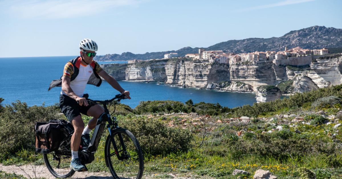
The king of long-distance hiking trails in Corsica is a dream come true, but not everyone has the time and energy to embark on a backpacking adventure of its 16 stages flying over the peaks of the island.
All is not lost, however, because it is possible to flirt with the mythical route for the day and take it for a few hours of walking on its most legendary sections, such as the Aiguilles de Bavella, Lake Nino or the Coscione plateau.
Sports hikes to some of the most beautiful sites in the Corsican mountains.
To discover
Stays in France: weekends, hotels and tailor-made stays from our partners
Read alsoIn Corsica, three essential hikes from one shore to the other
Towards the circus of Bonifato
The Bonifato circus.
STANISLAS FAUTRE / Le Figaro Magazine
Its name means “the forest of blessings”.
Many holidaymakers are familiar with the cool haven of the
Bonifatu forest
, about twenty kilometers from Calvi.
Fewer are those who use it as a starting point to set off towards the GR20, which infiltrates the circus of Bonifatu, above the forest, on the heights of Balagne.
Who says GR20 says demanding mountain hiking.
This route is no exception to the rule.
It does indeed cease to climb (750 m of elevation gain) to
the Carozzu refuge
, the goal of the second stage of the route.
The reward ?
A superb view of the circus needles and the basins located under the
Spasimata footbridge
, synonymous with swimming, just before arriving at the refuge.
Count about 4 hours 30 round trip.
Our advice
You can have something to eat at the Carozzu refuge, where the caretaker serves simple and invigorating dishes appreciated by hikers in season or, on your return to your starting point, at the
Auberge de la Forêt de Bonifato
.
Better to leave early to avoid the hot weather.
Provide plenty of water.
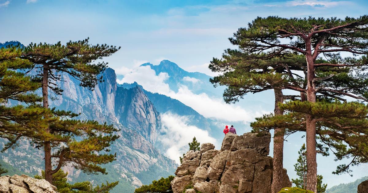
The tranquility of Lake Nino
The pozzines of Lake Nino.
STANISLAS FAUTRE / Le Figaro Magazine
For the brave ones who travel the GR20, the passage by the lake of Nino is like a moment of sweetness in the wildness of the Corsican mountains.
After days of rockery and unevenness, stage 6 is synonymous with walking on a gentle slope, in the shade, and above all with the gentle sensation underfoot provided by the pozzines, these spongy plant formations that border certain Corsican lakes.
A beautiful route allows you to reach this stage from the
Poppaghja forest house
, between Albertacce and the Vergio pass, in the coolness of the
Valdu Niellu forest.
.
The climb is uncompromising but the fatigue flies away when you discover the mirror of the lake bordered by pozzines, between which groups of horses draw light and moving spots.
The bravest can return by taking the very panoramic section of the GR towards the
Vergio pass
and make a loop via the
San Petru pass
(markings are lacking in some places).
Our advice
Depending on the route chosen, allow 4 to 5 hours round trip.
The main difficulty is the drop, almost 700 m.
Pack a picnic, as the shores of the lake provide a sublime setting for a break.
The pozzines are fragile: avoid trampling and stay on the trails as much as possible.
To read alsoTravel in Corsica, by the cross roads
Vizzavona and its basins
The English waterfalls, these natural baths on the course.
Adobe Stock / Emel
At the heart of the island mountain, Vizzavona roughly marks the middle of the GR20 route.
It is also one of the few points where the trail intersects a road, which makes it particularly easy to access.
Most visitors come here to enjoy the crystal clear waters of the
Cascades des Anglais
, an idyllic site of natural baths located on the route, reachable by a 1.5 hour walk round trip.
However, nothing prevents you from continuing further into the
Agnone valley
, to discover more peaceful basins and taste the freshness of the beech and laricio pine forest.
Those who want an adrenaline rush can even rub shoulders with the slopes of
Monte d'Oro
, the fifth summit of the island (2,389 m), via a route that is certainly busy but a bit acrobatic (and poorly marked in places).
Our advice
In season, Vizzavona and the English waterfalls are to be avoided if you are looking for calm.
These sites, the first center of interest on the road linking Ajaccio to Bastia via Corte, can indeed be very busy in the heart of summer.
The world apart from Coscione
A pig on the plateau of Coscione.
Adobe Stock / Viennamotion KG
On the heights of Alta Rocca, the mountain range in the south of the island, the village of
Quenza
extends a few kilometers as the crow flies (which may here be a bearded vulture) from the needles of Bavella.
This peaceful hamlet is also a gateway to
the Coscione plateau
.
Beneath the silhouette of Monte Incudine (2,136 m), this plateau, which extends between 1,400 and 1,700 m in altitude, contrasts with the decor that surrounds it with its vast pastures and its waterways bordered by pozzines.
All the conditions were there for the development of a pastoral activity.
A century ago, the Coscione had hundreds of breeders.
Today, few people live there – there are still a few sheepfolds – but the sheep, horses and pigs bred in semi-freedom are still the guests of the place.
Our advice
Several easy routes criss-cross the plateau, one of which crosses the route of the GR20.
From Quenza, you will have to drive towards the hamlet of
Jallicu
and then continue on a bad but passable road to the
Bucchinera
refuge
.
Plan water and food, because you may not meet anyone, even in high season.
Read alsoCorsica on the mountain side: our best experiences in the summer around Corte
Around the needles of Bavella
The needles of Bavella.
François BOUCHON / Le Figaro
Should we still present Bavella?
The culmination of
the Alta Rocca massif
, this pass inseparable from the seven granite spiers that rise up in the Mediterranean azure offers Corsica one of its most famous postcards.
Add clouds that like to dance between these aptly named
“Aiguilles de Bavella”
, laricio pines close to the summits and… the GR20.
For its fifteenth and penultimate stage, the path offers a crossing of the whole.
Or rather two, because he proposes two paths here.
The first runs along a ridge in wooded landscapes.
The second is rightly called the “alpine variant”: resolutely mineral, it climbs towards the needles to get as close as possible to this chaos of rock, taking sporty passages sometimes equipped with chains and revealing a panorama as far as the coast. oriental to (really!) breathtaking.
The good news is that it is possible from the
Col de Bavella
to go through a loop using the two variants and to return to its starting point.
The route is not easy – around 6 hours and nearly 800 m of elevation – and is aimed at motivated hikers, but allows you to immerse yourself in the world of the GR20 for a whole day.
Who knows, maybe on arrival you will want to try the whole adventure?
Advice
The Bavella pass is overcrowded in high season.
In addition to car parks, you will find bars and restaurants.
This sporty mountain hike is aimed at hikers accustomed to the mountains.
Practical notebook
A few precautions
Putting one foot in front of the other may seem within everyone's reach, but hiking in the mountains requires you to follow a few rules.
All the more so on the GR20.
Created in 1972, this path which today has 16 stages and connects Calenzana, in Balagne, to the outskirts of Porto-Vecchio, i.e. approximately 180 km with a highest point at 2,607 m, follows an uncompromising route which favors the beauty of the landscapes to the muscles of walkers.
The nature of the island also adds its difficulties.
Conditions here can be harsh, even in the “medium” mountains, and summer thunderstorms are legendary.
In summary: do not underestimate the GR20, including on day trips.
The equipment to be provided
Good hiking shoes are essential, as well as protection against the sun and rain.
Don't leave without checking the weather forecast, bring a map and bring enough water and energy foods.
Many people enjoy walking with sticks on these steep and rocky paths.