

Hottest day of the week: meteorologists warn – heavy thunderstorms will follow at the weekend
Created: 08/13/2022, 04:49 am
By: Marc Dimitriu, Patrick Mayer
Midsummer is literally parked in Germany.
There is an extreme heat warning in some areas on Thursday – then the thunderstorms come.
The weather ticker.
Heat in Germany:
Thunderstorms are coming in the south at the weekend.
Midsummer
parks in this country: Only for the North Sea coast there is no heat warning.
It 's getting
even hotter
in
Germany
: temperatures of up to 39 degrees on Thursday.
This
ticker about the heat in this country
is over.
You can read
all further developments regarding the
weather in Germany in this news ticker.
Update from August 4th, 6:36 a.m .:
Germany is facing the hottest day of the entire week this Thursday (August 4th).
The German Weather Service (DWD) predicts that temperatures will reach up to 39 degrees locally.
The highest values are to be expected in southwest Germany and in the southern center.
Especially in the Upper Rhine Graben, the meteorologists warn of sometimes “extreme heat stress”.
According to the DWD forecasts, it will be a little cooler in the extreme west and north-west, where it should be 27 to 32 degrees warm.
Storms are also possible in the north-west, with local danger of heavy rain, hail and heavy gusts of wind.
That should be a little foretaste of the next few days, because the heat should be over by Friday for the time being.
The heat reached its preliminary peak on Thursday (August 4th) - with temperatures up to 39 degrees.
© Karl-Josef Hildenbrand/dpa
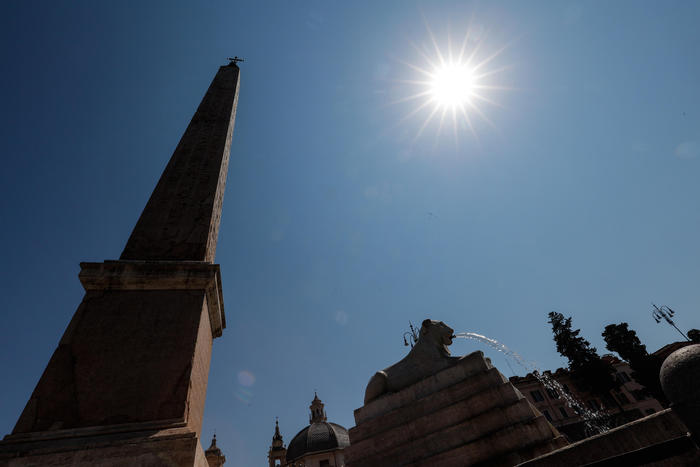
Heat in Germany: Thunderstorms are coming in the south at the weekend
Update from August 2, 9:55 p.m .:
The heat is followed by thunderstorms.
As the German Weather Service (DWD) currently reports, strong thunderstorms with the potential for severe weather are moving from central to southern Germany on Friday during the course of the day and during the night on Saturday.
In the south and parts of the east there is again a strong heat load.
For Saturday, the DWD expects rain and thunderstorms in some areas in the south, for example for Lake Constance and Upper Swabia.
Isolated with heavy rain potential.
Storms are therefore not excluded in the south.
On Sunday it can be thunderstorms at the edge of the Alps, in some areas severe rainstorms cannot be ruled out.
Because of the heat this weekend too: a thunderstorm over Lake Constance in southern Germany.
(symbol photo) © IMAGO / imagebroker
also read
Fish deaths in the Oder: toxins are spreading - Lemke warns of an "environmental catastrophe"
After a fatal accident in an amusement park: an eyewitness raises serious allegations against the operator
Midsummer parks in Germany: Only for the North Sea coast there is no heat warning
Update from August 2, 8:30 p.m.:
It's hot, hotter, the hottest.
The heat wave is not rolling over Germany, midsummer is literally parked in this country.
Namely between the Baltic Sea, the Bavarian Alps, Lusatia and the Rhineland.
Everywhere the same picture.
Even in the evening, the German Weather Service (DWD) issued a heat warning for the entire federal territory, almost for the entire federal territory.
Only for the North Sea coast and the area around Kiel in Schleswig-Holstein was there no heat warning in the evening.
With a view to Thursday, the DWD even warns of extreme heat in Breisgau in Baden around Freiburg.
Sweltering hot cities: High temperatures are measured in Frankfurt am Main and Mannheim
Update from August 2, 5:30 p.m .:
Germany is happy about it, but sometimes also groans under the heat at the beginning of August.
From north to south, from east to west - it's midsummer everywhere in Germany.
According to the online portal
wetterdienst.de
, the highest temperatures were measured this Wednesday in Müllheim - with up to 36.1 degrees.
In the middle of the city of Frankfurt am Main with 35.7 degrees and in Mannheim with 35.1 degrees it was sweltering hot today.
According to various reports, the peak of the hot temperatures will not be reached until this Thursday.
In any case, August keeps its promises this year.
It's getting even hotter in Germany: temperatures of up to 39 degrees on Thursday
Update from August 2, 1:10 p.m .:
It will be even hotter in Germany: On Thursday the temperatures will reach up to 39 degrees, “which at the same time marks the peak of the heat wave,” said meteorologist Tobias Reinartz from the German Weather Service on Wednesday.
Thunderstorms, some severe, can bring temporary cooling on Thursday and Friday, but then it will remain summery and warm in many places.
For Thursday, the DWD warned of strong and sometimes extreme heat stress in the Upper Rhine Graben.
The experts recommend drinking enough water, avoiding direct sun and physical exertion, and keeping your home cool.
According to forecasts, there may be local severe showers and thunderstorms in the west and north-west on Thursday.
There is a local risk of heavy rain, hail and heavy gusts of wind.
Otherwise there is a lot of sunshine with at most harmless cumulus clouds.
Maximum temperatures are in the northwest and near the Baltic Sea at 25 to 32 degrees, otherwise, according to the DWD, it gets very hot at 32 to 39 degrees - with the highest values in the southwest and in the southern center.
On Friday the sky will be heavily overcast in a wide strip from the south-west to the north-east.
Then there can be sometimes heavy showers and thunderstorms, which gradually shift to the south-east.
In the southeast, the day often starts sunny at first, later the risk of thunderstorms increases with a local risk of severe weather.
In the northwest, on the other hand, the sky is becoming increasingly loose, with some longer sunny periods, and showers can only occur near the North Sea.
The maximum values are in the north-west half at 20 to 28 degrees, in the south-east half it gets hot again at 29 to 35 degrees.
"On Saturday, showers and thunderstorms will also clear the hot air in the south and south-east.
It stays warm there at 25 to 30 degrees," said meteorologist Reinartz.
In the north, on the other hand, it will be cooler.
Thanks to Hoch Oskar, the weather is calming down: "So Sunday and the beginning of the new week will also be calm, increasingly warm again in the north and unfortunately probably mostly dry overall."
Heat wave in Germany: DWD expects the peak on Thursday
Update from August 2, 3:18 p.m .:
“A low north of Scotland will shovel very hot air from the Mediterranean Sea to Germany in the next few days,” explains DWD meteorologist Marco Manitta in a current video about the upcoming heat.
Temperatures are heading for a peak on Thursday.
The heat schedule currently looks like this:
Tuesday (2 August 2022) | up to 30 degrees |
Wednesday (3 August 2022) | Temperatures between 30 and 37 degrees |
Thursday (4 August 2022) | Temperatures between 30 and 39 degrees. |
During the course of the day on Thursday, however, the potential for severe weather also increases.
The DWD is already expecting thunderstorms with heavy rain, hail and gusts of wind in the north-east.
"Short but crisp heat wave": Meteorologist warns of high temperatures - "up to 40 degrees"
Update from August 2, 12:31 p.m .:
While the temperatures are increasing over the course of the week and are even expected to exceed 40 degrees, there is a risk of severe thunderstorms at the same time.
The first thunderstorms in the north-west are expected to move to Germany on Thursday.
This is reported
by wetter.com
.
On Friday these then solidify.
Except for the south-east, there can be severe thunderstorms with heavy rain and hail.
Temperatures also drop to as low as 18 degrees on the North Sea.
In the south, however, it will remain hot at 30-37 degrees.
The focus of the thunderstorms on Thursday are from NRW to the Baltic Sea.
On Friday then in the middle of the Saarland to Saxony, as well as on the edge of the Alps.
"Short but crisp heat wave": Meteorologist warns of high temperatures - "up to 40 degrees"
Update from August 1, 7:50 p.m.:
This week will be an extremely sweaty affair.
For Wednesday and Thursday, the forecasts are now up to 40 degrees, as reported by
wetter.com
.
The US weather model even brings values of 41 or even 42 degrees into play.
It seems to be getting particularly hot in central and eastern Germany.
Extreme heat stress is even expected for Thursday due to particularly humid and therefore muggy air masses.
The temperatures on the Upper Rhine could even feel like 43 or 44 degrees.
The heat could also last on Friday, and on top of that there will be no precipitation.
The breather will probably also be very short, from Saturday the temperatures could rise again.
Fluid intake: Germany is groaning under another heat wave.
© IMAGO / Harry Koerber
First report from August 1st:
Munich – After cooling off in the last days of July, the heat is expected to return to Germany in August.
At the beginning of the week, however, rain, thunderstorms and sometimes storms have to be expected again.
From the middle of the week, the German Weather Service (DWD) sees a “new significant heat wave”.
Week starts with light showers and isolated thunderstorms - otherwise hot and dry
On Monday afternoon, showers are expected over central and eastern Germany.
In the course of the day also with individual thunderstorms, which spread to the south in the evening.
In the south it will be partly sunny beforehand.
In the north it will be cloudy, towards the coast it will be sunny for a longer period of time in the afternoon and also mostly dry.
Temperatures in the north west and north reach between 18 and 24 degrees, otherwise it stays hot with highs of 25 to 31 degrees.
According to the DWD, there will be showers and individual thunderstorms in the south and south-east from dense source clouds on the night of Tuesday.
In the foothills of the Alps regionally even longer lasting and sometimes thundery rainfall.
Otherwise variable to slightly cloudy and dry.
In the southern half 18 to 12 degrees, in the north 12 to 5 degrees.
"Widespread hot with 30 to 35 degrees": heat wave from Wednesday
On Wednesday the weather will finally change and then the real heat is expected.
It will be "widely hot with 30 to 35 degrees", reported the meteorologists about Bavaria.
According to the forecast, temperatures in the Lower Main and in the large cities of Bavaria will fall below the 20-degree mark at night.
According to the DWD, there should only be a cool 13 degrees in some Alpine and Bavarian Forest valleys.
In the north the weather will remain changeable, in the north-west it will also be cloudy at times, but there will hardly be any showers.
In the north-west it stays only slightly cooler than in the rest of the country at 22 to 29 degrees.
Partly cloudy in the north on Thursday night, but hardly any showers.
Otherwise few clouds and dry.
Minimum temperatures from 23 to 17 degrees, in the southeast up to 14 degrees.
According to the weather trend, the mercury column will continue to climb in the second half of the week.
DWD meteorologist Marcus Beyer explained that it will be a “short but crisp heat wave”, as people have been familiar with from the past two months.
(md with dpa)


/cloudfront-eu-central-1.images.arcpublishing.com/prisa/KMEYMJKESBAZBE4MRBAM4TGHIQ.jpg)


