
Calm is back.
Clearings are chasing away the instability of the middle of last week.
This improvement in the weather is linked to the Azores anticyclone which is regaining pressure in the Bay of Biscay.
Sunday, the temperature remains summery, but precipitation is expected in the west of the country according to La Chaîne Météo*.
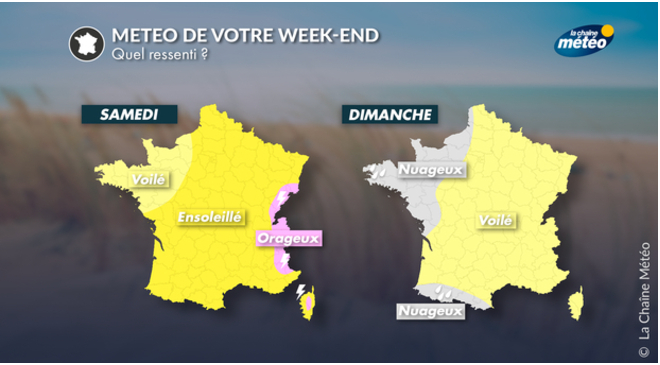
The trend for Saturday August 20:
the mornings are cloudy between the Center-West and the
Grand-Est.
Light rain is possible locally.
The sun is present in the afternoon.
The Vosges and the Jura are under the threat of storms.
In the Northeast, the mornings are very cold with a temperature of 7°C.
The Mistral and the Tramontana blow up to 50 km/h in the Mediterranean but the weather remains very sunny.
Temperatures are between 20 to 33°C across the country.
Read alsoFaced with heat waves, are thunderstorms inevitable?
The trend for Sunday August 21:
unlike Saturday, the Centre-East and the North-East benefit from dry and sunny weather.
Disturbances arriving from the northwest bring many clouds to western France and rain to Brittany.
Thunderstorms are likely over the Pyrenees and the Southern Alps.
Temperatures drop this Sunday because of the clouds in the North where they are expected 18 to 25°C.
In the rest of France, they are stable and emerge from 26 to 33°C.
*
The Weather Channel belongs to the Figaro group.


