US forecasts up to 6 major hurricanes this season 1:54
(CNN) --
It's not your imagination.
The tropical formations of the Atlantic have been very quiet this year despite NOAA and other experts forecasting an above-average season.
There hasn't been a named storm since early July, and if one doesn't form by the end of the day, it will be the first August in 25 years not to have a named storm.
"Since 1950, two Augusts have not had named storm formations in the Atlantic: 1961 and 1997," tweeted Phil Klotzbach, a research scientist at Colorado State University.
The Atlantic hurricane season has been exceptionally quiet.
Why?
And what will happen now?
And it's not just limited to August.
Klotzbach also tweeted:
"For the first time since 1941, the Atlantic has had no named storm activity (eg, tropical storms or #hurricanes) from July 3 to August 30."
But the trend may not continue.
advertising
"This remarkably quiet period of Atlantic tropical cyclones is likely to end soon," Klotzbach said Wednesday morning.
Hurricane season is about to pick up, but may not reach the level initially anticipated
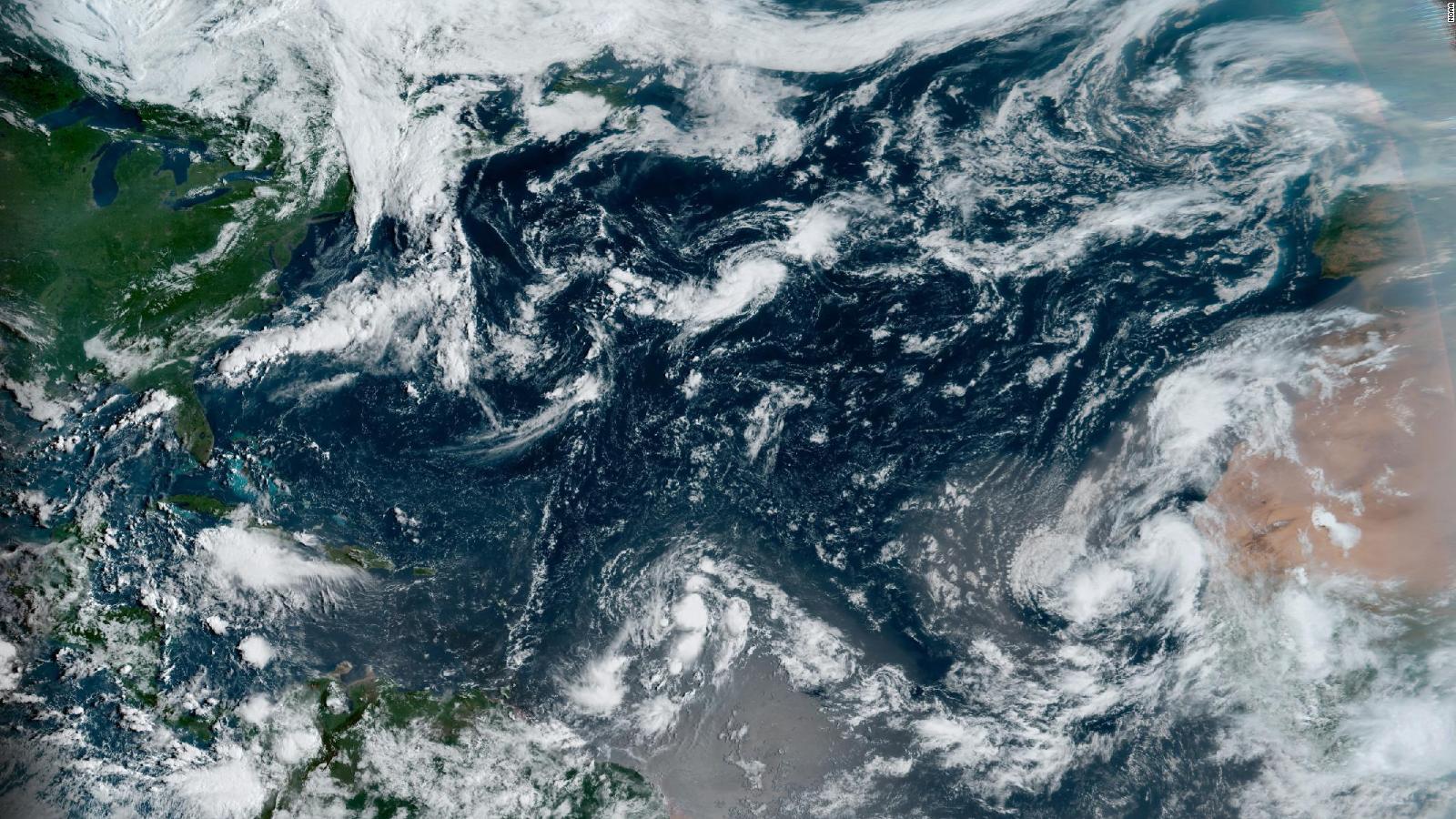
The National Hurricane Center is monitoring three zones for possible tropical development in the next five days.
The National Hurricane Center is actively monitoring three areas where tropical cyclones are likely to form in the next five days.
Two of them have a high chance of forming, and one off the west coast of Africa has a medium chance.
Forecast models show a possible hurricane heading toward the United States by the Labor Day holiday weekend.
But models show the storm will make a 180-degree turn and head back out into the Atlantic, possibly approaching Bermuda.
The western US will face a prolonged record heat wave this week
Conditions seem quite ripe for the formation of three hurricanes in the next 10 days, Klotzbach told CNN, adding that he is not ruling out having five more hurricanes after September 10.
Still, above-average hurricane season predictions could fall short this year.
"The latest seasonal hurricane forecast from Colorado State University was issued in early August, but the odds of these forecasts coming true are getting lower by the day," Klotzbach acknowledged.
"Now the odds of getting 20 named storms, 10 hurricanes and 5 major ones are really low," Klotzbach said.
"Like I've said before, forecasting the weather and climate keeps you humble."
Looking back historically, the other two years without named storms in August had quite different results.
"1961 ended up being a hyperactive hurricane season with an extremely active September-November, while 1997 was a below average season," Klotzbach tweeted.
It's still too early to predict with any certainty, but forecasters are focused on a system that will move off Africa in about 6-7 days.
It will be one to watch, if some of the factors that suppress tropical storms this summer abate.
Satellite images taken Wednesday morning show tropical activity beginning to pick up as we approach the peak of hurricane season.
Varying wind speed and strength kept hurricanes at bay
According to CNN meteorologist Taylor Ward, there have been a couple of factors that have likely led to a quiet July and August in the Atlantic basin.
"Mainly above-normal wind shear and dry air."
Wind shear is the change in wind speed and strength with height in the atmosphere.
High levels of wind shear prevent tropical disturbances from developing into well-organized systems and can also disrupt systems that are just beginning to form.
"We are currently in a La Niña pattern, which tends to reduce wind shear over the Caribbean and the Tropical Atlantic," he said.
"So the fact that, so far, we've recorded above normal wind shear is surprising."
NOAA updates its Atlantic hurricane forecast and says it will remain above normal
Klotzbach agreed that one reason is vertical wind shear in the Caribbean and central tropical Atlantic.
But, he tweeted, "Although the shear has been stronger than anticipated, it's still not that high. The 30-day average shear across the Caribbean and tropical Atlantic is tracking between an average #hurricane season and above average." average," Klotzbach tweeted.
"However, the shear is stronger than the typical #LaNina year."
"Similar to high wind shear, dry air also limits the growth of tropical wave thunderstorm activity," Ward explained.
The dry air is mainly in the form of Saharan dust.
The dust leaves Africa and moves through the Atlantic basin.
"This is not unusual in the early stages of the Atlantic hurricane season, but this year has been above average," he noted.
"Although the central tropical Atlantic/Caribbean has been generally dry, it is not hugely anomalous," Klotzbach tweeted.
For a hurricane to form, CNN meteorologist Chad Myers said, many ingredients need to come together perfectly.
"If a single key piece is missing, tropical systems will not develop," he said.
"Everything has to go right, but it only takes one thing for it to go wrong."
Current indications are that things will start to improve.
But for now, it is a matter of waiting.
La Niña years historically tend to have a more active end to the hurricane season, which will last another three months.
"Will the second half of the season make up for the first? We don't really know yet, but we certainly hope not," Myers said.
Hurricane


/cloudfront-eu-central-1.images.arcpublishing.com/prisa/KJKFJLLN25HIBCH7EI7AXP3X44.jpg)