

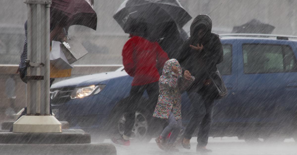
The northern half of the country is marked by frequent showers and sleet, this Tuesday, September 27, according to the
Weather Channel *
.
A strong wind is also blowing in the Mediterranean, particularly over the Var and Corsica.
In question, a deep depression which circulates on the North Sea and conveys a flow from the northwest on France.
This disturbed ocean air causes strong instability on French territory, in particular on the north-eastern two-thirds.
The skies are gray and the weather wet and cold above the mountain peaks.
Read alsoThe overheated Mediterranean promises us storms in the fall
The weather in your area
From
Brittany
to the
Grand Est
via
Île-de-France
: north of the Loire, the weather is very unstable and cool, and subject to strong winds.
The sky will be changeable in the morning.
The clearings alternate with still infrequent showers, but already present in the North-East.
These showers are getting stronger in the afternoon, especially near the
Channel
coast and northeast of the Seine.
Sleet gusts can also be expected in the
Ardennes
region , where the wind is gusting to 70-80 km/h and 50-70 km/h inland.
The feeling is cool, dress warmly.
More sustained and regular showers fell on
Brittany
and the
Cotentin
at the end of the afternoon.
Read alsoIn France, the century promises us heat waves, erosion and storms
South
of the Loire
, the weather is milder.
Showers are less frequent there, although the weather remains very cloudy and very humid.
South of the
Garonne
, and especially towards the
Pyrénées-Atlantiques
, the sky remains overcast and rainy all day.
There is also a north-westerly wind on the Atlantic coast, and especially in the mountains.
For its part, the center-east is not spared and it is raining on the plains.
The sky remains very overcast, particularly in the mountains, where regular rain falls in
Franche-Comté
and
Savoie
.
It is cold, especially in the afternoon when the highs do not take off.
In the mountains, the snow can fall from 1400 meters and stay on the ground at 1600 meters with blizzard conditions.
The
Southeast
still retains beautiful clearings and the sky remains rather clear.
Be careful, however, to cover yourself warmly, since the tramontane and mistral reach 80 km/h, and 100 km/h on the Var.
Westerly winds sweep across
Corsica
, and gusts can reach 140 km/h on exposed capes and the mountains.
Temperatures are cooler than seasonal averages.
*The Weather Channel is a property of the Figaro group.


/cloudfront-eu-central-1.images.arcpublishing.com/prisa/KMEYMJKESBAZBE4MRBAM4TGHIQ.jpg)


