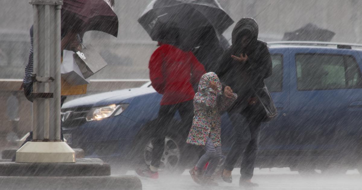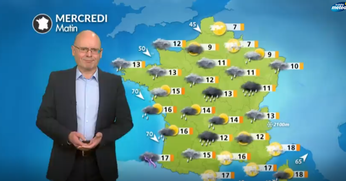
The autumn weather continues this Wednesday, September 28 with low temperatures, rain and wind, according to the Weather Channel*
.
Heavy rains fall on many regions, especially from the Pyrenees to the Center-East of France, showers welcome on these territories victims of drought.
In question, a deep depression which circulates on the North Sea and conveys a flow from the northwest on France.
Read alsoIn France, the century promises us heat waves, erosion and storms
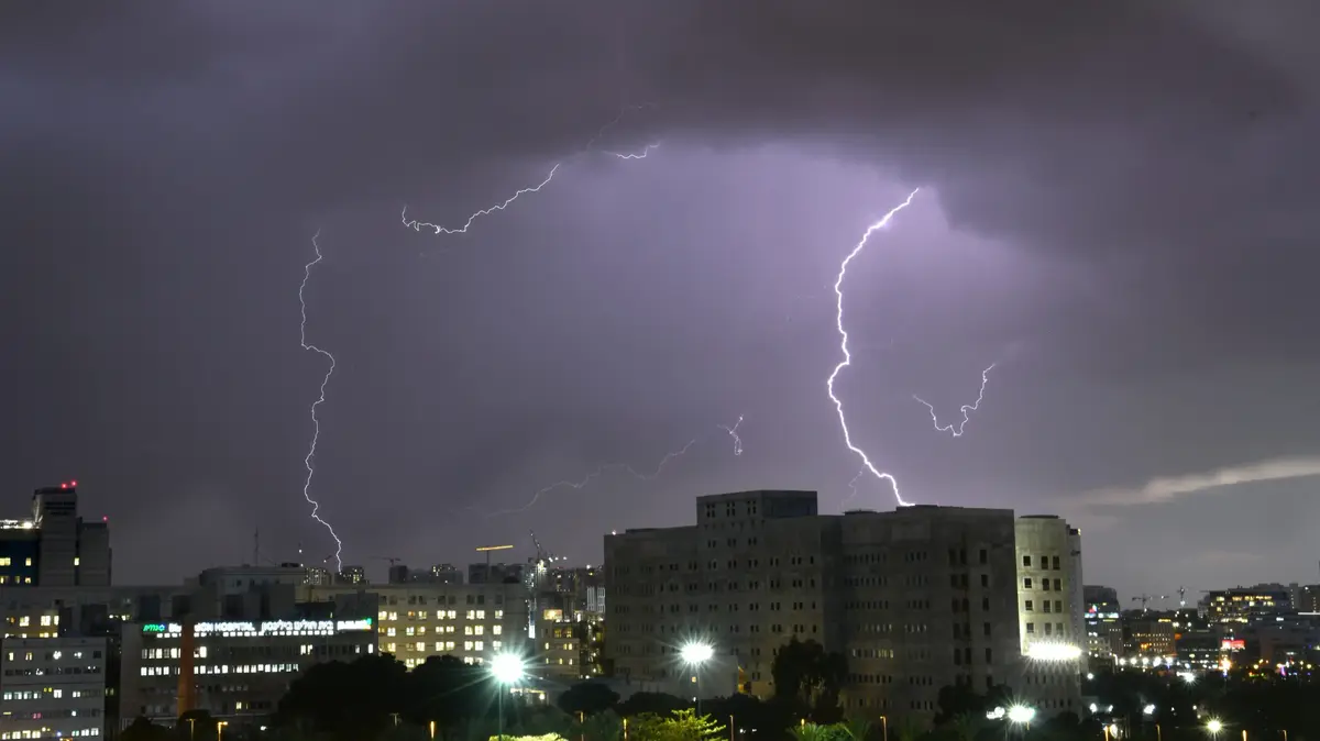
This disturbed oceanic air causes strong instability on French territory, and the disturbance concentrating cold air and abundant rain accumulations remains blocked on the central territories.
A strong wind blows on the Aquitaine coast and around the Mediterranean, where cold air rushes in.
Temperatures remain cool, and peak in the afternoon.
The weather in your area
Heavy showers are expected in the
northwest
in the morning, with good gusts of wind.
The weather softened in the afternoon, with less rain and less wind.
Temperatures remain relatively correct in the morning, with mercury between 10 and 13°C.
Be careful, however, not to discover yourself in the afternoon: the temperatures do not rise!
The sky is mixed
north of the Seine
, in
Hauts-de-France
and in
Champagne-Ardenne
.
The weather remains mild, and it should not rain.
If the wind remains rather weak, the temperatures do not rise, settling around 14° to 15°C in the afternoon.
No change in
Ile-de-France
, since the weather remains cloudy, with some clearings and some showers to be expected during the day.
We can expect rain in the south of the region in the early morning, showers which should then drain towards the
Center
.
From
the Loire Valley
to the
Center
and
Burgundy
, in
Lorraine
, the morning remained quite rainy, after a more than humid night.
The rains stop but the sky remains very cloudy at the end of the day.
Temperatures remain cool.
From the
South-West
to the
Center-East
via
Auvergne-Rhône-Alpes
,
Franche-Comté
and
Alsace
, the day remained rainy.
Showers are expected in the Basque Country, the heights of Limousin, the west of the Jura mountains and the Savoyard pre-Alps.
Limagne, Forez and Lyonnais remain relatively spared by the rains.
Temperatures remain low.
At altitude, the snow falls around 2200 meters in the Pyrenees, 1700 meters in Auvergne and 1600 meters in the Jura and the Savoies.
Read alsoThe hottest summer 2022 recorded in Europe, according to the Copernicus service
The weather is strong wind coming from the West in the
South-East,
especially in the south of
Var
and
Corsica
.
Gusts can still reach 100 km / h, even 140 km / h on the capes of Corsica and the mountains.
The sky remains fairly clear despite passing clouds.
It is more threatening in western Corsica, with showers to be expected in the mountains.
Temperatures, slightly lower than seasonal averages, still reach 21° to 24° in the afternoon, or even 27°C in Nice.
*The Weather Channel is a property of the Figaro group.