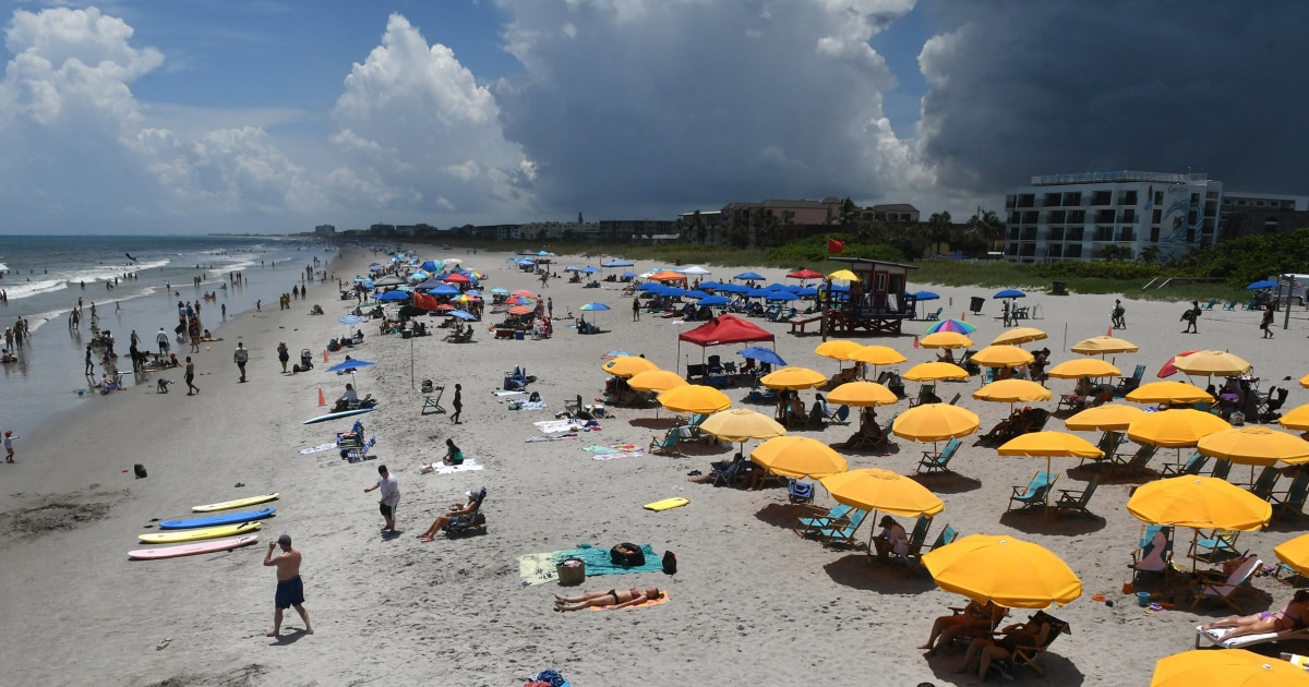
Hurricane Ian sucks much of the water out of Tampa Bay 2:20
(CNN) --
Hurricane Ian made landfall on Florida's Gulf Coast as one of the strongest tropical cyclones on record to hit the area.
Its storm surge could be unlike anything on record there by the time the eye of the hurricane reaches the coast, and forecasters are warning heavy rains from Ian, which are expected to continue across the peninsula into Thursday, could lead to life-threatening flooding.
These are the aspects of Hurricane Ian that are unprecedented.
The strongest tropical cyclone on record in the region
Despite being in hurricane territory, major hurricanes, Category 3 or higher, are not common in this part of Florida.
Hurricane Ian made landfall along the southwestern coast of Florida near Cayo Costa around 3:05 pm (Miami time) with winds near 150 mph (240 km/h), making Ian a a high level category 4 hurricane.
Tide forecast: up to 5.4 meters
The National Hurricane Center on Wednesday increased Ian's storm surge forecast from 12 to 18 feet (3.6 to 5.4 meters) from Englewood to Bonita Beach, which would be something never seen before in the region.
Storm surge is caused primarily by the hurricane's strong winds, which blow from the ocean onto land and push huge amounts of water farther offshore, and will likely be the deadliest part of Hurricane Ian.
90% of hurricane-related deaths are water-related, according to the National Hurricane Center, and about 50% are caused by storm surge.
advertising
Current size of #Ian's eye and eyewall, compared with Charley's in 2004 when it was in a similar location approaching the coast #flwx pic.twitter.com/E0V9MRVZ6w
— Stu Ostro (@StuOstro) September 28, 2022
Hurricane Charley, which made landfall in the same area as a Category 4 hurricane in 2004, had a maximum storm surge of about 6-7 feet (2 meters), so Ian's forecast is more than double that.
Part of what will make Ian's dizzy spell that much bigger is his size.
The hurricane's eyewall, where the strongest winds are found, covers a much larger area than Charley's in 2004, and its hurricane-force winds extend 128 kilometers (80 miles) across the tropical cyclone, which will extend the storm surge over a much larger area.
Unprecedented Strength
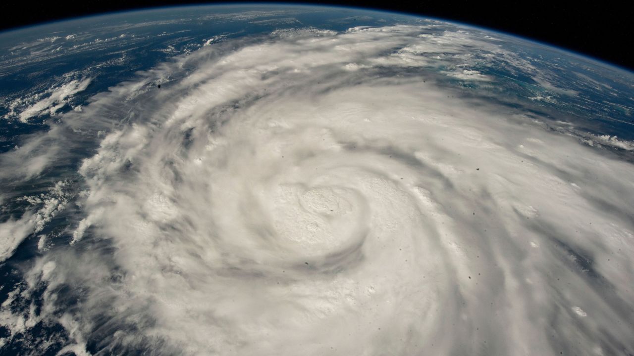
View of Hurricane Ian from the International Space Station on September 26.
Credit: NASA via AP
Hurricane Ian rapidly intensified this Wednesday morning.
Its maximum winds increased from 193 to 250 km/h (120 mph to 155 mph) in less than three hours, jumping from a Category 3 to a strong Category 4 in the process.
Rapid intensification is defined as an increase in wind speed of 56 km/h (35 mph) or more in 24 hours, and has historically been a rare phenomenon.
But scientists say hurricanes are increasingly likely to intensify as the climate crisis progresses, raising ocean temperatures and setting the stage for them to explode at breakneck rates and become larger and more deadly hurricanes.
Ian's intensification is unprecedented for a tropical cyclone this strong in its location Wednesday morning, according to Sam Lillo, an engineer with the DTN Weather forecast team.
Not only did Ian's intensity jump significantly, but there is no record of a tropical cyclone this strong strengthening at all in that location, according to Lillo.
What types of hurricanes are there and what do categories 1, 2, 3, 4 and 5 mean?
Threat of extreme flooding for several days
Extreme rainfall is a big concern with Hurricane Ian.
Instead of quickly traversing the Florida panhandle after landfall, Ian is going to take his time reaching the Atlantic, which means he'll have more time to generate high-capacity flooding rains.
"Widespread, potentially life-threatening, catastrophic flooding is expected in parts of central Florida, with significant flooding in southern Florida, northern Florida, southeastern Georgia and coastal South Carolina," the National Center said on Wednesday. of Hurricanes.
"Significant and prolonged river flooding is expected throughout central Florida."
The Weather Prediction Center has issued its highest outlook, Level 4 out of 4, for extreme rainfall over a wide swath of the Florida panhandle, including the Tampa area, Cape Coral, Orlando and Melbourne.
Rain rates are likely to exceed 3 inches (76 mm) per hour on Wednesday, which could result in at least 1 foot (30 cm) of rain in central Florida, the center said.
Precipitation will move north on Thursday, putting Gainesville and Jacksonville at risk.
What to expect from Hurricane Ian in Tampa, Fort Myers, Punta Gorda and more
Record flooding of rivers expected
What makes Ian's flood threat even more intense is that Florida's rivers were already swollen before the hurricane hit.
Over the past two weeks, there has been more than twice the average rainfall in South Florida, with widespread amounts of more than 6 inches (152 mm).
The Peace River, which flows from central Florida in Polk County and empties into the Port of Charlotte, was several meters above flood stage Tuesday.
This is particularly concerning because Hurricane Ian is expected to push the worst storm surge into Charlotte Harbor.
A huge rush of water upriver could cause a bottleneck in river flow and even more flooding in and around Port Charlotte and Punta Gorda.
Record river levels are forecast in many places, including:
Cypress Creek at Worthington Gardens: 4.4m (previous record is 4.2m)
Myakka River at Myakka State Park: 3.9m (previous record is 3.8m)
Horse Creek in Arcadia: 5.6m (previous record was 5.4m)
Peace River at Zolfo: 7.68m (previous record is 7.62m)
Peace River at Bartow: 3.4m (previous record is 3.3m)
-- Allison Chinchar contributed to this report.
FloridaHurricane Ian