
Hurricane Ian sucks much of the water out of Tampa Bay 2:20
(CNN) --
Here's a list of key places in Florida that will be affected by Hurricane Ian, and what CNN forecasters are predicting as the cyclone moves.
These are estimates based on the latest forecast guidance and are subject to change.
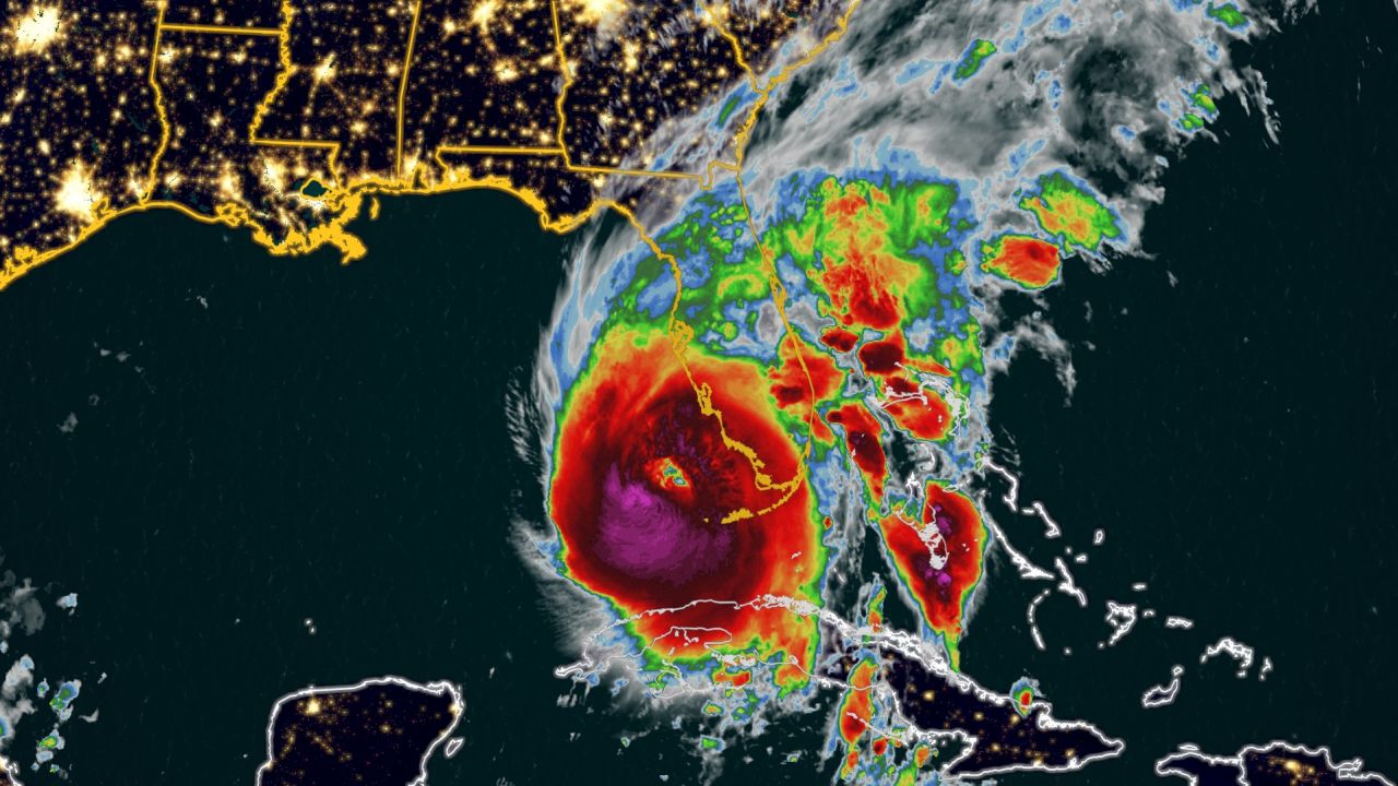
Hurricane Ian is shown in this satellite image as it churns off the Florida coast early Wednesday.
Fort Myers:
Tropical Storm Force Wind Gusts:
Before 8 a.m. Wednesday through 8 a.m. Thursday
Hurricane-force wind gusts:
9 a.m. to 8 p.m. this Wednesday
Maximum winds:
gusts of 128 to 144 km/h and higher, from 10 am to 6 pm this Wednesday
Rain forecast:
101 to 152 mm through Friday
Storm surge forecast:
3.6 to 4.8 meters
Punta Gorda/Port Charlotte:
Tropical Storm Force Wind Gusts:
Before 8 a.m. Wednesday through 9 a.m. Thursday
Hurricane-force wind gusts:
11 a.m. to 10 p.m. Wednesday
Maximum winds:
gusts of 177 to 209 km/h and higher, from 2 pm to 7 pm this Wednesday
Rain forecast:
152 to 203 mm through Friday
Storm surge forecast:
3.6 to 4.8 meters
Sarasota:
Tropical Storm Force Wind Gusts:
6 a.m. Wednesday to 9 p.m. Thursday
Hurricane-force wind gusts:
3 p.m. Wednesday to 2 a.m. Thursday
Maximum winds:
gusts to 128 to 144 km/h and higher, 6 pm Wednesday until midnight
Rain forecast:
254 to 355 mm until Friday
Storm surge forecast:
1.8 to 3 meters
St. Petersburg:
Tropical Storm Force Wind Gusts:
6 a.m. Wednesday to 12 a.m. Friday
Maximum winds:
gusts up to 112 km/h and higher, from 8 pm Wednesday to 4 am Thursday
Rain forecast:
254 to 330 mm until Friday
Storm surge forecast:
1.2 to 1.8 meters
Tampa:
Tropical Storm Force Wind Gusts:
8 a.m. Wednesday through Thursday afternoon
Maximum Winds:
Gusts to 60 mph and higher, 5 pm Wednesday through Thursday morning
Rain forecast:
304 to 381 mm through Friday
Storm surge forecast:
1.2 to 1.8 meters
This is Cuba after the passage of Ian 2:13
Florida