Closed slopes and even ski areas, snow fronts that are greener than white... The mildness records recorded at the end of the year in France and Europe have so far compromised ski activity in low and medium altitude resorts. , where professionals highlight other activities.
According to the meteorologist of the Weather Channel (*) Cyrille Duchesne the snow will be back between Sunday and Monday, at medium and high altitude, while the country is gradually moving towards more "normal" temperatures.
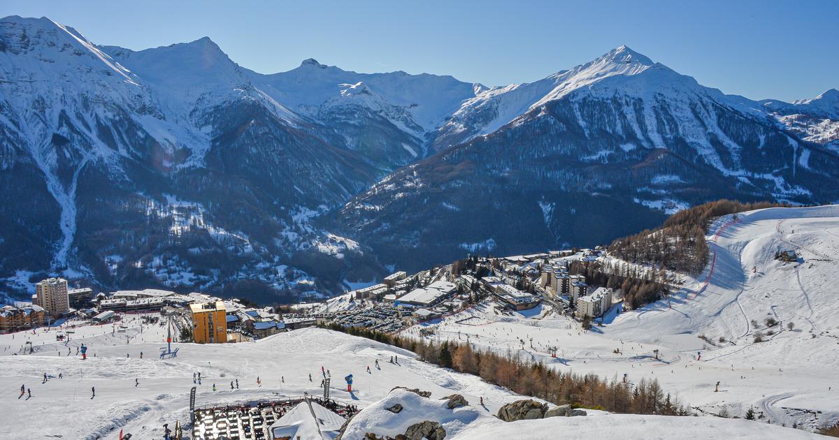
Read alsoRanking of the 200 French ski resorts: ski pass prices, snow cover... which one is right for you?
LE FIGARO - Half of the ski slopes are closed to date. How do you qualify the current snowfall and temperature compared to the averages for the season?
CYRILLE DUCHESNE.
- The situation is unfavourable, the resorts are suffering with the notable exception of the southern Alps, in particular Queyras and Ubaye, or the border Alps.
Some resorts have to close slopes or close altogether in the Vosges, Jura, Massif Central, part of the Pyrenees... There is hardly any snow at low altitude and the large ski areas only really manage to operate beyond of 1800 meters.
Compared to seasonal averages, it is the abnormally high temperatures that are in question.
2022 is a year of heat records and the mountains are on the front line.
The thaw caused the melting of snow which, in volume, is within the average for the season with heavy falls at the beginning of December, combined with negative temperatures.
The exceptional thaw of the Christmas holidays and until today, especially in the Pyrenees, has degraded or got the better of the snowpack with the zero degree isotherm sometimes located at night at more than 3000 meters!
Under these conditions, even the production of artificial snow is difficult.
The rain snow limit should be between 1200 and 1400 m, which will also benefit mid-altitude resorts
What are the prospects?
I am optimistic, the weather will be calm and mild until the weekend but the situation will improve on the snowy front from this Sunday.
A vast low pressure system is moving over Western Europe with cooling aloft.
The context will be favorable for snowfall since precipitation will be associated with a depression that will cross the country, especially to the east.
In summary, it will snow from Sunday - Monday on all the massifs, but three uncertainties persist to this day.
The rain-snow limit, first of all, should be between 1200 and 1400 m, which will therefore also benefit mid-altitude resorts, but this can still fluctuate favorably, that is, it may snow lower .
These falls, then,
influenced by wet west-northwest flows should be more intense on the massifs in the east of the country (Vosges, Jura and Northern Alps), and less in the Pyrenees and the Southern Alps, two areas influenced by the anticyclone Mediterranean.
Finally, will this snowy weather persist?
The disturbances should continue but it is still too early to advance further, in particular on the rain-snow limit, which could refluctuate in altitude.
(*) The Weather Channel is a property of the Figaro group.
Find its mountain and snow weather forecast online.
/cloudfront-eu-central-1.images.arcpublishing.com/prisa/S7EEXKSOAFNC5GML424T7A7DFY.jpg)


/cloudfront-eu-central-1.images.arcpublishing.com/prisa/2C5HI6YHNFHDLJSBNWHOIAS2AE.jpeg)