
Cold weather across Mexico is atypical, expert says 2:31
(CNN Spanish) --
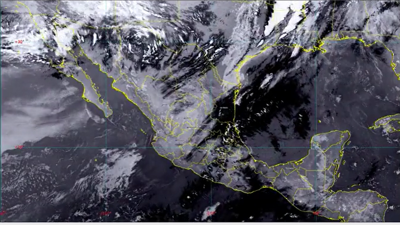
The National Meteorological Service (SMN) of Mexico reported this Wednesday that cold front number 21 of the 2022/2023 season will continue to affect various areas of the country in the next 96 hours.
This phenomenon, which was announced by the SMN on December 31 and represents the last cold front of 2022, has been causing, among other things, rain and frost in several states of the country.
Likewise, the SMN foresees the entry of a new cold front, number 22, in the 96 hours of the forecast, so the weather conditions in that period will be affected by both fronts.
Increase the minimum wage in Mexico by 20% by 2023: how much will the amount be and when does it come into effect?
Cold front 21 and 22 in Mexico: where and how it affects
Forecast for Wednesday, January 4 to Thursday, January 5
According to the SMN, the cold front 21 will move slowly over eastern Mexico and the cold air mass associated with this front will cover the northwest, north, and northeast of the country.
The cold front is accompanied by a low pressure channel and a "North" event.
All this will cause the following weather conditions in the country:
advertising
Tabasco, Veracruz and Chiapas
: intervals of showers with heavy occasional rains (25 to 50 millimeters -mm-)
Puebla and Oaxaca
: intervals of showers (5 to 25 mm)
Michoacán, Guerrero, Hidalgo, Tlaxcala, State of Mexico, Mexico City, Morelos, Campeche, Yucatán and Quintana Roo
: isolated rains (0.1 to 5 mm)
Coast of Tamaulipas and Veracruz
: moderate "North" event with gusts of 40 to 50 kilometers per hour (km/h) during the afternoon of Wednesday, extending during the night with gusts of 50 to 70 km/h in the
Isthmus and Gulf from Tehuantepec
Mountainous areas of Chihuahua and Durango
: minimum temperatures for Thursday morning from -10 to -5 degrees Celsius (°C) with frost
Mountainous areas of Baja California, Sonora, Zacatecas and the State of Mexico
: minimum temperatures for Thursday morning from -5 to 0 °C with frost
Mountainous areas of Coahuila, Nuevo León, San Luis Potosí, Aguascalientes, Jalisco, Michoacán, Guanajuato, Querétaro, Hidalgo, Puebla, Tlaxcala, Mexico City and Veracruz
: minimum temperatures for early Thursday morning from 0 to 5 °C with possible frosts
Forecast for Thursday, January 5 to Sunday, January 8
The SMN points out that on Thursday the cold front 21 off the coast of Veracruz, while on Friday and Saturday it will remain stationary over the Mexican southeast and the Yucatan Peninsula.
In turn, the cold air mass associated with cold front 21 will cover the north, northeast, center, and east of the country.
In the forecast period from Thursday to Saturday, the SMN foresees the entry of cold front 22, which will travel through the northwest and north of the Mexican Republic.
All of the above will generate cold to very cold weather in the mornings and nights, as well as very strong showers, winds and rains from Thursday towards the early hours of January 8.
Here is the forecast by area of the country and by day:
From 5 to 6 January
Tabasco and Chiapas
: very heavy rains with intense punctuals (75 to 150 mm)
Veracruz and Oaxaca
: heavy rains with very strong points (50 to 75 mm)
Puebla and Campeche, Yucatán and Quintana Roo
: intervals of showers with heavy punctual rains (25 to 50 mm)
Baja California, San Luis Potosí, Hidalgo and Querétaro
: intervals of showers (5 to 25 mm)
Tamaulipas, Guanajuato, Michoacán, State of Mexico, Mexico City, Morelos, Tlaxcala and Guerrero
: isolated rains (0.1 to 5 mm)
"North" event with gusts of 60 to 80 km/h in the
Isthmus and Gulf of Tehuantepec
, and with gusts of 40 to 60 km/h on the
coast of Veracruz and Tabasco
Gulf of California, Baja California, Sonora, Coahuila, Nuevo León, Tamaulipas, Zacatecas and San Luis Potosí
: wind with gusts of 40 to 60 km/h
Mountainous areas of Chihuahua and Durango: minimum temperatures for early Friday morning from -10 to -5 °C with frost
Mountainous areas of Baja California, Sonora, Zacatecas, Aguascalientes and the State of Mexico
: minimum temperatures for early Friday morning from -5 to 0 °C with frost
Mountainous areas of Coahuila, Nuevo León, San Luis Potosí, Jalisco, Michoacán, Guanajuato, Querétaro, Hidalgo, Puebla, Tlaxcala, Mexico City, Oaxaca and Chiapas
: minimum temperatures for early Friday from 0 to 5 °C with possible frosts
From 6 to 7 January
Chiapas
: heavy rains with very strong points (50 to 75 mm)
Veracruz, Oaxaca, Tabasco, Campeche, Yucatán and Quintana Roo
: intervals of showers with heavy punctual rains (25 to 50 mm)
Puebla
: intervals of showers (5 to 25 mm)
Tamaulipas, San Luis Potosí, Hidalgo, State of Mexico, Colima, Michoacán and Guerrero
: isolated rains (0.1 to 5 mm)
Isthmus and Gulf of Tehuantepec
: north component wind with gusts of 60 to 70 km/h
Coahuila, Nuevo León and Tamaulipas
: south component wind with gusts of 40 to 60 km/h
Gulf of California, Baja California and Sonora
: wind with gusts of 40 to 60 km/h
Mountainous areas of Chihuahua and Durango
: minimum temperatures for early Saturday morning from -10 to -5 °C with frost
Mountainous areas of Baja California, Sonora, Zacatecas, Aguascalientes and the State of Mexico
: minimum temperatures for Saturday morning from -5 to 0 °C with frost
Mountainous areas of Coahuila, Nuevo León, San Luis Potosí, Jalisco, Michoacán, Guanajuato, Querétaro, Hidalgo, Puebla, Tlaxcala, Mexico City, Oaxaca and Chiapas
: minimum temperatures for early Saturday morning from 0 to 5 °C with possible frosts
From 7 to 8 January
Chiapas, Tabasco, Campeche, Yucatán and Quintana Roo
: intervals of showers with heavy punctual rains (25 to 50 mm)
Veracruz and Oaxaca
: intervals of showers (5 to 25 mm)
Coahuila, Nuevo León, Tamaulipas, San Luis Potosí, Puebla and Guerrero
: isolated rains (0.1 to 5 mm)
Isthmus and Gulf of Tehuantepec
: north component wind with gusts of 40 to 60 km/h
Nuevo León and Tamaulipas
: south component wind with gusts of 40 to 60 km/h
Gulf of California, Baja California, Chihuahua and Sonora
: wind with gusts of 40 to 60 km/h
Mountainous areas of Chihuahua and Durango
: minimum temperatures for Sunday morning from -10 to -5 °C with frost
Mountainous areas of Baja California, Sonora, Zacatecas, Aguascalientes and the State of Mexico
: minimum temperatures for Sunday morning from -5 to 0 °C with frost
Mountainous areas of Coahuila, Nuevo León, San Luis Potosí, Jalisco, Michoacán, Guanajuato, Querétaro, Hidalgo, Puebla, Tlaxcala, Mexico City, Oaxaca and Chiapas
: minimum temperatures for Sunday morning from 0 to 5 °C with possible frosts
weathercold front

