
Since the dramatic earthquake that struck Turkey and Syria on Monday February 6, many images have been circulating on social networks.
Devastated cities, pain for survivors who have lost loved ones, rescuers in the ruins… But also a fault.
The latter, called East Anatolian, crosses the south-east of Turkey for hundreds of kilometers.
A huge fault visible from the sky
The "slip-slip" faults that run beneath Turkey are formed by two tectonic plates sliding past each other.
The shift, of almost three meters, is therefore the direct result of the movements of these two rocky blocks which have slid against each other.
This is particularly visible in Kahramanmaras, northwest of Gaziantep.
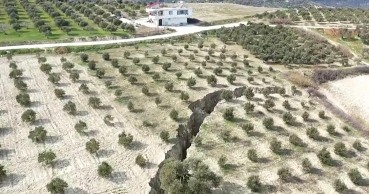
Far from the tumult of devastated cities, the countryside is also affected.
The traces left by the earthquake are impressive and could easily serve as the setting for a disaster film.
The before/after satellite images released by the Maxar company also show the fault line that crosses the fields and the road at Nurdagi, west of Gaziantep.
Before the earthquake: a satellite image of Nurdagi, Turkey, September 6, 2019. MAXAR TECHNOLOGIES / REUTERS
After the earthquake: a satellite image of Nurdagi on February 7, 2023. MAXAR TECHNOLOGIES / REUTERS
The damage is also visible on the coasts of the Mediterranean Sea, in the province of Hatay.
The olive groves are crossed by the fault.
The ditch, almost 30 meters deep, leaves an unrecognizable landscape.
It is more than a hundred meters wide in places.
Infrastructure cut or shifted
This fault also affected infrastructure, such as roads or railway lines.
These images testify to the violence of the seismic phenomenon which has led to the humanitarian catastrophe currently being experienced by Turkey and Syria.
The death toll now rises to more than 28,000 dead and the WHO estimates that nearly 23 million people were affected by the earthquake.