
The last few weeks felt like spring.
Since January 20, observes
La Chaîne Météo
*, temperatures have been
“daily 4 to 6°C above seasonal averages across France”.
A time gone by.
Since Tuesday evening, the weather conditions have been agitated: the wind will blow more, first to the north of the Loire before spreading across the country, progressing towards the South.
“This deterioration will be accompanied by episodes of fairly strong winds
,” details the specialized site, and by rain.
This Wednesday, February 7, Pas-de-Calais was also placed on orange rain-flood alert by Météo France.
“Given the saturated soils, we fear overflowing of the rivers which come down from Artois, such as the Aa, the Lys or the Liane”
, anticipates
La Chaîne Météo
.
A bad omen for the inhabitants of this department which has been particularly affected by bad weather in recent months.
“Fairly strong winds across the entire territory”
On Thursday, a depression coming from the Irish sky will cause a
“sustained flow”
which will mainly affect Brittany and Lower Normandy.
Gusts of up to 90 to 100 km/h along the seaside and on the Atlantic and Breton islands are expected, details
La Chaîne Météo
.
Nothing to worry about though:
“It’s a classic winter gale”
.
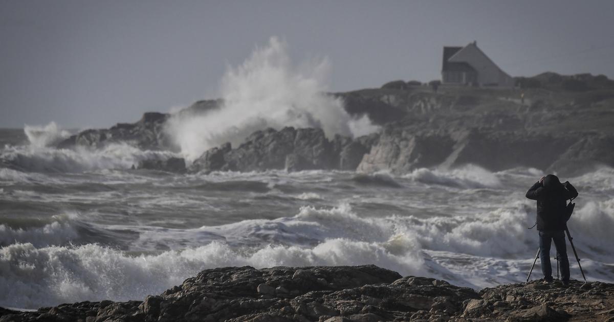
A
“large swell” of five to six meters will be observed on the northern half of the Bay of Biscay, but the
“moderate”
tidal coefficients
(76 Thursday evening)
“will limit the risks of coastal submersion”
.
The depression will then descend towards Spain.
And will cause
“quite strong winds across the entire territory”
in its path , predicts
La Chaîne Météo
.
The most affected territories will be Languedoc, the south of the Massif Central, the Rhône valley, the Lyon region up to the Saône valley going up towards the Langres plateau.
The wind will also remain strong north of the Loire.
From the lower Rhône valley to Franche-Comté, the wind could reach 90 to 100 km/h.
In the mountains,
“gusts of 120 km/h are possible, on south-facing ridges”
.
These powerful winds will blow until the night from Friday to Saturday.
“Possible risk of flash floods”
On the Mediterranean rim,
“the rains will return in force from Friday”
, finally estimates the specialized site.
And significant accumulations are expected between Saturday and Sunday –
“possibly more than a month of rain”
.
If the forecasts do not agree, for the moment, on the intensity of the expected episode, three geographical areas will be particularly affected: the Cévennes, the Nice hinterland and Provence.
Forecasts do not agree, for the moment, on the intensity of the expected episode; three geographical areas will be particularly affected: the Cévennes, the Nice hinterland and Provence.
The Weather Channel.
“With very dry soils, water may have difficulty infiltrating to groundwater. We will need to monitor a possible risk of flash floods in the Cévennes
,” adds La Chaîne Météo.
*The Weather Channel is a property of the Figaro group
.