
Environmental defense fund (EDF), a non-profit that has been working on identifying transformative solutions to the most critical environmental problems since 1967, together with its European arm Edfe, has started a partnership with Google for a satellite that will map, measure and track methane emissions into the atmosphere.
It is called MethaneSat and is based on a technology that involves the use of AI applied to satellite images to identify oil and gas infrastructures around the world.
Ready to be launched in March 2024 on a SpaceX Falcon 9 rocket, MethaneSat will orbit the Earth 15 times a day at an altitude of over 500 kilometers, explains a note from EDF.
The project's goal is to quantify and trace methane emissions to their source and enable energy companies, governments and scientists to have access to essential information to reduce emissions from oil and gas infrastructure more quickly and effectively around the world.
By combining the ability to precisely measure methane levels with high spatial resolution over large areas, it will be able to detect even small emissions that other satellites do not capture today but which account for up to 80% of emissions in many regions.
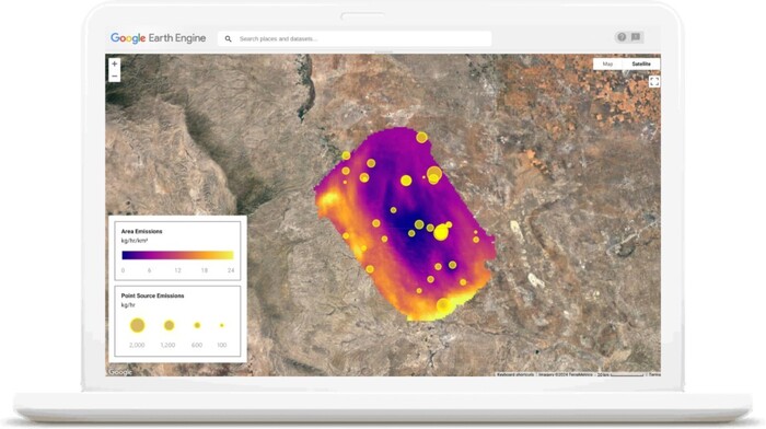
Google, which has long collaborated with EDF, will insert the data collected by the satellite into the most important geospatial analysis platform in the world, Google Earth Engine, which involves over 100,000 scientists around the world.
Furthermore, the company will make Google Cloud services available to host calculations and algorithms, also supporting Edf in the mapping of oil and gas infrastructures through Artificial Intelligence systems that will make the processing, access and visualization of MethaneSat data faster and safer.
Reproduction reserved © Copyright ANSA