
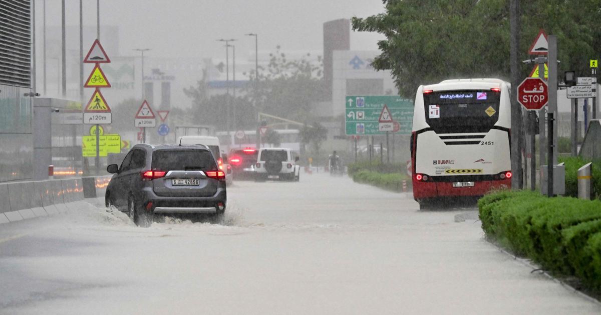
Thunderstorms of rare intensity accompanied by torrential rains hit the Arabian Peninsula on Tuesday. In 24 hours in Dubai, roads, shopping centers and metro stations were invaded by torrents of water. Dubai International Airport, one of the busiest in the world, diverted some flights on Tuesday. The violent storms also affected Bahrain, several regions of Qatar and Oman, where at least 19 people died in the floods.
Davide Faranda is director of research in Climatology at the CNRS.
LE FIGARO. - Do we already have a first assessment of the extent of the precipitation that fell in Dubai this Tuesday?
DAVIDE FARANDA. -
We already have some preliminary data: those from Dubai airport and data recovered by satellites and radars. The combination of all this data will be integrated into the statistics in a few days to provide a complete assessment of what happened. At the moment, we know that the bulk of the precipitation fell within a radius of 150-200 kilometers centered on the Dubai metropolitan area and in the direction of Abu Dhabi.
How to explain this meteorological phenomenon?
From Monday, a low pressure area developed over central Saudi Arabia, then slowly moved east the next day. The development of this cyclonic depression has been associated with the presence of a tropical jet core, a high-altitude wind current that enhances vertical motion, favoring the formation of thunderstorms. Very strong storms formed over the Gulf countries, causing an impressive series of precipitation and wind. This pressure configuration is unprecedented.
Is the event historic?
A phenomenon of such magnitude, yes, we can say that it is historic. The international ClimaMeter consortium [of which the CNRS is a part, which carries out measurements on extreme events due to global warming, Editor's note] is studying the event. However, it is so intense and unprecedented that we cannot find similar events in our databases, which date back to 1979!
Some media speak of the equivalent of two years of precipitation falling in 24 hours. Is it correct ?
Indeed, in Al Ain, on the border between Oman and Abu Dhabi, up to 254 mm fell in less than 24 hours, which corresponds to about two years of rainfall for the region. This is the greatest amount of rain ever recorded since measurements began in 1949. In Oman, Bahrain or Qatar, even if the amounts of rain may have been lower, we could have what we call
"flashes". floods”,
a significant overflow of water due to very dry soil. There may be more impact on certain areas while there is less rain, depending on the geography of the soil.
Is it due to global warming?
The region is indeed experiencing global warming, with increasing temperatures and stronger winds. This has the effect of loading the atmosphere with more precipitable water. But statistical analyzes cannot find similar events to say that this is an event directly linked to warming, nor can they say whether this phenomenon will occur again in the future.
Generally speaking, what we can say about this area, based on the IPCC reports, is that warming changes climate variability: increasingly, long periods of drought will be punctuated by more intense torrential rains. in this area. Extreme precipitation will occur more often. This will complicate the management of water resources. If there is too much water at once and less over time, storage is a challenge.
Some suggest the hypothesis of a consequence of the artificial rain which the Emirates use during periods of drought...
It's unlikely. It is true that the authorities sometimes carry out these artificial rains, by injecting hydrophilic particles into the atmosphere which form condensation nuclei for the rain. Because rain is not just made of water, it is formed around solid particles. But the origin of the phenomenon was quite far from the precipitation zone. So if these artificial falls had any influence, it was surely weak. Clearly, this was not the main factor.