Little time? At the end of the text there is a summary.
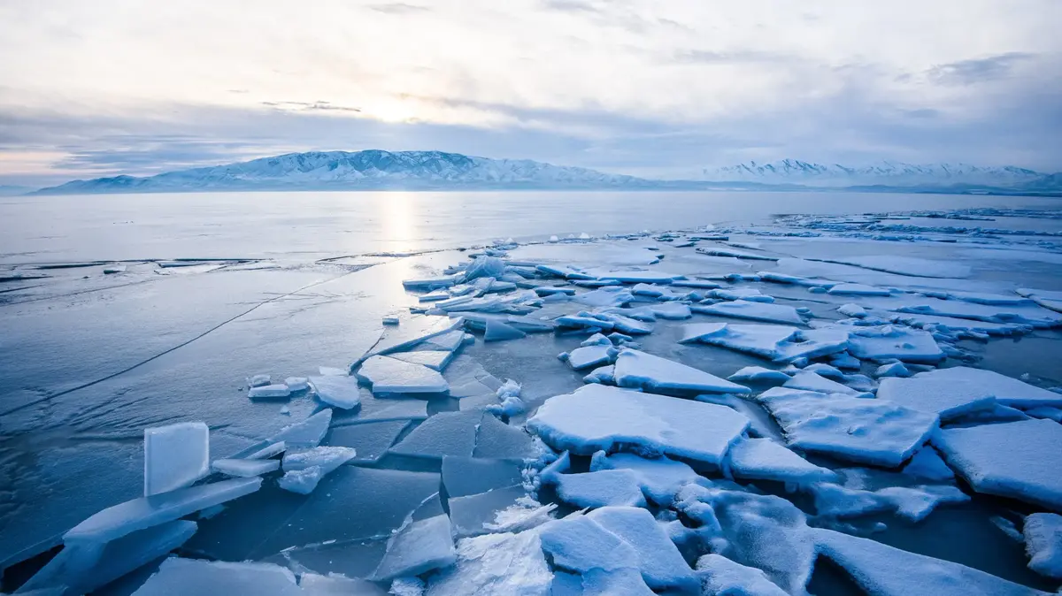
Wind speeds of up to 100 kilometers per hour, six to nine meters high waves - who is traveling with a ship in the Antarctic Ocean, must be tough. "This is the wildest marine area in the world," says Mike Weber, a geophysicist at the University of Bonn. Danger from icebergs threatens too. Especially smaller specimens can change their direction abruptly by changing wind.
From March to May Weber had a particularly keen eye for the white giants. He was one of the scientific leaders on an expedition with the 143-meter research vessel "Joides Resolution". On main route of the icebergs, the researchers wanted to take samples from the ocean floor. They hope for information about the future of the southern polar region, whose fate will affect the coasts of the whole world.
Theoretically, in the Antarctic alone, there is so much water stored as ice that if completely defrosted, global sea levels could rise 58 meters. The melt was leisurely for a long time, but has recently increased massively: By 2006, the share of Antarctic in the current sea level rise was still about 0.05 millimeters per year. Since then it has already increased almost fortyfold to 0.47 millimeters per year.
photo gallery
7 pictures
Antarctic: ice for 58 meters sea level riseThe UN IPCC reported in autumn that the ice sheet lost about 155 gigatons per year between 2006 and 2015. This is mainly due to glaciers in the West Antarctic. Many researchers fear that parts of the ice sheet there may already be so unstable that they can no longer be saved. The result would be a devastating trend that could not be stopped for hundreds, even thousands of years, regardless of how humanity's greenhouse gas emissions evolve.
What the world might look like when this massive melt sets in - that's what the mission is supposed to find out. The "Joides Resolution" can penetrate far into the ocean floor with its huge drill pipe: in up to four kilometers of water depth, it sometimes goes one more kilometer into the ground. The ship is operated by the International Ocean Discovery Program (IODP), an international network of about two dozen countries, including Germany. This year, the Joides Resolution examined three regions in the Antarctic:
- Amundsenmeer : The region is considered the Achilles heel of the West Antarctic Ice Sheet. The glaciers are particularly threatened by warm ocean currents.
- Drake Passage : The area is located in the Antarctic Circumpolar Current, the planet's most powerful ocean current. It transports 150 times as much water as all the rivers in the world combined. Here a large-scale heat exchange between ocean and atmosphere takes place.
- Scotiameer : The area between the Antarctic Peninsula and the Falkland Islands is considered the main hiking route and cemetery of large icebergs.
"Looking to the future with the knowledge of the past"
The drilling cores of the expeditions should reveal how exactly the Antarctic ice has reacted to elevated temperatures in the past. "We want to look into the future with the knowledge of the past," says Thomas Ronge from the Alfred Wegener Institute, who participated in the same expedition as Weber. Above all, it is about the question of what water levels worldwide can be expected in the future.
There are several factors responsible for global sea level rise:
- The waters of the oceans extend through the earth-heating.
- In many mountains, such as the Alps or the Himalayas, the glaciers are melting.
- The polar ice sheets in Greenland and the Antarctic also lose ground.
"The rate of sea level rise from the ice sheets has increased tremendously, with both Greenland and the Antarctic being above the worst case scenario of the IPCC," said Ronge. In other words, more meltwater is currently entering the oceans than the models predicted for the strongest heating considered.
Search for rock fragments
Observations on unstable ice areas are found, among others, on the Pine Island, on the Thwaites, on the Smith and on the Kohler Glacier on the Amundsenmeer in the West Antarctic. The samples from the IODP drilling are to help to better assess the stability of these glaciers. Particular attention is paid to the findings about so-called interglacials, ie past warm periods.
- About three million years ago, in the middle Pliocene, it was up to three degrees warmer on Earth than before the beginning of industrialization. That would be comparable to temperatures that could prevail on earth in about 80 years if the climate protection treaty of Paris is not consistently implemented. Researchers speculate that the ice sheet of West Antarctica had almost completely decayed under these conditions three million years ago. However, there is no reliable evidence so far that should be supplied by the cores. The sea level was then about 15 meters higher than today.
- The period under investigation is about 120,000 years ago. Many models assume that the ice sheet of the West Antarctic collapsed even then. At that time, the sea level was six to nine meters higher than today. Temperatures were about two degrees above pre-industrial levels. That is the value anchored as the ultimate goal for climate protection in the Paris Agreement. Perhaps the Treaty of Paris is therefore not enough to keep the problem areas of the Antarctic stable.
The researchers are tracking the possible path the melting icebergs could have taken then. If the Antarctic has lost much ice in past warm periods, its traces would have to be found in the sedimentary cores, for example from the Scoti Sea - in the form of deposits of coarse sand and gravel
"When the icebergs were still glaciers on land, they picked up rock fragments from there on their undersides, melting the material into the sea," explains researcher Ronge. The geochemical fingerprint of the rocks allows an assignment from which region of the Antarctic they originated. From a total of 2.8 kilometers of sediment core from the Scoti Sea alone, the team of scientists took 26,000 individual samples in the course of November. These will now be analyzed.
New map - no one has ever seen Antarctica
Numerous Antarctic glaciers flow into an ice shelf floating on the water. If this ice shelf is stable, it slows down the glacier flow. But this is no longer true for all areas, because hot water is currently damaging the ice from below.
Mathieu Morlighem / University of California, Irvine
Map of the Antarctic Underground
Important information on where that is provides the first full-scale mapping of the Antarctic subsoil. It will be featured this week by a team led by Mathieum Morlighem from the University of California, Irvine, in the journal Nature Geoscience. Eisen has worked to consolidate the ice thickness measurements from a total of 19 different expeditions into one image.
In some areas, the ice streams are therefore relatively well protected by the properties of the subsoil. But somewhere else a sudden retreat threatens, for example - as already suspected - at the Thwaites and the Pine Iceland Glacier. There are also problem areas at the Support Force and the Recovery Glacier, which flow into the Filchner-Ronne Ice Shelf between West and East Antarctica, as well as at the Totten Glacier in the East Antarctic.
The ice shelf is of elementary importance: "Once it has disappeared or weakened, threatens a dramatic chain reaction: from the ice lying glacial ice then slipping in ever greater speed - especially when the lying below the sea level bottom of the Eiszunge further towards the land "says Olaf Eisen of the AWI.
In summary, on three expeditions, researchers drilled the seabed off the Antarctic this year. In the collected samples, they are looking for clues as to when the ice sheet collapsed in earlier phases of Earth history. The evaluation of the samples is still ongoing. Indications of which glaciers are particularly at risk, also provides another current research. For the first time, the subsurface of the Antarctic was mapped nationwide.

/cloudfront-eu-central-1.images.arcpublishing.com/prisa/DBT2OEOLXBGZTLYKDBM2FWSJNM.jpg)

/cloudfront-eu-central-1.images.arcpublishing.com/prisa/RDP7XNGW75D75IA7EEZLKLBVJQ.jpg)