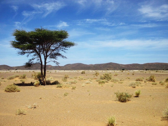
Not just desert and sand dunes: in Western Sahara and the Sahel there are 1.8 billion trees, many more than previously imagined.
This is indicated by the research of the University of Copenhagen based on the analysis of 11,000 images detected by satellites and published in the journal Nature.
High-resolution satellite images and new data collected showed a relatively high density of tree cover for this arid area.
Previous attempts to map dry areas had suggested that they were largely devoid of trees and shrubs.
The technologies available so far allowed a resolution of 10-30 meters, not enough to count single trees.
The group led by Martin Brandt managed to analyze 11,000 satellite images and make a detailed count of trees and shrubs over an area of more than 1.3 million square kilometers between Western Sahara, Sahel and sub-wetlands.
The satellite images used reached a resolution of 0.5 meters and made it possible to demonstrate that the size and density of trees are associated with rainfall and land use;
they also indicated that canopy coverage increases from 0.1% in extremely arid areas to 13% in sub-humid areas.
Isolated trees and shrubs in arid regions are very important, because they contribute to biodiversity, provide shelter and food resources, and help maintain the environment by preventing erosion.