After a general refreshment and several days of rain, the good weather will not yet be back across the country this Sunday.
France is cut in two with an eastern half under the sun and heat and a western half under the clouds and a certain coolness, announces the Weather Channel.
To discover
Covid-19: vaccination as the only remedy
Read also: Weather, variants, vaccines: questions that remain unanswered regarding Covid-19
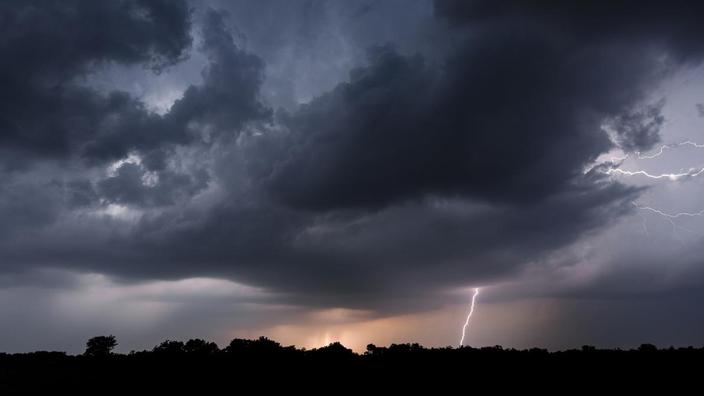
A new stormy wave will also begin between the Pyrenees and the west of the Massif Central between 7 p.m. and 9 p.m.
These sometimes violent thunderstorms will progress in the direction of Limousin and Auvergne.
This stormy new wave is more violent and more extensive than yesterday.
Throughout the eastern part of France, summer weather returns, hot and sunny with average temperatures between 27 and 32 ° C in
Provence-Alpes-Côte d'Azur
and
Corsica
.
From
Auvergne-Rhône-Alpes
to the
Grand Est
via
Bourgogne-Franche-Comté
, the sky is often hazy but the sun dominates.
A few showers will start in the afternoon near the reliefs or even a thunderstorm on the Massif Central.
In the West, strong thunderstorms are therefore to be expected with fairly low average temperatures.
This degradation will be accompanied by strong gusts of wind that can reach 80 to 100 km / h when thunderstorms pass, accumulations of rain that can reach 40 to 60 mm under the strongest thunderstorms, and a new risk of mudslides and storms. flooding on saturated soils, details the Weather Channel.
Read also: How heat influences and changes our behavior
These thunderstorms, associated with heavy rains go up towards the
Center-Val de Loire
during the night and then
towards the
Paris basin
.
In these two regions, temperatures remain below seasonal norms with the afternoon no more than 20 to 24 ° C.
It is the improvement in
Brittany
with the return of beautiful clearings.
* The Weather Channel belongs to the Figaro group