The freezing cold of winter has returned after an exceptionally mild wave that deprived ski resorts of snow.
Could the “ polar vortex
” phenomenon
, which caused the historic cold spell in December in the United States, cause the thermometer to drop further for the rest of the season?
The polar vortex is a cold pocket that forms each winter above the poles, at very high altitude, around 30 kilometers, in the stratosphere.
A belt of wind and air maintains this cold depression around the poles.
But it happens that the vortex deforms and flows of cold air rush beyond the air belt.
Read alsoThese crazy projects to slow down global warming
“
Geography conditions these vortex stalls
,” explains forecaster Régis Crépet of
La Chaîne Météo*
.
"
In the United States, for example, the cold can rush along the Rocky Mountains to the Gulf of Mexico which is, by comparison, at the level of Morocco on the other side of the Atlantic
".
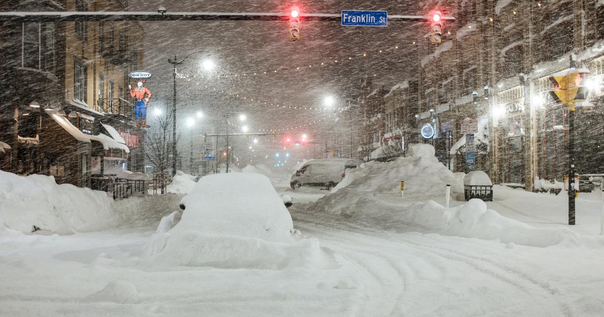
The country has experienced a dizzying drop in temperatures, reaching -31.1°C in Denver (Colorado) or even more surprisingly -9.4°C in Houston (Texas).
The phenomenon of the "
polar vortex
" is at the origin of the episode of historic cold in the month of December in the United States.
The Weather Channel.
Cold snap in Western Europe
In Western Europe, on the other hand, much less prone to shifts in this polar vortex, the seas and oceans that surround the continent soften the climate.
And the cold waves (declared as such from defined low temperature thresholds) caused by the deformations of the vortex are therefore much rarer.
"
The last dates back to February 2018 when the temperature had dropped to -42 in Norway, 250 kilometers north of Oslo
", notes
La Chaîne Météo
in a note.
And the last major cold spell in France dates back to February 2012. A polar stall caused temperatures in France to fall below -10°C for several days.
"
But the current cold is not due to this fluctuation of the vortex
", explains Régis Crépet.
The classic cold weather of the season, with an installed anticyclone, should also soften in the weeks to come.
“
There will be a north-westerly wind coming from the ocean then a westerly wind loaded with humidity which will bring us a rather mild and very disturbed month of February
”, warns the meteorology expert.
Is global warming responsible?
The current cold is therefore a classic winter weather.
But vortex deformations in Western Europe may be more frequent in the future due to global warming.
"
The Arctic zone has warmed twice as fast as the rest of the planet over the past thirty years
", notes
La Chaîne Météo
, which has led to a more marked melting of the ice and a more unstable polar vortex favoring descents of polar masses in winter at our latitudes.
But “
the experts are not unanimous on the causal links
”.
Research is still needed to analyze these causal links.
Especially since the behavior of the vortex is still a source of questioning, especially during "
sudden stratospheric warming
", a phenomenon that is still poorly understood during which the temperature softens very markedly at high altitude, causing the cold air to fall heavier towards the ground.
Read alsoAmerica paralyzed by the “blizzard of the century”
The effects of global warming remain especially visible through progressively less cold winters.
But "
some studies warn of a possible resurgence of cold spells due to the weakening of the vortex, resulting in very large temperature variations between cold snaps and significant mild spells
", indicates
La Chaîne Météo
.
*
The Weather Channel is a property of the Figaro group.