It is a significant rainfall deficit that worries meteorologists. The northern half of the France is affected by a "flash drought" and has not seen a single drop of rain for more than twenty days. In question, summer temperatures coupled with a warm north-east wind and the presence of an anticyclone located at the level of the British Isles and the North Sea. "We have already had long periods without rain, but often between March and April, decrypts Cyrille Duchesne, meteorologist at The Weather Channel*. This is exceptional for the period between mid-May and mid-June."
In the south of France - particularly in the Pyrénées-Orientales - rainfall deficits and groundwater had had a dramatic impact on agricultural crops. Some farmers had lost part of their harvest. Faced with this "flash drought", could farmers in the north of the country experience repercussions similar to those experienced in the south of France?
'Loss of profits'
On Twitter, meteorologist François Jobard assures that the soils of the northern half are "losing the benefits of a rainy spring". We had months of March and April with a level of precipitation above normal season," says Jacques Blarel, irrigation expert at the Nord-Pas-de-Calais Chamber of Agriculture. These soils were moist in late spring, but high temperatures and wind dried them out. The last similar phenomenon dates back to 1949. According to Jacques Blarel, these rains have helped "calm things" after a more complex start to the year.
Concretely, this drying of the soil concerns the first 40 centimeters, that is to say the part concerned "when we talk about agriculture", recalls Cyrille Duchesne. According to him, this situation concerns above all the "Paris basin", the "north" and the "northeast" of the France.
See alsoHow the Hérault mountains are preparing for their greatest drought
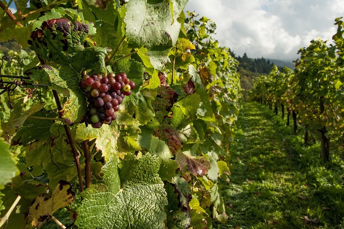
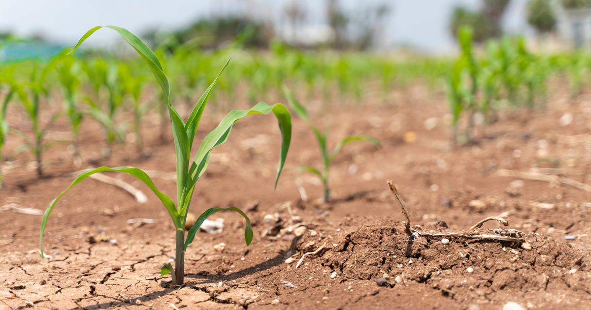
This could have consequences on the crops sown in the spring in these areas. "Potatoes and beetroot, for example, are being planted at the moment," explains Cyrille Duchesne. These crops need a lot of water from the first weeks to grow." According to the Ministry of Agriculture, the Hauts-de-France region accounted for 61% of national potato production and 51% of beet production.
«
It is the crops that suffer the most because their roots are not deep, "says on Twitter, agroclimatologist Serge Zaka, according to whom this same logic also applies to corn and sunflower. "We can observe a slowdown in growth that can resume if conditions improve," he also noted on June 4. Jacques Blarel is more reassuring, saying that the Nord and Pas-de-Calais "are not at a stage where there is a lack of water for plantations". If it does not rain in the coming month, it will become more complex," he says.
Some less affected cereals
Another phenomenon that could slow down the agricultural production of crops sown in the spring: "crusting". The rapid drying of very wet soils causes the formation of a very solid crust on the surface," explains Cyrille Duschene. With the consequences of the impossibility for some crops to "cross this crust" and therefore to come out of the ground. On the other hand, this phenomenon concerns only a small part of production, "most of the surfaces having had time to lift".
According to Serge Zaka, the consequences on so-called winter crops - that is to say those "sown in autumn and harvested at the beginning of summer" such as "wheat, rapeseed or barley" - will be less important. These plants being planted "for several months", "the roots can draw [water] deeper," he says. They are therefore less affected by a soil drought that affects only the first 40 centimeters.
" READ ALSO In the Pyrénées-Orientales, farmers on the front line facing drought and potential fires
Nevertheless, "the grains of these cereals are forming," adds Cyrille Duchesne. If temperatures remain too high, a phenomenon of scalding could appear. In concrete terms, the grains are currently at a "milky" stage - i.e. not very solid - and are at risk of drying out. "There would then be a loss of yield with smaller volumes of grain," analyzes the meteorologist.
Shortages this summer?
However, the Mass is not said for the future. "We should see the end of this dry weather this weekend, thunderstorms being possible, predicts Cyrille Duchesne. If this temperature alteration does take place, we should see improvements."
For Serge Zaka, it is still too early to "talk about massive yield losses". "Everything will depend on the second half of June" since "thunderstorms finally seem to be emerging from the West as early as June 10," he analyzes. "We have to monitor developments between now and mid-June. Otherwise, it would become crucial for spring crops," he says.
*The Weather Channel is a property of the Figaro group.
/cloudfront-eu-central-1.images.arcpublishing.com/prisa/ARR2O7RSB5GA3PHABH4GHEX5FY.jpg)