
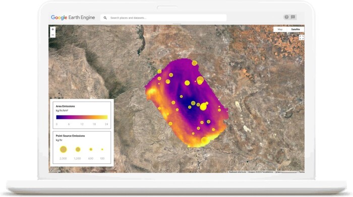
Agreement between EDF and Google for mapping methane emissions. MethaneSat will orbit the Earth 15 times a day at an altitude of over 500 kilometers.
The project's goal is to quantify and trace methane emissions to their source. Google will insert the data collected by the satellite into the most important geospatial analysis platform in the world, Google Earth Engine. The company will make Google Cloud services available to host calculations and algorithms, also supporting Edf in the mapping of oil and gas infrastructures through Artificial Intelligence.