
Fiona strengthens to category 4 hurricane 0:38
(CNN) --
Hurricane Fiona is the strongest of the Atlantic season, and now forecast models show a developing storm could become a monstrous threat to the US Gulf of Mexico coast as early as next week.
An area of disorganized activity a couple of hundred miles east of the Caribbean Sea will likely develop into the next tropical storm, called Hermine, in the next few days, perhaps even in the next few hours, according to the National Hurricane Center.
This small group of storms has drawn the attention of meteorologists because both US and European forecast models have consistently shown them developing into a tropical system and entering the Gulf of Mexico, although the models do not have the best track record when forecast in the long term.
"The fact that almost all forecast models make it a westward-moving hurricane is absolutely concerning," said CNN meteorologist Chad Myers.
There is a 70% chance it will become a tropical depression in the next 48 hours, and there is a 90% chance it will develop in the next five days, according to the hurricane center.
So it is likely to be developed, but its trajectory can still be debated.
advertising
"Well, there's a lot of uncertainty right now," María Torres, a spokeswoman for the hurricane center, told CNN.
"But yeah, it's something that we're keeping an eye on and monitoring closely as we head into the weekend and into early next week."
Over the next few days, the disturbance is forecast to move west-northwestward across the southern Windward Islands, on the eastern edge of the Caribbean, and then move into the central Caribbean Sea later in the week, the hurricane center said Wednesday morning.
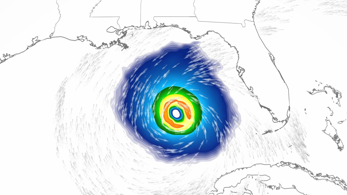
By the end of next week, both models show the storm will enter the Gulf of Mexico.
Use the slider to scroll left and right to see the difference between the US weather forecast model (left) and the European weather forecast model (right).
The two models from Wednesday morning show a storm in the Gulf next week, which has forecasters worried.
The US model shows the storm as a large and possibly major hurricane.
The model shows it will make landfall in northwestern Florida on September 30.
The European model indicates that it will reach southern Florida a day earlier, but as a much smaller but nearly as intense storm.
If the storm system enters the Gulf as the forecast models say, the conditions are ideal for its development.
"The water is extremely hot and the atmosphere is very conducive to rapid development," Myers said.
Conditions in the Gulf of Mexico are favorable for the system to strengthen, and it will do so very quickly, Torres told CNN.
It's been a slow start to what was anticipated to be an above-average hurricane season.
Only one storm has made landfall in a US territory, and no hurricanes have made landfall on or threatened the contiguous United States.
Now, a week after the peak of hurricane season, the tropics seem to have woken up, and meteorologists fear that people have let their guard down.
"After a slow start, the Atlantic hurricane season has rapidly accelerated," tweeted Phil Klotzbach, a research scientist at Colorado State University.
"People tend to let their guard down and think we're out of the woods," Torres said.
"But really, the season is going on. We're still in September; we've still got October. Anything that forms over the Atlantic or the Caribbean is something we have to continue to watch very closely."
The Atlantic hurricane season ends on November 30.
Four times a day, the US and European forecast models generate an updated forecast.
And after each execution, meteorologists will tweet what they think will happen.
Whatever happens, if you live in the Caribbean, Florida, and other Gulf Coast states, pay attention and watch what the National Hurricane Center has to say once the storm is strong enough to be named.
The trail it emits at that time will give a better and better indication of what is most likely to happen.
Hurricane


