
Matching the days of Corona: The technology giant is updating its map service - and will notify you of an increase in morbidity in your area • How does it work and when will it reach your device?
• all the details
Photo: Yinon Ben-Shoshan
Google has announced an extensive update to its map service, Google Maps (or Google Maps), and from now on it will incorporate information about the spread of Corona virus in cities and countries around the world.
The new option is designed to help people "make more informed decisions about where to travel and what to do," the company's official blog post said.
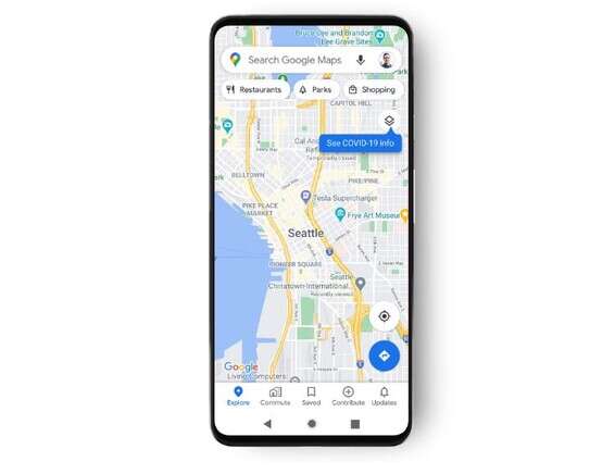
The new feature will hit Android and iOS devices next week, and it will work in all countries around the world.
To activate the new layer, inside the app at the top, tap on the layers icon (two squares) and then on "Corona virus information" (COVID-19).
According to Google, you will be shown the average number of new patients per 100,000 people in the last 7 days, and whether there is an increase or decrease in morbidity. The colors of each layer show different cases of illness: gray - less than one case; Yellow - 10-1 new patients; Orange - 20-10 new patients; Dark orange - 30-20 new patients; Red - 40-30 new patients; Dark red - over 40 new patients.