
In the peri-coastal areas of Antarctica, global warming is causing an increase in the release of greenhouse gases from frozen ground (permafrost), a phenomenon that could extend along the more than 24,000 kilometers of coast of the white continent.
This is what emerges from a study conducted as part of the Seneca project (SourcE and impact of greeNhousE gasses in AntarctiCA), funded by the National Antarctic Research Program (Pnra) and coordinated by the National Institute of Geophysics and Volcanology (Ingv).
The results are published in the journal Science of the Total Environment.
The research, which constitutes the first extensive geochemical campaign conducted in the Antarctic continent, is the result of the collaboration between Ingv, Gns Science (New Zealand), the University of Otago (New Zealand), the University of Oslo (Norway), the Sapienza University of Rome, of Padua and the Institute of Environmental Geology and Geoengineering of the National Research Council (Cnr-Igag).
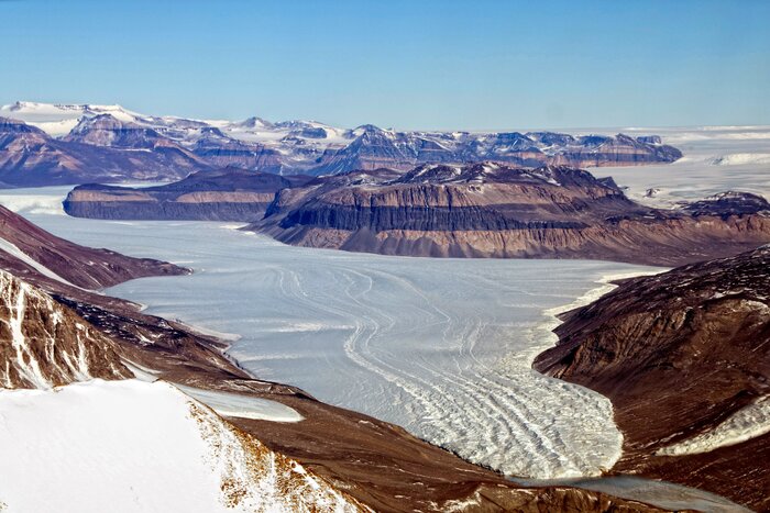
The areas of Antarctica known as the McMurdo Dry Valleys, located in the eastern sector, constitute the largest ice-free area of the Antarctic continent, where atmospheric conditions have generated one of the most extreme environments on the planet: they represent about 10% of the deglaciated soil of the entire continent and, as is the case for the northern polar regions, they tend to warm up even if more slowly.
"During the southern summer of 2019/2020, the first extensive geochemical campaign was carried out on an area of about 22 square kilometers in the Taylor Valley", says Livio Ruggiero, INGV researcher and scientific manager of the Seneca project.
"The investigation allowed the surface measurement of the concentration of a wide range of gases, including carbon dioxide, methane and hydrogen, in the soil and of the CO2 flux in order to identify the preferential return routes for deep and evaluate their migration mechanisms.
Comparing these data with the limited previous data available, an increase in the flux of carbon dioxide was observed, estimated at about 15 tons per day over an area of 21.6 square kilometres.
In fact, the CO2 emission calculated during the summer period is approximately 448.5 tons per month for the entire area”.
The research results highlight the need to carry out further extensive surveys "to adequately evaluate greenhouse gas emissions in regions characterized by the presence of permafrost", adds Ruggiero.
"This work has produced a map of CO2 emissions that could be a starting point for future research aimed at assessing the origin of these gases and monitoring the greenhouse gas emissions released by the Antarctic permafrost".