
Look at the new satellite that will monitor natural phenomena on Earth 0:45
(CNN) --
Scientists have long used space technology to help predict the weather, detect wildfires and aid understanding of phenomena like the climate crisis.
But this state-of-the-art German satellite is described as a game changer for its ability to use more than 250 colors to produce the most accurate data on water, land and vegetation in satellite history, according to scientists.
The Environmental Mapping and Analysis Program, or EnMAP, is capable of taking measurements that would otherwise be invisible, from the degree of pollution in a river that runs through a forest, to the amount of nutrients that a plant has.
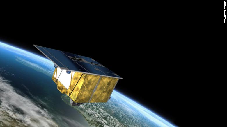
Artist's rendering of the German environmental satellite EnMAP.
The images that EnMAP will be able to take will be of such high resolution that scientists will be able to study the environment with a level of detail previously impossible for space observation systems to achieve, the scientists told CNN.
The sophisticated satellite was designed to study the environmental impact of the climate crisis, observe how environments respond to human activities, and monitor the management of the world's natural resources.
"There have already been big moments, and I can't wait to see the data...there are so many possible implications," EnMAP mission manager Sebastian Fischer told CNN a week after EnMAP successfully launched on 1 of April.
A series of recent reports from the United Nations Intergovernmental Panel on Climate Change (IPCC), based on research by hundreds of scientists from around the world, concluded that the Earth is warming faster than scientists thought, that we are running out of ways to adapt, but that solutions are at our fingertips.
Engineers put the EnMAP into a shipping container.
EnMAP data will help scientists track and examine real-time environmental changes, whether natural or human-caused, and potentially help develop the next generation of long-term climate forecasting models, Anke told CNN. Schickling, who oversees the EnMAP mission's Science and Exploitation Program.
advertising
"In the future we will receive even more reliable information about the changes caused by humans and the damage caused to our ecosystems," said the Research Minister of the state of Brandenburg, Manja Schüle.
"These are the best prerequisites for developing innovative climate change adaptation measures."
The satellite reached its destination in Earth orbit on April 9, eight days after it was launched from Cape Canaveral, Florida on a SpaceX Falcon 9 rocket. Now, scientists are waiting to receive its data.
"Everyone is very excited to get the data and understand if their algorithms and ideas of what they want to do with the data can really measure up to what they've been brewing for the last two years," Schickling said.
EnMAP in production in a clean room at OHB System AG in Bremen, Germany.
Understanding how light interacts with different materials, such as plants, water or soil, makes it easier to identify them and define their characteristics from a distance.
The EnMAP satellite technology uses the nearly 250 different colors to more accurately and specifically determine the features of the land or water it observes.
The satellite's spectrometers first capture a photo of a section of the Earth below it.
Instead of assigning the entire photo a color to classify it, the satellite dissects each pixel in the photo and assigns each its most appropriate color in the spectrum.
This allows for historical accuracy.
"Each item the satellite sees is like a fingerprint: unique," Schickling said.
All materials on the planet's surface reflect sunlight in unique ways.
The relationship between the way something reflects light and the color assigned to the material is called a spectral signature.
These spectral signatures are unique identifiers for the EnMAP.
"Without Earth observation from space, it would be very difficult to quantify the global scope of the climate crisis and its consequences," says Anna Christmann, Federal Government Commissioner for Aerospace.
"Germany is making an important contribution to European space technology and to an intact planet."
The satellite is designed to withstand the harsh conditions of space for at least five years, but scientists are confident EnMAP will last longer for optimal data collection.
And while the EnMAP satellite is the first of its kind, successor missions are already planned for the future.
NASA's Surface Biology and Geology study, for example, aims to collect data by the end of the decade to "address terrestrial and aquatic ecosystems and other elements of biodiversity, geology, volcanoes, the water cycle, and applied science topics relevant to many areas of social benefit," according to the program's website.
The European Space Agency also contributes hyperspectral data with the CHIME satellite.
CHIME will provide "support for European Union and other policies related to the management of natural resources, assets and benefits", but a launch date has not yet been set.
climate changesatellite
/cloudfront-eu-central-1.images.arcpublishing.com/prisa/2GDLZTB5X5B3LIT7SP2QN3HLOI.jpg)


/cloudfront-eu-central-1.images.arcpublishing.com/prisa/Q2GFUQLBLVDFDE4G6U6GH2UFJE.png)
