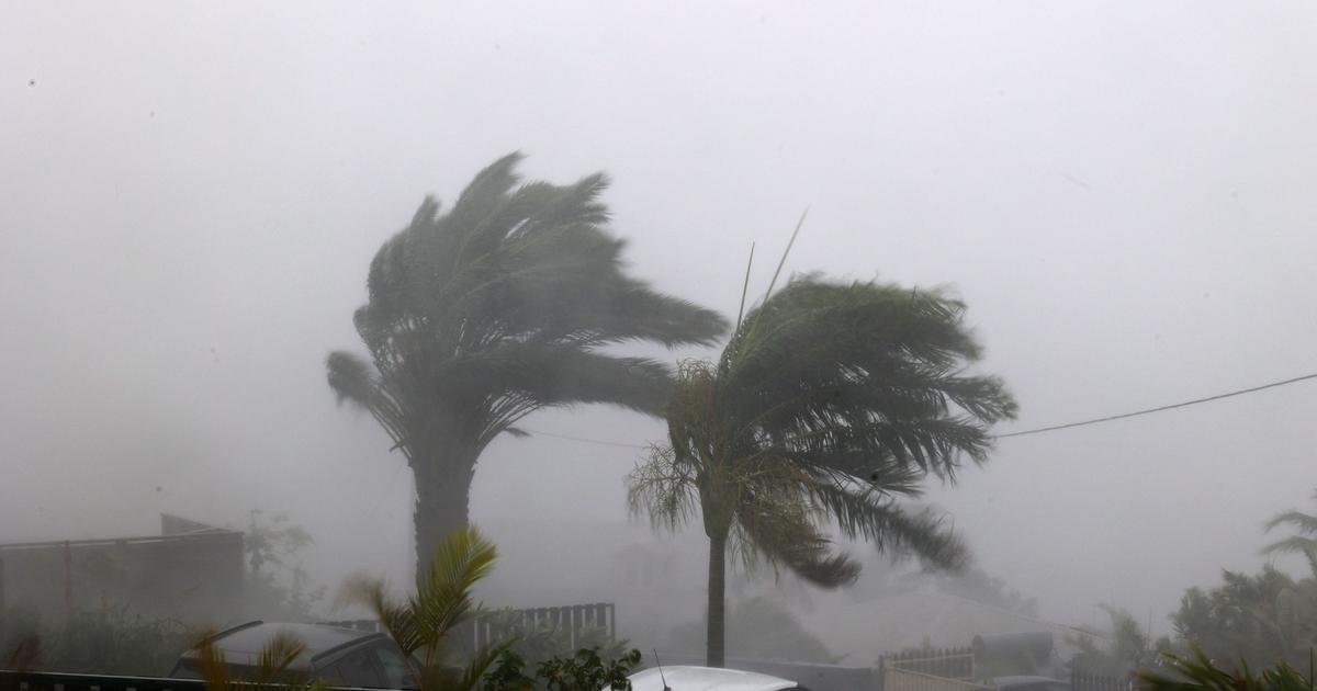
Coastal zone of Mexico, under alert for storm Karl 0:32
(CNN Spanish) --
Tropical storm Karl continues to move southeast through the Gulf of Mexico with maximum winds of 95 km / h and gusts of 110 km / h, according to the most recent update from the Mexican National Weather Service.
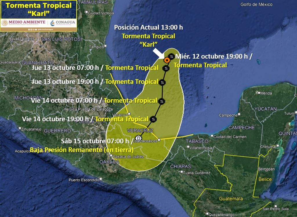
Karl formed this Tuesday in the Bay of Campeche, in the Gulf of Mexico, and its center was this Wednesday afternoon (4:00 p.m. local time) off the coast of the state of Veracruz, 310 km east of Cape Red, according to the weather service.
The service warns that Karl could change direction of travel off the coast of Veracruz in the next few hours.
Alert issued in Mexico after the formation of Tropical Storm Karl
The storm will bring intense rains (from 75 to 150 mm) caused by its cloud bands in the states of Veracruz and Puebla.
Very strong rains (from 50 to 75 mm) in Oaxaca, Chiapas and Tabasco.
Heavy rains (from 25 to 50 mm) in Tamaulipas and Campeche.
The coastal area from Cabo Rojo to Puerto Veracruz is under alert.
The National Meteorological Service informs that these rains could increase the levels of rivers and streams, as well as cause landslides and floods in low-lying areas, for which it calls on the population to heed the meteorological warnings of the Conagua and to follow the indications of the local authorities and of Civil Protection.
advertising
Due to the effects and risks posed by the tropical storm, the Secretary of the Navy reported on the closure of ports in Alvarado, Veracruz, in Puerto Matamoros, in Tamaulipas, in Villahermosa, Tabasco and in Campeche.
⚠️Due to the #TropicalStorm #Karl, @SEMAR_mx reports the closure of #ports 🚧 in the #GulfofMéxico and #MarCaribe (11:30 a.m.)
🚢Large boats:#Veracruz: Alvarado.
⛵Small vessels:#Tamaulipas: Puerto Matamoros
1/3 🧵 pic.twitter.com/UvlpznThI2
– National Civil Protection Coordination (@CNPC_MX) October 12, 2022
In addition, the storm will cause winds with gusts of 80 to 90 km/h with waves of one to three meters high on the coast of Veracruz and 60 to 80 km/h in Tamaulipas.
Track of Tropical Storm Karl: When will it make landfall in Mexico?
The path of Tropical Storm Karl will be as follows, according to the most recent forecast from the National Weather Service:
October 12: The tropical storm is expected to continue moving through the Gulf of Mexico towards the southeast of the country.
October 13: Karl will approach the coast of Veracruz, it will be located 315 km northwest of Laguna Verde and 240 km east-northeast of Nautla.
Tabasco and Veracruz could begin to feel the effects of the storm starting this Thursday.
October 14: Karl will be very close to the coast of Veracruz, 135 km north-northeast of Puerto de Dos Bocas, Tabasco.
October 15: Tropical storm Karl is expected to make landfall in the state of Veracruz, 80 km south-southwest of Coatzacoalcos, on Saturday around 1 pm (local time) and will weaken for the rest of the day.
CampecheChiapasOaxacaTabascoTamaulipasTropical StormVeracruz