Typhoon Signal No. 8 is in effect, and the latest news of the typhoon signal is constantly updated!
The Observatory reissued Typhoon Signal No. 8 at 1:40 p.m. on November 2, and Nigg moved to about 40 kilometers southwest of the observatory at 2:00 a.m. on November 3. It was windy and rainy in the south of Hong Kong in the early morning.
The Observatory reissued Typhoon Signal No. 3 at 5:20 a.m., but pointed out that the squally and showers associated with Nigg would affect Hong Kong.
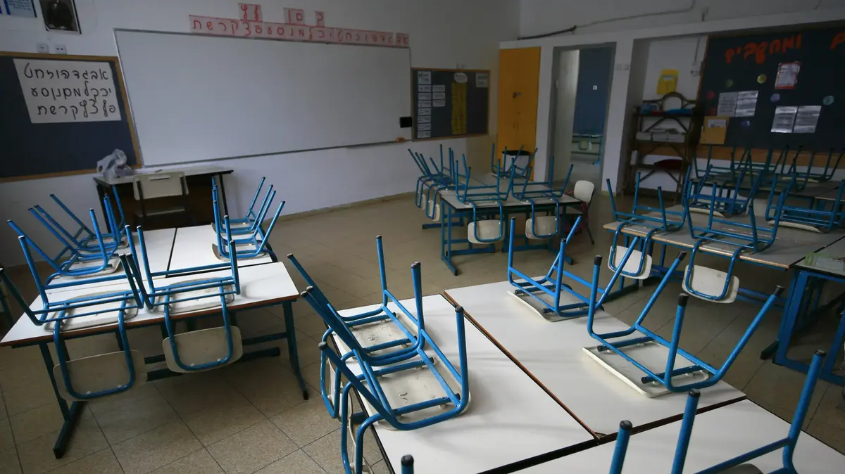
The Education Bureau announced at 5 a.m. that morning classes and all-day classes in kindergartens and all-day classes will be suspended, while primary and secondary schools will suspend classes.
If the Observatory cancels Typhoon Signal No. 3 before 10:30 a.m., afternoon classes in kindergartens will resume.
Click to view ↓The latest traffic news↓
Negative Ball.
Traffic News|MTR services are normal, KMB and Long Win are gradually resumed at 6 a.m.
▼Negger typhoon news on November 3▼
[05:20] The Observatory changed the No. 3 strong wind signal.
The first gale or storm signal on November 8 in half a century was issued at 1:40 p.m. yesterday and was in effect for nearly 16 hours in total.
[05:16] At present, Tropical Storm Nigga is about 10 kilometers northeast of Macau and continues to move northwestward. The Bureau of Meteorology predicts that Nigge will make a close landfall in the north of Macau, and the intensity will be further weakened by then.
Considering that the threat to Macau from Niger has been reduced, the Bureau of Meteorology will issue Typhoon Signal No. 3 from 6:00 a.m. to 8:00 a.m.
Tropical Cyclone Nig gathered about 50 kilometers southwest of the observatory at 3:00 a.m. on November 3.
(Photo from the Observatory)
[05:00] The Education Bureau announced that since the Observatory is expected to change the Tropical Cyclone Warning Signal No. 3 before 5:30 a.m., the morning classes and all-day classes of kindergartens, schools for children with physical disabilities and schools for children with intellectual disabilities will be suspended today.
Other morning schools and full-time schools (including primary and secondary schools) will not have class suspensions today.
If the Observatory cancels the Tropical Cyclone Warning Signal No. 3 before 10:30 a.m., afternoon classes in kindergartens will resume today.
[04:25] The northwest typhoon signal No. 8 in Macau is still in effect.
The Bureau of Meteorology said that at 4 a.m., Tropical Storm Nig gathered about 20 kilometers east of Macau, generally heading towards the mouth of the Pearl River, and had a chance to pass over Macau.
The forecast map of the Hong Kong Observatory shows that Niger is likely to make landfall in Macau.
[03:47] The No. 8 Southeast Gale or Storm Signal is now in effect.
The Observatory said that according to the current forecast path, Nigg will gradually move away from Hong Kong and weaken, and the Observatory will change the No. 3 strong wind signal at or before 5:20 am.
At 4:00 a.m., Tropical Storm Nig gathered about 50 kilometers west-southwest of the Observatory, and was expected to move northwestward at a speed of about 10 kilometers per hour, passing over the waters of southern Hong Kong and moving towards the Pearl River Estuary.
Under the combined influence of the Niger and the northeast monsoon, strong winds were still blowing in the southwest of Hong Kong.
▼On November 2, the big waves hit the shore in Xinghua Village▼
+8
[03:05] The northwest typhoon signal No. 8 in Macau is still in effect. Nigga is currently about 40 kilometers east of Macau, generally heading towards the mouth of the Pearl River.
According to the Bureau of Meteorology, Niger's moving speed is relatively slow, and it is expected to be closest to Macau early this morning, and there is a chance to pass over Macau, so the No. 8 typhoon will remain until this morning.
The Macao Meteorological Bureau said that Nigga had a chance to pass over Macau.
(Photo by Macao Meteorological Bureau)
[02:51] At 3:00 a.m., Tropical Storm Neg gathered about 50 kilometers southwest of the Hong Kong Observatory, and was expected to move northwestward at a speed of about 10 kilometers per hour, passing over the waters of southern Hong Kong and moving towards the Pearl River Estuary.
Gale or storm signal No. 8 is expected to remain until 5 a.m.
[02:40] The Observatory changed the No. 8 southeast gale or storm signal.
[02:35] The yellow rainstorm warning is cancelled.
[01:54] The Observatory said that at 2 am, Tropical Storm Nig gathered about 40 kilometers south-southwest of the Observatory, and was expected to move northwest at a speed of about 10 kilometers per hour, passing the waters in southern Hong Kong and moving towards the Pearl River Estuary.
Under the combined influence of the Nigg and the northeast monsoon, gale force winds are blowing in parts of the eastern and southern parts of Hong Kong, and the No. 8 Gale or Storm Signal is expected to be maintained before 5 am.
In the past hour, the highest sustained wind speeds recorded at Cheung Chau, Tai Mei Tuk and Central Pier were 82, 65 and 56 km/h respectively.
[01:35] The Observatory issued a yellow rainstorm warning.
[00:58] As of 0:00 am today, November 3, the government 1823 call center has received 11 reports of fallen trees.
The government has not received any reports of landslides or flooding.
The Hospital Authority said that as of 00:30 a.m., a woman was injured during the storm and was being treated in the emergency department of a public hospital.
[00:46] The Observatory said that at 1:00 a.m., Tropical Storm Nig gathered about 50 kilometers south-southwest of the Observatory. It is expected that the No. 8 gale or storm signal will be maintained before 5:00 a.m. Please pay attention to the latest news before going out in the morning. weather news.
In the past hour, the highest sustained wind speeds recorded at Waglan Island, Cheung Chau Beach and North Point were 85, 75 and 61 km/h respectively, and the highest gusts were 96, 91 and 87 km/h respectively.
The Observatory said that extensive areas of Hong Kong may be affected by heavy rain in the short term, and the public should be vigilant.
[00:15] The Observatory said that in the short term, extensive areas in Hong Kong may be affected by heavy rain, and the public should be vigilant.
[00:10] The Observatory said that under the combined influence of the Niger and the northeast monsoon, strong winds are blowing in the southern part of Hong Kong.
Meanwhile, squalls and showers associated with Nigg continued to affect Hong Kong.
It is expected that the No. 8 Gale or Storm Signal will be maintained before 2 am on November 3, reminding the public to pay attention to the latest weather information before going out in the morning.
Tropical Cyclone Nig gathered about 60 kilometers south of the observatory at 0:00 on November 3.
(Photo from the Observatory)
▼November 2nd under the typhoon signal No. 8 in Mong Kok at night▼
+2
▼On November 2, there was a big swell in Xinghua Village▼
Nigga weakened to a tropical storm on the night of November 2 and concentrated about 100 km southeast of the Hong Kong Observatory.
(Photo from the Observatory)
[20:53] The Observatory said that at 9:00 p.m., Tropical Storm Nig gathered about 90 kilometers south-southeast of the Hong Kong Observatory, and was expected to move northwestward at a speed of about 10 kilometers per hour, close to the Pearl River Estuary.
In the past one or two hours, the convection related to Niger has weakened, but there are still strong winds near its center. According to the current forecast, as Niger approaches the Pearl River Estuary, Hong Kong will be at the beginning of tomorrow morning (Thursday, 3rd) from tonight to early tomorrow. Gale winds are still possible, and squalls and showers associated with Nigg will affect Hong Kong.
The No. 8 Gale or Storm Signal is expected to remain until 2 a.m. tomorrow.
[20:40] The wind is up!
The Observatory has changed the No. 8 Northeast Gale or Storm Signal to replace the No. 8 Northwest Gale or Storm Signal. The originally sheltered areas may become windy, reminding the public to remain vigilant.
Negative typhoon | It is predicted that the northeasterly wind will change to the northwesterly, and the wind direction is not as expected, causing the No. 8 typhoon to be weak
[20:03] The Observatory said that at 8 p.m., Tropical Storm Nigga gathered about 100 kilometers southeast of the Hong Kong Observatory and was expected to move northwestward at a speed of about 10 kilometers per hour, close to the Pearl River Estuary.
Niger has entered within 100 kilometers of the Hong Kong Observatory. Affected by the rainbands related to Niger, there are strong winds and showers in the area around the Pearl River Estuary.
The No. 8 Gale or Storm Signal will remain at least until 10pm tonight.
The observatory said the convection associated with Nig had weakened in the past hour or two, but strong winds remained near its center.
Further weakening of Nig is expected, and the duration of Gale No. 8 or storm signal will depend on the degree of weakening of Nig.
If Nigg weakens into a tropical depression, or the local winds weaken significantly, the Observatory will change to a lower tropical cyclone warning signal.
[19:53] Macau Typhoon Signal No. 3 is still in effect.
The Bureau of Meteorology said that the No. 8 northwesterly typhoon signal will also be issued at 9:30 p.m., predicting that the wind will increase in Macao.
At 7 p.m., Niger gathered about 140 kilometers southeast of Macau, roughly west of the Pearl River Estuary.
At 5:00 pm on November 2, Tropical Storm Nig gathered about 130 kilometers southeast of Hong Kong.
[16:45] The Observatory said that according to the latest forecast, Nigge will be closer to Hong Kong tonight than previously expected, passing by within 100 kilometers of Hong Kong.
Affected by the rainbands associated with Niger, the rain will gradually become more frequent in Hong Kong tonight.
The No. 8 Gale or Storm Signal will remain at least until 10pm tonight.
The Observatory expects that Nigg will weaken further, and the duration of Gale No. 8 or the storm signal will depend on the weakening of Nigg.
If Nigg weakens further into a tropical depression, the Observatory will issue a lower tropical cyclone warning signal.
[15:45] The Observatory pointed out that Niger will be closer to Hong Kong tonight than previously expected, passing by within 100 kilometers of Hong Kong.
Affected by the rainbands associated with Nigg, the rain will be more frequent in Hong Kong tonight.
No. 8 Gale or Storm Signal will remain at least until 6pm tonight.
[13:47] The Department of Health announced today that due to the Tropical Cyclone Warning Signal No. 8 being in effect, all DH clinics will be closed except for methadone clinics which will open according to normal service hours.
People on methadone treatment can go to a methadone clinic to take methadone.
[13:45] According to the Observatory, according to the latest forecast, Niger is expected to gradually weaken, but it will be very close to the Pearl River Estuary tonight, passing within about 150 kilometers south of Hong Kong.
Hong Kong will gradually change from northerly to easterly winds later today, and the originally sheltered areas may become windy.
Gale or Storm Signal No. 8 will remain at least until 6pm tonight.
Whether the signal is maintained thereafter depends on the weakening of Nigg and its distance from Hong Kong.
[13:40] The Observatory changed the No. 8 northwest gale or storm signal.
[12:21] The Hong Kong Metropolitan University announced that due to inclement weather, all Hong Kong Metropolitan University classes, including online classes, scheduled to be held at or after 1 pm this afternoon have been cancelled.
All ongoing classes will be cancelled at 1:00 pm.
[11:45] The Observatory said that at 12:00 noon, Severe Tropical Storm Nig gathered about 180 kilometers southeast of Hong Kong, that is, near 21.0 degrees north latitude and 115.2 degrees east longitude, and is expected to move northwest at a speed of about 10 kilometers per hour, close to the Pearl River. The area west of the mouth.
According to the Observatory, according to the latest forecast, Niger will gradually weaken, but it will be very close to the Pearl River Estuary tonight, passing within about 150 kilometers south of Hong Kong.
Hong Kong will gradually change from northerly winds to easterly winds today, and the originally sheltered areas may become windy.
Under the combined influence of the Niger and the northeast monsoon, the local wind is expected to intensify gradually this afternoon, and the Observatory will issue the No. 8 Gale or Storm Signal at or before 1:40 pm.
[11:40] The Observatory is expected to issue the Tropical Cyclone Warning Signal No. 8 at or before 1:40 pm.
[11:06] The Hong Kong Examinations and Assessment Authority announced that due to bad weather, the international and professional examinations held this afternoon (2nd) will be cancelled/rescheduled.
The relevant arrangements will be announced by the relevant examination institutions within days.
In addition, the Hong Kong Diploma of Secondary Education Examination Teacher Professional Development Seminar held this afternoon will be cancelled and the relevant arrangements will be announced later.
[09:45] At 10:00 a.m., Severe Tropical Storm Nig gathered about 220 kilometers southeast of Hong Kong, that is, around 20.8 degrees north latitude and 115.5 degrees east longitude, and is expected to move northwest or north by northwest, with a speed of about 10 kilometers per hour, close to West of the Pearl River Estuary.
The Observatory pointed out that due to the combined influence of the Niger and the northeast monsoon, strong winds are generally blowing in Hong Kong, and gale force winds are occasionally blowing in the highlands.
Strong wind signal No. 3 will be maintained until noon.
Although Niger will gradually weaken, the speed of its weakening is still variable.
According to the latest forecast path, Niger will be very close to the Pearl River Estuary later today, passing by within about 150 kilometers south of Hong Kong. The local wind will gradually change from northerly to easterly, and the originally sheltered place may become more windy. , the local wind will further intensify, and the Observatory will consider issuing the No. 8 Gale or Storm Signal between 12:00 noon and 2:00 pm.
[09:00] Hong Kong Disneyland Resort announced that due to the possibility of the No. 8 Gale or Storm Signal issued by the Observatory as early as 12 noon, the park will be temporarily closed today.
[08:45] The Observatory pointed out that at 9:00 a.m., Severe Tropical Storm Nig gathered about 230 kilometers southeast of Hong Kong, that is, around 20.7 degrees north latitude and 115.5 degrees east longitude, and is expected to move to the northwest or north-northwest at a speed of about 10 km, close to the west of the Pearl River Estuary.
▼On November 2nd, the swimmers took a morning swim by the Hung Hom sea under the typhoon signal No. 3▼
+6
[07:45] At 8:00 a.m., Severe Tropical Storm Nig gathered about 230 kilometers southeast of Hong Kong, that is, around 20.7 degrees north latitude and 115.6 degrees east longitude, and is expected to move northwest or north by northwest, with a speed of about 10 kilometers per hour, close to West of the Pearl River Estuary.
The Observatory pointed out that due to the combined influence of the Niger and the northeast monsoon, strong winds are generally blowing in Hong Kong, and gale force winds are occasionally blowing in the highlands.
Strong wind signal No. 3 will be maintained until noon.
Although Niger will gradually weaken, the speed of its weakening is still variable.
According to the latest forecast path, Niger will be very close to the Pearl River Estuary later today, passing by within about 150 kilometers south of Hong Kong.
The Observatory pointed out that Hong Kong will gradually change from northerly winds to easterly winds. The originally sheltered areas may become windy, and the winds in Hong Kong will further intensify. The Observatory will consider the issue of Gale No. 8 or storm between 12:00 noon and 2:00 pm Signal.
[05:25] The Education Bureau announced that all schools will be closed today as the Hong Kong Observatory will consider issuing the Tropical Cyclone Warning Signal No. 8 between 12:00 noon and 2:00 pm.
The Social Welfare Department said that since the Tropical Cyclone Warning Signal No. 3 has been issued, the Social Welfare Department advises the public not to send their children or family members to child care centres, centres providing after-school care services, elderly service centres or including sheltered workshops, integrated vocational rehabilitation service centres , Day Rehabilitation Service Units including the Integrated Vocational Training Center and the Development Center, but the centers will continue to be open to those in need during their normal office hours.
Citizens who need to send their children or family members to the center or service unit can contact the center or service unit first.
[04:50] Under the combined influence of Niger and the northeast monsoon, strong winds are generally blowing in Hong Kong, with occasional strong winds blowing in the highlands.
Strong wind signal No. 3 will be maintained until noon.
Although Niger will gradually weaken, the speed of its weakening is still variable.
According to the latest forecast path, Niger will be very close to the Pearl River Estuary later today, passing by within about 150 kilometers south of Hong Kong. At that time, Hong Kong will gradually change from northerly winds to easterly winds, and the originally sheltered areas may become effective. The wind will further strengthen in Hong Kong. The Observatory will consider issuing the No. 8 Gale or Storm Signal between 12:00 noon and 2:00 pm.
[03:00] At 3:00 a.m., Severe Tropical Storm Nig gathered about 260 kilometers southeast of Hong Kong, that is, around 20.4 degrees north latitude and 115.7 degrees east longitude, and is expected to move northwest or north by northwest, with a speed of about 10 kilometers per hour, close to the western coast of Guangdong.
At 00:00 on November 2, Severe Tropical Storm Neg gathered about 290 kilometers southeast of Hong Kong.
(Photo from the Observatory)
[00:55] Due to the typhoon, Modern Terminals will suspend all heavy container delivery services from November 2, 2022.
[00:53] The Observatory pointed out that Severe Tropical Storm Nigga is about 270 kilometers southeast of Hong Kong, and is expected to move to the northwest or north-northwest at a speed of about 10 kilometers per hour, close to the western coast of Guangdong.
The Macau Meteorological Bureau said that the No. 3 typhoon is expected to remain in the early morning and the wind will increase in Macau.
At 00:00, Severe Tropical Storm Nig gathered about 330 kilometers southeast of Macau.
According to the latest forecast, Nigel will pass within about 100 kilometers of Macau from the afternoon of the 2nd to the beginning of the 3rd. Due to the uncertainty of the movement path and weakening degree of Niger, the No. 8 wind was changed during the day on the 2nd. The chance of the ball is medium to high.
Affected by the combined influence of "Nigg" and the northeast monsoon, the wind in Macau is expected to gradually intensify to level 6 to 7, with occasional level 8 and gusty winds.
Due to the recent astronomical tide and the fact that Niger is closer to Macau than expected, there will be about 0.2 meters of water in the southern part of the Inner Harbor in the early morning of the 2nd, and about 0.5 meters of water will appear in the Inner Harbor area from the evening of the 2nd to the early morning of the 3rd. to remind the public to pay attention to the latest weather information and to take precautions against wind and flood as soon as possible.
[00:40] Modern Terminals Limited announced that due to the typhoon, Modern Terminals will suspend all heavy container delivery services from 5:00 a.m. on November 2.
▼Negger typhoon news on November 2▼
▼On November 1st under the typhoon No. 3, there was rain in the strong wind▼
+1
November 1st Storm News
Nigel typhoon | The Observatory changed to No. 8 typhoon signal, only one station recorded strong winds and tracked the wind speed of 8 designated wind stations.
[22:40] The Observatory predicted at 4 pm today (1st) that due to the strong tropical storm "Nigg" taking a path closer to Hong Kong, tomorrow (2nd, Wednesday) will pass within about 150 kilometers southwest of Hong Kong , so it is considered that Typhoon Signal No. 8 will be issued during the daytime tomorrow.
Why did the Observatory give an early warning this time to consider "hanging the wave"?
According to the data from the Observatory, at 8 o'clock tonight, the gale circle of Niger is about 222 kilometers (120 nautical miles), which means that the gale circle is likely to cover the entire territory of Hong Kong when it is closest to Hong Kong.
Po Toi Island and Sok Kwu Islands at the southern tip of Hong Kong are likely to be the first to fall, and will be the first to be hit by strong winds at about 4 a.m. tomorrow.
November 1st at 8pm.
Severe Tropical Storm Nigga concentrated about 330 km south-southeast of Hong Kong.
(Photo from the Observatory)
Typhoon Negga
[21:23] Severe tropical storm Nig is gradually approaching the coast of South China. The Observatory announced today (1st) afternoon that it will consider issuing the No. 8 typhoon tomorrow (2nd).
Some members of the public made preparations for the storm tonight. Some of the shelves of the three large supermarkets in Tsuen Wan and Tung Chung became "good shelves", and the bread shelves and vegetable shelves were almost emptied.
Some citizens rushed to the supermarket after get off work to go shopping. They said that they were preparing for tomorrow's typhoon, so they bought more vegetables and ready-to-eat roasted rice as their three meals tomorrow.
Some citizens bought some bread and vegetable storage grains, and said with a smile, "Everyone is so quick, and the vegetables are so quick to help people buy them."
[20:56] The Observatory said that since the severe tropical storm "Nigg" adopted a path closer to Hong Kong, it will consider issuing the No. 8 Gale or Storm Signal during the day on Wednesday (2nd).
Since 2007, the Observatory has made reference to the wind data recorded by eight anemometer stations when issuing Tropical Cyclone Warning Signal No. 8. For example, four of the eight anemometer stations recorded sustained winds ranging from 63 to 117 per hour. km, it is very likely that the No. 8 typhoon will be issued.
Niger hit Hong Kong. As of 5 pm on Tuesday (1st), only one of the eight wind measuring stations in Cheung Chau recorded strong winds.
However, as of the announcement at 8:40 p.m., the Cheung Chau Meteorological Station had recorded the highest sustained wind speed of gale force (8 to 9) with a wind speed of 63 kilometers per hour.
As for Tate's Cairn and Waglan Island, which are not reference anemometer stations, the maximum sustained wind speeds are 86 kilometers per hour and 65 kilometers per hour respectively, both of which are gale force winds.
+1
[16:48] The observatory said that although the Niger is gradually weakening, there are still variables in its weakening speed.
According to the latest forecast, Nigge will take a path closer to Hong Kong and pass within about 150 kilometers southwest of Hong Kong tomorrow (2nd).
It is expected that the winds in Hong Kong will gradually strengthen tomorrow, and the No. 3 strong wind signal will be maintained before 6 am tomorrow.
The Observatory will consider issuing the No. 8 Gale or Storm Signal tomorrow, but the actual time will depend on local wind changes.
Members of the public should remain vigilant and pay attention to the latest weather information before going out tomorrow morning.
[13:45] Strong wind signal No. 3 is now in effect.
The Hong Kong Observatory expects an average wind speed of 41 to 62 kilometers per hour in Hong Kong.
At 2:00 p.m., Severe Tropical Storm Nig gathered about 380 kilometers south-southeast of Hong Kong, that is, around 19.3 degrees north latitude and 115.9 degrees east longitude, and is expected to move to the northwest or north-northwest at a speed of about 10 kilometers per hour, close to the western coast of Guangdong .
[11:45] Under the combined influence of Niger and the northeast monsoon, strong winds are expected to prevail in Hong Kong today, with occasional strong winds on the highlands, and the No. 3 strong wind signal will remain today.
In addition, the outer rainbands of Niger are affecting the northern part of the South China Sea and the coast of Guangdong.
There are large waves and swells on the sea surface, the public should stay away from the shore and stop all water activities.
In the past hour, the highest sustained wind speeds recorded at Tate's Cairn, Waglan Island and Ngong Ping were 68, 55 and 53 km/h respectively, and the highest gusts were 85, 60 and 77 km/h respectively.
At 6:00 this morning, Severe Tropical Storm Nigga gathered about 450 kilometers south-southeast of Hong Kong.
[08:45] The Observatory pointed out that due to the combined influence of the Niger and the northeast monsoon, strong winds are expected to prevail in Hong Kong today, with occasional strong winds on the highlands, and the No. 3 strong wind signal will remain today.
In addition, the outer rainbands of Niger are affecting the northern part of the South China Sea and the coast of Guangdong.
There are large waves and swells on the sea surface, the public should stay away from the shore and stop all water activities.
Members of the public doing outdoor work or activities should also pay attention to weather changes.
According to the current forecast path, Nigge will be quite close to the Pearl River Estuary tomorrow (2nd), passing by about 200 kilometers southwest of Hong Kong, and its intensity will gradually weaken, but the speed of weakening is still variable.
The Observatory will closely monitor its movement and development to assess whether a higher tropical cyclone warning signal is required at that time.
Members of the public should remain vigilant and pay attention to the latest storm news.
In the past hour, the highest sustained wind speeds recorded at Tate's Cairn, Waglan Island and Cheung Chau were 69, 56 and 48 km/h respectively, and the highest gusts were 81, 64 and 66 km/h respectively.
[07:45] The observatory pointed out that Niger has entered the northern part of the South China Sea and has moved steadily to the north in the past few hours.
Under the combined influence of the Niger and the northeast monsoon, strong winds are expected to prevail in Hong Kong this morning, with occasional gale force winds in the highlands.
The No. 3 strong wind signal will remain at least until 12:00 noon today (1st).
There are large waves and swells on the sea surface, the public should stay away from the shore and stop all water activities.
Members of the public doing outdoor work or activities should also pay attention to weather changes.
According to the current forecast, Niger will be relatively close to the Pearl River Estuary from late Wednesday (2nd) to early Thursday (3rd), and its intensity will gradually weaken, but the distance to the Pearl River Estuary and its weakening speed are still quite variable.
The Observatory will closely monitor its movements and developments to assess whether a higher tropical cyclone warning signal is required.
Members of the public should remain vigilant and pay attention to the latest storm news.
In the past hour, the highest sustained wind speeds recorded at Tate's Cairn, Waglan Island and Cheung Chau were 71, 57 and 55 km/h respectively, and the highest gusts were 88, 64 and 80 km/h respectively.
[05:25] As the No. 3 Tropical Cyclone Warning Signal has been issued, the Social Welfare Department advises the public not to send their children or family members to child care centres, centres providing after-school care services, elderly service centres or including sheltered workshops, integrated vocational rehabilitation service centres , Day Rehabilitation Service Units including the Integrated Vocational Training Center and the Development Center, but the centers will continue to be open to those in need during their normal office hours.
Citizens who need to send their children or family members to the center or service unit can contact the center or service unit first.
[05:22] The Education Bureau announced that as the No. 3 Tropical Cyclone Warning Signal is now in effect, kindergartens, schools for children with physical disabilities and schools for children with intellectual disabilities will be closed today.
[04:55] The observatory said that Niger has entered the northern part of the South China Sea and has moved steadily to the north in the past few hours.
Under the combined influence of the Niger and the northeast monsoon, strong winds are expected to prevail in Hong Kong this morning, with occasional gale force winds in the highlands.
The No. 3 strong wind signal will remain at least until 12:00 noon today (November 1).
There are large waves and swells on the sea, and the public is urged to stay away from the shore and stop all water sports.
According to the current forecast, Niger will be quite close to the Pearl River Estuary from late Wednesday (November 2) to the beginning of Thursday (November 3), and its intensity will gradually weaken, but the distance to the Pearl River Estuary and its weakening speed are still There are considerable variables.
The Observatory will closely monitor its movements and developments to assess whether a higher tropical cyclone warning signal is required.
[03:17] The Macao Meteorological Bureau changed the typhoon signal No. 3 at 3:00 a.m. on November 1. "Nig" gathered about 500 kilometers southeast of Macao. It is expected that the No. 3 typhoon will remain in the morning.
(Macao Meteorological Bureau)
Typhoon Typhoon Neg | Typhoon Typhoon No. 3 was changed in the early morning in Macau and is expected to remain Typhoon Typhoon Typhoon Neg in the morning| Typhoon Typhoon No. 3 is maintained today for kindergartens and some special schools today
▼On October 31, citizens enjoyed the sunset under the No. 3 typhoon▼
+5
▼October 31st storm news▼
Nigel typhoon | The Observatory has recorded 13 waves in November, two "Bermena" and one will be hoisted with No. 9 typhoon typhoon | Qiutai and "Typhoon Killer" meet the wind, and experts point out that distance is the key to the Niger wind Ball|The Observatory is expected to upgrade to a typhoon on Tuesday evening, passing 180 kilometers south of Hong Kong on Wednesday
▼The sky turned red and purple in the evening under the typhoon No. 3 on October 31▼
+1
At 8:00 pm on October 31, Severe Tropical Storm Nig gathered about 580 kilometers south-southeast of Hong Kong.
(Photo from the Observatory)
【22:32】強烈熱帶風暴尼格逐漸逼近華南沿岸,天文台於今日(31日)下午改發三號強風信號,料最少維持到明日(11月1日,星期二)正午12時。天文台會視乎尼格與珠江口 的距離及其減弱速度,審視需否發出更高風球。
天文台今晚更新尼格預測移動路徑圖,料明日下午5時會進入香港400公里防線,並升格成颱風,中心附近最高持續風速達每小時120公里,屬颱風下限(118公里或以上)。天文台料在周三(2日)下午5時,尼格移至香港正南約180公里的南海之上,但會減弱變回強烈熱帶風暴,周四(3日)逐漸向海南方向移動並再減弱。
【21:45】現代貨箱碼頭有限公司公布,因颱風關係,現代貨箱碼頭將於11月 1日早上起 暫停所有吉櫃交收服務。
10月31日風暴消息
強烈熱帶風暴尼格在10月31日下午3時集結在香港東南偏南約640公里。(天文台圖片)
【16:27】天文台表示,3號風球會至少維持至明日(11月1日,星期二)正午12時。過去數小時,尼格穩定地靠近南海北部。受尼格及東北季候風的共同影響,預料本港今晚及明早普遍吹強風,高地間中吹烈風。
按照現時預測,尼格會在星期三(11月2日)稍後至星期四(11月3日)初時相當接近珠江口一帶,其強度會逐漸減弱,但與珠江口的距離及其減弱速度仍存在相當變數。天文台會密切監測其動向和發展,評估是否需要發出更高熱帶氣旋警告信號,提醒市民應保持警覺,留意最新風暴消息。
【16:22】教育局表示,由於三號熱帶氣旋警告信號現正生效,幼稚園、肢體傷殘兒童學校及智障兒童學校今日停課。但上述學校須保持校舍開放,同時實施應變措施,照顧已返抵學校的學生,並在安全的情況下,方可安排學生返家。
【16:20】天文台改發三號強風信號。
【16:18】有市民表示,黃大仙檢測中心提早在下午3時30分截龍,不再接受進入。按當局規定,所有戶外檢測站在3號或以上風球便需停止運作。
一號戒備信號會至少維持至今日下午4時
天文台表示,一號戒備信號,現正生效。表示有一熱帶氣旋,在香港約800公里內,可能影響本港。
受尼格及東北季候風的共同影響,本港離岸吹強風,高地間中吹烈風。一號戒備信號會至少維持至今日下午4時。
隨著尼格逐漸靠近南海北部,本港風勢會在今晚進一步增強,天文台會在下午4時至5時改發三號強風信號。而海面有大浪及湧浪,市民應遠離岸邊及停止所有水上活動。進行戶外工作或行山的市民亦請留意天氣變化。
天文台指,按照現時預測,尼格會在星期三(11月2日)稍後至星期四(11月3日)相當接近珠江口一帶,其強度會逐漸減弱,但與珠江口的距離及其減弱速度仍存在相當變數,市民應保持警覺,留意最新風暴消息。
▼10月30日 熱帶氣旋尼格逐步逼近香港▼
+2
▼10月30日 「嘩鬼」蘭桂坊迎萬聖節▼
+25
截至10月31日凌晨風暴消息:
在10月31日凌晨3時,強烈熱帶風暴尼格集結在香港東南偏南約750公里,中心附近最高持續風速為每小時105 公里,預料向西北或西北偏北移動,時速約10公里,移向南海北部。天文台凌晨1時45分表示,尼格明早(31日)與本港保持超過600公里距離,一號戒備信號會至少維持至明日早上5時,提醒市民明早出門前留意最新天氣消息。
按照現時預測路徑,尼格會在未來數天移向南海北部,靠近華南沿岸。受尼格及東北季候風的共同影響,未來兩三日沿岸地區風勢頗大,海有湧浪;與尼格相關的外圍雨帶亦會在本周中期為該區帶來狂風驟雨。
預測周二晚本港以南約200公里掠過
按照天文台最新的預測路徑圖,尼格周二(11月1日)晚上進入本港東南偏南400公里範圍,其時中心附近最高持續風速達每小時110公里;尼格其後向西北移動,周三(11月2日)晚上在本港以南約200公里掠過,甚至可能不足200公里,其時中心附近最高持續風速達每小時105公里。
The nine-day weather forecast updated at 0:00 a.m. today is expected to be sunny and dry for part of Halloween today, with a northerly wind of magnitude 5 (freshness), offshore at magnitude 6 to 7 (strong wind, No. 3 typhoon), high ground Up to level 8 (strong winds, No. 8 typhoon winds. The weather deteriorated significantly on Tuesday, and there will be a few showers. Later, the rain will be more frequent, strong winds blowing offshore, and strong winds blowing on the highlands, and the lowest temperature in the city. It fell to 19 degrees with squally showers on Wednesday.
The nine-day weather forecast for Hong Kong issued by the Observatory at 0:00 am on October 31.
(Photo from the Observatory)
High chance of typhoon No. 3 issued in Macau from noon to evening
The Macao Meteorological Bureau pointed out at 1:00 a.m. that Niger gathered about 790 kilometers south-southeast of Macao, and is expected to slowly move northward toward the coast of southern China.
Affected by the replenishment of the northeast monsoon, it is still sunny and dry during the day today. Although the wind may occasionally reach magnitude 6 in the morning, it is expected that the northeast monsoon will further intensify and push south in the evening. With the gradual approach of Niger, the wind will further intensify. Therefore, there is a high chance that the No. 3 typhoon will be issued this afternoon to evening.
The Bureau of Meteorology is forecasting stronger winds and occasional showers from Tuesday to Thursday under the combined influence of Niger and the continued northeast monsoon.
In addition, due to the astronomical tide in the next few days, there may be flooding in the Inner Harbor area from midnight to early morning. The public is reminded to pay attention to the latest weather information.
▼October 29th, the swimmers fell into the water with unobstructed waves at Shek O▼
+3
Typhoon Nigga | The Macao Meteorological Bureau issued the No. 1 typhoon in the early morning and it is expected to maintain the typhoon in the early morning|The Observatory predicted that the No. 1 typhoon will be issued at the earliest tonight, 11.1% of the typhoon will break through 400 kilometers | The Observatory will hang the typhoon in November There are 13 waves, two "Bo Meina", and one is going to hang the No. 9 typhoon ball saddle typhoon | The falling wave is suspected of hasty Observatory: the wind has a forecast of up and down, and a two-hour buffer saddle typhoon | Only one condition is considered when making a decision | The wind holiday is not as expected