
The bodies of two deceased canyoners have been rescued by members of the Civil Guard of Panticosa Mountain (Huesca) after receiving an alert call at 14:00 p.m. on Saturday, according to sources from the armed institute in the area, reports Patricia Ortega Dolz. The event, which has coincided with the storms and torrential rains that the isolated depression at high levels (dana) – a pocket of air in high layers of the atmosphere – is leaving throughout the country, occurred in the Gorgol ravine, in Tramacastilla de Tena, where the members of the Special Mountain Intervention Rescue Group (Greim) moved. "Two people have died, for reasons yet to be determined, possibly by drowning," say sources of the Civil Guard of Huesca. The investigation is still ongoing.
The mayor of Sallent de Gállego, Jesús Gericó (PP), regrets the "fatality" and the "tragedy", but points out that "in weather conditions like today [for this Saturday], it is not the most advisable to get into a ravine", in reference to this ravine, which works as a natural drain of the port, since it channels the water that falls at the highest levels and could have suffered a strong flood. Gericó also recalls that there were information panels on the A-136 with warning messages for "danger due to strong storms" and that even the Valle de Tena Trail, scheduled for this Saturday, had been suspended. Up to 100 liters per square meter have left the rains at the head of that valley.
A group of people take refuge from the intense rain this Saturday in Valencia. Juan Carlos Cardenas (EFE)
A car circulates in the rain, on Saturday, on a road in Castellón.Paco Poyato (Europa Press)
A pedestrian walks through the zebra crossing of a street in Pamplona (Navarra), this Saturday. Alvaro Barrientos (AP)
A flooded street in Pamplona on Thursday. Europa press (MUNICIPAL POLICE)
Two people walk in the rain, this Saturday, in Madrid.Carlos Luján (Europa Press)
A cyclist runs along the promenade of Palma, this Saturday. Clara Margais (dpa / picture alliance / Getty)
A car circulates in the rain, this Saturday, in Castellón.Paco Poyato (Europa Press)
View of the promenade of Palma (Mallorca) with people with umbrellas, this Saturday. Clara Margais (dpa / picture alliance / Getty)
Two pilgrims, who make the Camino de Santiago, arrive in Pamplona, this Saturday. Villar Lopez (EFE)
People with umbrellas in the center of Pamplona (Navarra), this Saturday. Villar Lopez (EFE)
Two pedestrians cross a zebra crossing in Pamplona on Friday. Alvaro Barrientos (AP)
Several people take refuge from a storm that has unloaded on Logroño in just five minutes and that has forced to stop at the concert of Quique González, within the Muwi festival, held on Friday at Bodegas Franco-Españolas de Logroño.RAQUEL MANZANARES (EFE)
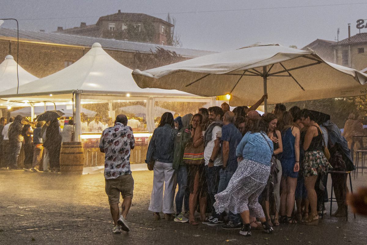
This is the most serious event related to persistent rains, in many areas strong or very strong and accompanied by storms, which are being noticed this Saturday throughout Spain, except the Canary Islands and Ceuta. Rainfall has fallen in parallel with temperatures, which have plummeted up to 10° from Friday. Sixteen communities are on alert, with orange level warnings, the second of a scale of three, in nine of them, Balearic Islands, Castilla y León, Castilla-La Mancha, Catalonia, Madrid, Navarra, Basque Country, La Rioja and Valencia, and in Melilla.
The rains have been concentrated this afternoon in the northeast, especially in Navarra, where "10 stations already exceed 70 liters, even some in the center the 100", highlights the State Meteorological Agency (Aemet). A lot of water also fell in the Valencian Community, where the pre-emergence remains activated due to heavy rains in Castellón and on the coast of Valencia. Until 20.00, according to the Valencian Association of Meteorology (Avamet), 189 liters had been collected in Borriol, 158 in Vilafamés; 130 in La Pobla de Tornesa; 107 in Betxí and 101 in Tírig, all towns in Castellón, where five people trapped in their cars had to be rescued in the municipalities of Onda, Betxí and Borriol.
In addition, there have been falls of trees in Vila-real and Onda, revision of facades in Borriana and Onda, where a balcony had fallen, and a bilge in Albocàsser. It has also attended four vegetation fires caused by lightning strikes on trees in Borriol, Onda, Vila Real and Almassora. In total, 15 interventions of the Provincial Consortium of Firefighters of Castellón until 16.00, in which no person has been injured.
The rains are also intense in Catalonia, where the storm is entering the south of Tarragona, in the regions around the Ebro Delta and the massif of the Ports de Besseit, reports Clara Blanchar. The Meteorological Service of Catalonia (Meteocat) has reported a "practically torrential intensity" in the station of the Ports, where in 30 minutes almost 40 liters have accumulated. The agency has warned that the rains are intensifying and there are several cases of precipitation that exceed 20 liters in half an hour, as in Mas de Barberans (Montsià region) with 33.1. In the evening, according to Aemet forecasts, there is also "probability of very strong showers in areas of the peninsular center, especially in the Community of Madrid and the northern half of Castilla-La Mancha".
This is how the STORM passed through Logroño #tormenta #rayos #LaRioja #DANA #lluvia #granizo@AEMET_Esp @AEMET_LaRioja @NueveCuatroUno@ondacerolarioja @RadioRioja @tvr @Stormyalert@RAM_meteo @DuncanWingen @JAGfoto @enricnavarrete pic.twitter.com/RN1nGG5wdZ
— Meteosojuela La Rioja (@meteosojuela) September 2, 2023
Early in the morning, a storm has discharged on Logroño, where it has flooded sections of the L0-20, downhills, streets and roundabouts. The City Council has reinforced the emergency devices and emphasizes that, "except for floods or traffic jams, there have been no serious incidents." Last night, another intense downpour in the capital of La Rioja forced to suspend the performance of Quique González and the rest of the concerts of the Muwi festival.
In Andalusia, two other lightning strikes have caused fires in Gádor (Almería) and Frigiliana (Málaga), while in the Ebro Delta there has been a small tornado and a sleeve of sea has become another small tornado when it touches down in Torremolinos (Málaga) and has caused material damage in an area of hammocks and a beach bar. In addition, there have been waterspouts in front of the beach of Xilxes and Grao de Borriana (Castellón).
Petit tornado 🌪️aquest matí al #DeltadelEbre
📹 AUTHORSHIP VIDEO: ELI CABRERA
📍#Camarles 02/09/23@eltempsTV3 @TomasMolinaB @Vakapiupiu @alcantara_alb @MeteoMauri @AlfredRPico @aria_meteo @Oriol_RB@alexmegapc @meteopolita@AEMET_SINOBAS @SoniaPapell @SergiLoras @Canal21Ebre pic.twitter.com/eDBLp8WxjK
— Agustí Descarrega (Delta de l'Ebre 🌅 🌾 🦩) (@agus_descarrega) September 2, 2023
The danas are especially difficult phenomena to forecast, since a slight change in their position can vary the intensity and distribution of the expected rains, so the Aemet asks the population, in full operation return on the roads, to be attentive to the update of the meteorological part.
In the next few hours, explains Aemet, it will move through the west of the peninsula until Sunday to reach the Gulf of Cádiz and there will be an intense flow of air from the east, which will provide more fuel in the form of maritime humidity and will favor abundant rainfall for the second day in much of the Peninsula. Where it is less likely to rain is in Catalonia and other areas of the peninsular northeast, while the "greatest probability and intensity" of the rains will be in the southeast quadrant and the peninsular center.
🔴 #DANA live
This animation will alert the competent bodies of #Madrid, #Toledo and surroundings. 🚧🌊 These cities may or may not be affected by the storm system, but precautions must be taken.
🌐 https://t.co/WWUwquXWtz pic.twitter.com/ZTW1iPgDSi
— Meteored | tiempo.com (@MeteoredES) September 2, 2023
In the morning, "the most affected area will be the southeast, especially Valencia, Alicante and Murcia." In the afternoon, the worst will be experienced "in the center of the peninsula, most likely in Madrid and Toledo, where accumulated 80 liters could be reached or exceeded." The water can wreak havoc in Madrid, where in the last serious floods, last December, with subway stations turned into waterfalls and lobbies into swimming pools, flooded tunnels and numerous streets and access roads flooded, just 10.3 liters fell in an hour. "From here [Saturday at 18.00] to early Monday morning it can rain in the southern half of the Community of Madrid (including the capital) and east of the province of Toledo the same as it has rained so far throughout 2023. In the capital they have 145 liters and in Toledo 119 since January 1, "warned on Twitter the spokesman of Aemet, Rubén del Campo.
Eleven communities will be under alert, with orange warning in the Balearic Islands, Castilla-La Mancha, Catalonia, Madrid, Murcia, Valencian Community and Melilla. As for temperatures, it will not even reach 30 ° anywhere in the country. The highest values will occur in points of the Mediterranean and the northeast, but in the rest the maximums will be around 25 ° or even 20 °. Very strong gusts of wind are also expected in the eastern half, with poor sea conditions in the Mediterranean.
On Monday, uncertainty increases. Most likely, the center of the phenomenon moves away to the west by the Atlantic, so rainfall will be reduced in the east of the peninsula and in the Balearic Islands, but it is "likely that the unstable environment will continue, with showers and storms, in the western half and central area, where they can be locally strong or persistent, especially in the first half of the day." On the warning map, there are no oranges, but yellow persists, the lowest level, in the Balearic Islands, Castilla y León, Castilla-La Mancha, Catalonia, Community of Madrid, Basque Country and Valencian Community.
There may still be very strong easterly wind gusts in the east of the peninsula and the Balearic Islands, and bad seas in the Mediterranean. What there will be is "a clear trend towards the recovery of temperatures", with a return to normal values for early September. Already on Tuesday, the first meteorological autumn storm will have passed.