- Click to share on Facebook (Opens in a new window)
- Click to share on Twitter (Opens in a new window)
- Click here to share on LinkedIn (Opens in a new window)
- Click to email a friend (Opens in a new window)
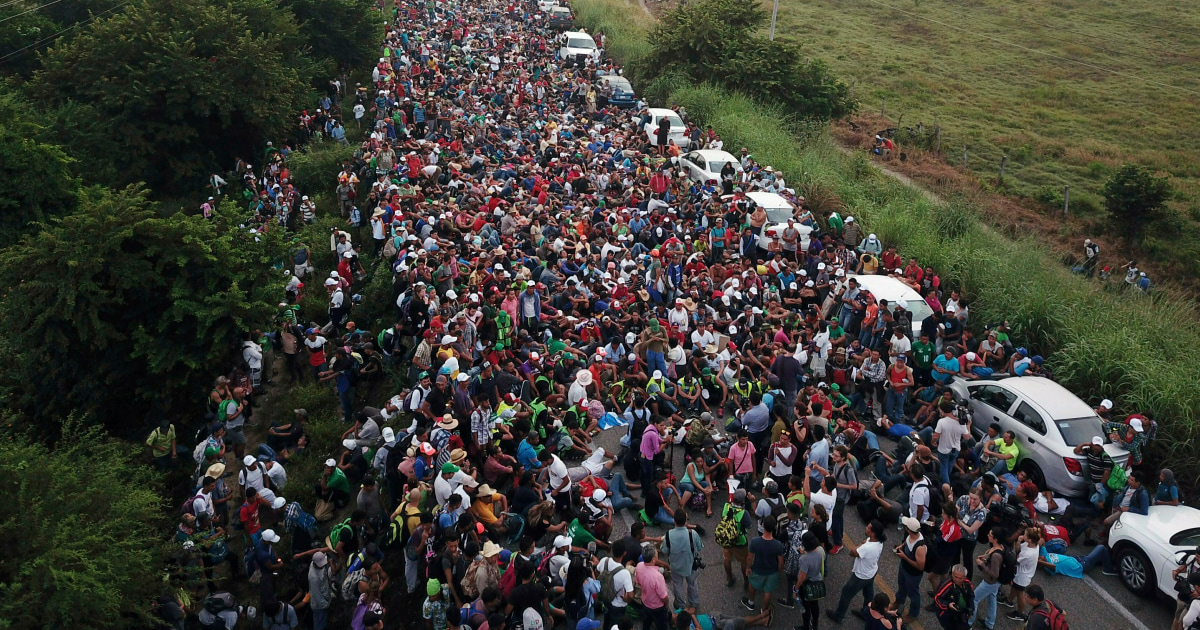
(CNN) - Following multiple defeats at the polls on Tuesday - the almost certain failure of Governor Matt Bevin in Kentucky and the victory of Democrats in the House and Senate of Virginia - the Republicans, from President Donald Trump down in the administration they have tried to minimize the importance of the election results.
READ: Who won and who lost in Tuesday's important elections in Kentucky, Virginia and Mississippi
So much so that the president of the Republican Party of Arizona, Kelli Ward, took that reasoning to new levels on Wednesday night when she pressed the "send" button with this tweet:
Should we look toward an #ElectoralCollege type system at the state level? # Elections2019 pic.twitter.com/RLkdRfJCUT
- Dr. Kelli Ward 🇺🇸 (@kelliwardaz) November 7, 2019
“Should we consider a system like the #ColegioElectoral statewide? # Elections2019 ”
The point to which Ward leads - and which seems to be backed by these maps divided into counties in both Virginia and Kentucky - is that there is a predominance of red (color of Republicans) over blue (corresponding to Democrats) in these graphics . And yet, the Democratic Party won in Virginia and seems to have defeated Bevin in Kentucky as well. (Bevin, who was behind Democrat Andy Beshear for just over 5,000 votes, is asking for the results to be reviewed.)
Hence Ward has asked in his publication if a system of the Electoral College type should be considered. Because if, for example, every county in a state obtained an electoral vote (hypothetically), then, obviously, looking at the two previous maps, the results would be much more favorable for Republicans.
READ: The elections of governors in Kentucky, Mississippi and Virginia are (mainly) about Trump
The problem with Ward's argument is that, well, it's silly. Very foolish.
And he's dumb for a very simple reason: these county maps, whether in a single state or nationwide, are enormously misleading. What they show are portions of land, not population size or density. So, if someone sees, say, a sparsely populated county but of a large geographic size in eastern Kentucky red against a smaller county with an important blue city, the first reaction would be: “Wait a minute. That red county is much bigger! ”
Under that logic, of course, Alaska would be the most important and powerful state in the country. It is giant!
These maps by counties have become favorite elements of Republicans to share on their social networks. Last month, in fact, Trump published this:
pic.twitter.com/dOta1Z9gtZ
- Donald J. Trump (@realDonaldTrump) October 1, 2019
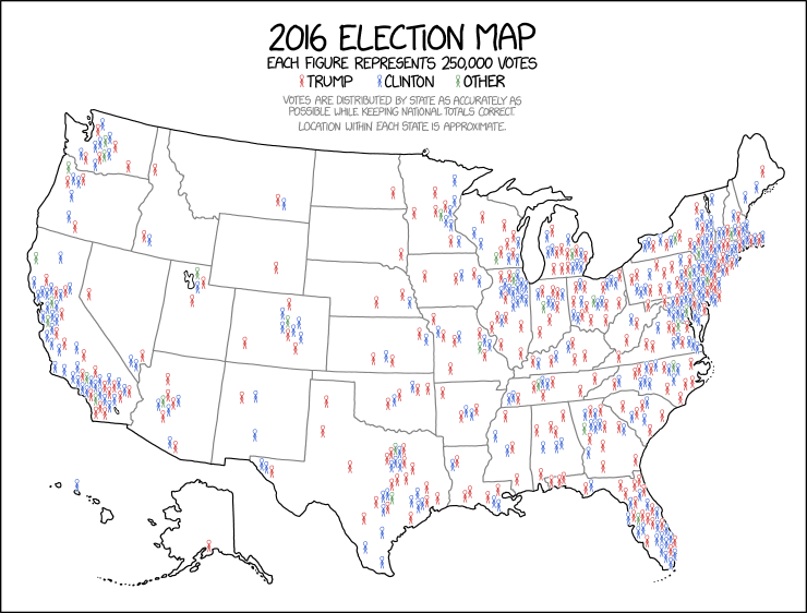
The problem, again, is that the land area does not vote. It is the people. Therefore, when the real population in the country is represented, the map looks very different. This, by cartoonist Randall Munroe on his XKCD website, is a much more accurate description of how the 2016 elections looked.
It looks very different, right?
Even if, to say something, we follow Ward's logic - something chilling! - and try to apply a system of the Electoral College in the race for the governorship of Kentucky, it is not certain (as she seems to believe) that the result is different. The allocation of the electoral vote is based on the population! That is precisely why Alaska has three electoral votes and California 55.
So, if we assign electoral votes by county in Kentucky, then Jefferson (city of Louisville) and Fayette (city of Lexington) would have many more than very rural and sparsely populated counties in the western confines of the state.
The fact that the Electoral College is linked to the population is the reason why we have only had five occasions in the presidential history of the United States in which the winner of the popular vote was different from that of the electoral vote. It may seem more common than that because two of those five times occurred in the last two decades (2000 and 2016). But, before the victory of the popular vote of Al Gore (and his defeat in the Electoral College) in 2000, 112 years have passed since the last time it happened. (See you, Benjamin Harrison!)
It is not clear if Ward knows that story and understands the difference between the people who vote and the land surface. However, what is evident is that sharing maps of Virginia and Kentucky by counties is very, very misleading.
Donald Trump Elections 2019 Kentucky Republican Party Virginia