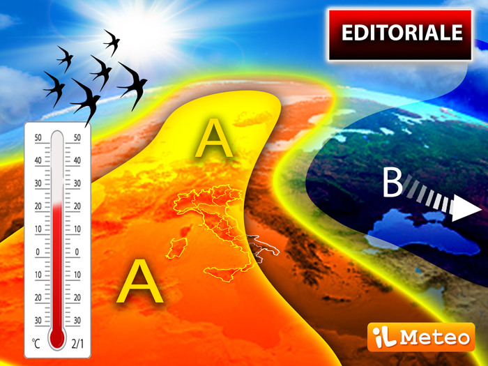
A robust anticyclone is arriving in the middle of the week that will bring spring weather, sunny days and rising temperatures to Italy.
A situation that will make the absence of rains and therefore drought persist, especially in the North.
This is what Antonio Sanò, director and founder of iLMeteo.it announces, underlining that at the beginning of the week the latest rains and snowfalls up to hilly altitudes will affect the southern regions, after which "a huge high pressure bubble will dominate the scene. ".
The anticyclonic blockade will in fact prevent Atlantic disturbances from reaching Italy: from mid-week we will therefore have many sunny days over most of our regions.
The maximum temperatures, given the partly African component of the high pressure, will often rise above the climatic averages: in some locations on the northern plains and part of the Center it is not excluded that the mercury column may rise well above 20 degrees .
"Worth noting - says Sanò - the downside of this anticyclonic phase: the drought and rainless period will continue, something really anomalous, especially in months that are usually among the wettest of the year, with rather worrying consequences".
In detail
Monday 21: In the North, partly cloudy sky in the far Northwest, few clouds elsewhere.
In the Center: rain showers on Sardinia, sun elsewhere.
South: local rains on Sicily and Calabria, partly cloudy elsewhere.
Tuesday 22: In the North, clear skies.
In the Center: prevailing good weather, all sun.
In the South: clear or partly cloudy skies.
Wednesday 23: In the north, ample sunshine.
Center: partly cloudy sky.
In the South: cloudy sky conditions.
Between Thursday and Friday still a super anti-cyclone master of Italy;
probable weather failure over the weekend.